
ETE N
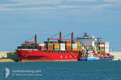
Container Ship
Current Trip
| Time Travelled | 5 days |
|---|---|
| Remaining Time | --- |
| Distance Travelled | 876.43 nm |
| Remaining Distance | --- |
| AVG Speed | 11.1 Noeuds |
| MAX Speed | 16.3 Noeuds |
| AVG Wind | 11 knots |
| MAX Wind | 17.9 knots |
| MIN Temp | 27.7°C / 81.86°F |
| MAX Temp | 29.7°C / 85.46°F |
| Tirant d eau | 12.5 m |
| Position reçue | 2024-03-19 06:09 |
Current Position
| Longitude | -13.50485° |
|---|---|
| Latitude | 28.06668° |
| Etat | Under way using engine |
| Vitesse | 17.2 Noeuds |
| Parcours | 213.1° |
| Zone | North Atlantic Ocean |
| Station | T-AIS |
| Position reçue | 2024-03-19 06:09 |
Info
Information
The current position of ETE N is in North Atlantic Ocean with coordinates 28.06668° / -13.50485° as reported on 2024-03-19 06:09 by AIS to our vessel tracker app. The vessel's current speed is 17.2 Noeuds
The vessel ETE N (IMO: 9509126, MMSI: 636019197) is a Container Ship that was built in 2012 ( 12 Age ). It's sailing under the flag of [LR] Liberia.
In this page you can find informations about the vessels current position, last detected port calls, and current voyage information. If the vessels is not in coverage by AIS you will find the latest position.
The current position of ETE N is detected by our AIS receivers and we are not responsible for the reliability of the data. The last position was recorded while the vessel was in Coverage by the Ais receivers of our vessel tracking app.
The current draught of ETE N as reported by AIS is 12.5 meters
Weather
| Temperature | 29.1°C / 84.38°F |
|---|---|
| Wind Speed | 11 knots |
| Direction | 162° SSE |
| Pressure | 1010.2 hPa |
| Humidity | 71.2 % |
| Cloud Coverage | 100 % |
Featured Company
Last Port Calls
| Port | Arrival | Departure | Time In Port |
|---|---|---|---|
| 2024-04-29 06:51 | 2024-04-30 03:44 | 20 h | |
| 2024-04-17 13:24 | |||
| 2024-04-05 18:45 | 2024-04-06 20:49 | 1 d | |
| 2024-04-02 14:33 | 2024-04-03 03:13 | 12 h | |
| 2024-03-25 05:01 | 2024-03-26 10:01 | 1 d | |
| 2024-03-17 13:43 | 2024-03-17 15:07 | 1 h | |
| 2024-03-17 01:09 | 2024-03-17 03:38 | 2 h | |
| 2024-03-02 04:14 | 2024-03-03 11:25 | 1 d |
Last Trips
| Origin | Departure | Destination | Arrival | Distance | |
|---|---|---|---|---|---|
| 2024-04-06 21:49 | 2024-04-17 14:24 | 371.34 nm | |||
| 2024-04-03 04:13 | 2024-04-05 19:45 | 78.60 nm | |||
| 2024-03-26 11:01 | 2024-04-02 15:33 | 409.03 nm | |||
| 2024-03-17 16:07 | 2024-03-25 06:01 | 3101.39 nm | |||
| 2024-03-17 04:38 | 2024-03-17 14:43 | 55.16 nm | |||
| 2024-02-25 08:55 | 2024-03-17 02:09 | 4422.27 nm | |||
| 2024-02-25 08:55 | 2024-03-02 06:14 | 1935.25 nm |
Events
| Heure | Evenement | Détails | Position/ Destination | Info |
|---|---|---|---|---|
| 2024-05-03 14:40 | Démarrage | 5.17 nm, South of TEMA |
5.54875 / .04525
COTONOU
|
Vitesse: 4.4 kn Parcours: 162° |
| 2024-05-01 10:44 | Arret | 5.01 nm, South East of TEMA |
5.55276 / .04768
COTONOU
|
Vitesse: 0.1 kn Parcours: 265° |
| 2024-04-30 03:44 | PORT DE DEPART |
|
6.34140 / 2.43935
COTONOU
|
Vitesse: 4.9 kn Parcours: 110° |
| 2024-04-30 03:40 | Démarrage |
6.34362 / 2.43308
[BJ] COTONOU
|
Vitesse: 4.9 kn Parcours: 110° |
|
| 2024-04-29 07:07 | Arret |
6.34542 / 2.42116
[BJ] COTONOU
|
Vitesse: 0.1 kn Parcours: 266° |
|
| 2024-04-29 06:51 | Port d'arrivée |
|
6.34631 / 2.42864
[BJ] COTONOU
|
Vitesse: 8.7 kn Parcours: 308° |
| 2024-04-29 05:07 | Démarrage | 6.58 nm, South East of COTONOU |
6.27352 / 2.51574
COTONOU
|
Vitesse: 4.6 kn Parcours: 320° |
| 2024-04-27 18:08 | Arret | 7.08 nm, South East of COTONOU |
6.26870 / 2.52260
COTONOU
|
Vitesse: 0.3 kn Parcours: 249° |
| 2024-04-27 17:00 | Démarrage | 5.01 nm, South East of COTONOU |
6.27846 / 2.48361
COTONOU
|
Vitesse: 4.3 kn Parcours: 346° |
| 2024-04-27 15:36 | Arret | 5.43 nm, South East of COTONOU |
6.26469 / 2.47588
COTONOU
|
Vitesse: 0.3 kn Parcours: 303° |