
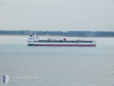
ESSAYRA
Cargo
Current Trip
| Trip Time | 17 days |
|---|---|
| Trip Distance | 5455.32 морская миля |
| AVG Speed | 12 Узлы |
| MAX Speed | 16.1 Узлы |
| Осадка | 8.7 м |
| AVG Wind | 13.2 knots |
| MAX Wind | 23 knots |
| MIN Temp | 11.3°C / 52.34°F |
| MAX Temp | 27.5°C / 81.5°F |
| Позиция Получена | 1 m тому назад |
Current Position
| Долгота | 3.74951° |
|---|---|
| Широта | 51.09797° |
| Статус | Moored |
| Скорость | |
| Курс | 335° |
| Район | North Sea |
| Станция | T-AIS |
| Позиция Получена | 1 m тому назад |
Info
Information
The current position of ESSAYRA is in North Sea with coordinates 51.09797° / 3.74951° as reported on 2024-08-31 23:47 by AIS to our vessel tracker app. The vessel's current speed is 0 Узлы and is currently inside the port of GENT.
The vessel ESSAYRA (IMO: 9735452, MMSI: 636017418) is a Cargo It's sailing under the flag of [LR] Liberia.
In this page you can find informations about the vessels current position, last detected port calls, and current voyage information. If the vessels is not in coverage by AIS you will find the latest position.
The current position of ESSAYRA is detected by our AIS receivers and we are not responsible for the reliability of the data. The last position was recorded while the vessel was in Coverage by the Ais receivers of our vessel tracking app.
The current draught of ESSAYRA as reported by AIS is 8.7 meters
Weather
| Temperature | 19.3°C / 66.74°F |
|---|---|
| Wind Speed | 7 knots |
| Direction | 62° ENE |
| Pressure | 1017.3 hPa |
| Humidity | 76.2 % |
| Cloud Coverage | 45 % |
Featured Company
Most Visited Ports (Last year)
| Port | Arrivals | |
|---|---|---|
| 11 | ||
| 7 | ||
| 3 | ||
| 2 |
Last Trips
| Origin | Departure | Destination | Arrival | Distance | |
|---|---|---|---|---|---|
| 2024-08-14 00:49 | 2024-08-31 19:21 | 5455.32 морская миля | |||
| 2024-07-23 14:57 | 2024-08-09 03:33 | 5165.94 морская миля | |||
| 2024-06-24 08:22 | 2024-07-11 10:52 | 5169.20 морская миля | |||
| 2024-06-03 18:43 | 2024-06-19 23:32 | 5452.22 морская миля | |||
| 2024-06-03 15:02 | 2024-06-03 16:49 | 9.46 морская миля |
Events
| Время | Событие | Детали | Позиция / Направление | Информация |
|---|---|---|---|---|
| 2024-08-31 18:26 | Статус изменился | Moored Under way using engine |
51.09792 / 3.74945
[BE] GENT
|
Скорость: Курс: 337° |
| 2024-08-31 18:23 | Окончание движения |
51.09795 / 3.74949
[BE] GENT
|
Скорость: 0.3 kn Курс: 335° |
|
| 2024-08-31 17:21 | Порт |
|
51.16698 / 3.79240
[BE] GENT
|
Скорость: 7.5 kn Курс: 200.4° |
| 2024-08-31 15:46 | Начало движения | 0.42 nm, North West of TERNEUZEN |
51.32567 / 3.81908
BE GNE
|
Скорость: 3.3 kn Курс: 152° |
| 2024-08-31 15:13 | Окончание движения | 0.65 nm, North West of TERNEUZEN |
51.32911 / 3.81653
BE GNE
|
Скорость: 0.3 kn Курс: 153° |
| 2024-08-31 12:40 | Изменение морского района | Dutch part of the North Sea Belgian part of the North Sea |
51.40533 / 3.33802
North Sea
|
Скорость: 12.4 kn Курс: 89.2° |
| 2024-08-31 07:56 | Обнаружено в море | Belgian part of the North Sea |
51.32852 / 2.36538
North Sea
BE GNE
|
Скорость: 4.5 kn Курс: 69.4° |
| 2024-08-31 06:46 | Статус изменился | Under way using engine Default |
51.29484 / 2.24954
BE GNE
|
Скорость: 3.9 kn Курс: 52° |
| 2024-08-31 06:44 | Статус изменился | Default Under way using engine |
51.29362 / 2.24671
BE GNE
|
Скорость: 3.9 kn Курс: 52° |
| 2024-08-31 06:26 | Статус изменился | Under way using engine Default |
51.28286 / 2.22079
BE GNE
|
Скорость: 3.6 kn Курс: 52° |