
ESSAYRA
Cargo
Current Trip
| Time Travelled | 3 days |
|---|---|
| Remaining Time | 13 days |
| Distance Travelled | 1021.37 nm |
| Remaining Distance | 4491.80 nm |
| AVG Speed | 10.7 Knop |
| MAX Speed | 15.3 Knop |
| AVG Wind | 15 knots |
| MAX Wind | 25 knots |
| MIN Temp | 9.9°C / 49.82°F |
| MAX Temp | 19.2°C / 66.56°F |
| Djupgående | 6.8 m |
| Position mottagen | 2 d sen |
Current Position
| Longitud | -3.88830° |
|---|---|
| Latitude | 49.66008° |
| Status | Under way using engine |
| Fart | 14.5 Knop |
| Kurs | 239.6° |
| Område | English Channel |
| Station | T-AIS |
| Position mottagen | 2 d sen |
Info
Information
The current position of ESSAYRA is in English Channel with coordinates 49.66008° / -3.88830° as reported on 2024-09-12 18:56 by AIS to our vessel tracker app. The vessel's current speed is 14.5 Knop and is heading at the port of SANTOS. The estimated time of arrival as calculated by MyShipTracking vessel tracking app is 2024-09-28 06:17 LT
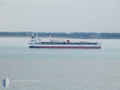
The vessel ESSAYRA (IMO: 9735452, MMSI: 636017418) is a Cargo It's sailing under the flag of [LR] Liberia.
In this page you can find informations about the vessels current position, last detected port calls, and current voyage information. If the vessels is not in coverage by AIS you will find the latest position.
The current position of ESSAYRA is detected by our AIS receivers and we are not responsible for the reliability of the data. The last position was recorded while the vessel was in Coverage by the Ais receivers of our vessel tracking app.
The current draught of ESSAYRA as reported by AIS is 6.8 meters
Weather
| Temperature | 19.2°C / 66.56°F |
|---|---|
| Wind Speed | 18 knots |
| Direction | 27° NNE |
| Pressure | 1021.8 hPa |
| Humidity | 77.3 % |
| Cloud Coverage | --- |
Featured Company
Last Port Calls
| Port | Arrival | Departure | Time In Port |
|---|---|---|---|
| 2024-08-31 17:21 | 2024-09-11 16:25 | 10 d | |
| 2024-08-09 06:33 | 2024-08-14 03:49 | 4 d | |
| 2024-07-11 14:52 | 2024-07-23 18:57 | 12 d |
Most Visited Ports (Last year)
| Port | Arrivals | |
|---|---|---|
| 11 | ||
| 7 | ||
| 3 | ||
| 2 |
Last Trips
| Origin | Departure | Destination | Arrival | Distance | |
|---|---|---|---|---|---|
| 2024-08-14 00:49 | 2024-08-31 19:21 | 5455.32 nm | |||
| 2024-07-23 14:57 | 2024-08-09 03:33 | 5165.94 nm | |||
| 2024-06-24 08:22 | 2024-07-11 10:52 | 5169.20 nm |
Events
| Tid | Event | Detaljer | Position / Dest | Information |
|---|---|---|---|---|
| 2024-09-12 19:03 | Status ändrad | Default Under way using engine |
49.64669 / -3.92354
BR SSZ
|
Fart: 14.5 kn Kurs: 239.6° |
| 2024-09-12 18:56 | UTANFÖR täckningsområde |
49.66008 / -3.88830
English Channel
BR SSZ
|
Fart: 14.5 kn Kurs: 239.6° |
|
| 2024-09-12 18:51 | I täckningsområde |
49.66672 / -3.87108
English Channel
BR SSZ
|
Fart: 14.4 kn Kurs: 239.8° |
|
| 2024-09-12 18:50 | Status ändrad | Under way using engine Default |
49.67324 / -3.85407
BR SSZ
|
Fart: 14.5 kn Kurs: 240° |
| 2024-09-12 17:55 | Status ändrad | Default Under way using engine |
49.78589 / -3.55848
BR SSZ
|
Fart: 14.5 kn Kurs: 241° |
| 2024-09-12 17:49 | UTANFÖR täckningsområde |
49.79884 / -3.52462
English Channel
BR SSZ
|
Fart: 14.5 kn Kurs: 241° |
|
| 2024-09-12 17:31 | Byter havsområde | United Kingdom part of the English Channel Guernsey part of the English Channel |
49.83446 / -3.43086
English Channel
BR SSZ
|
Fart: 14.5 kn Kurs: 239.7° |
| 2024-09-12 17:30 | Status ändrad | Under way using engine Default |
49.83735 / -3.42337
BR SSZ
|
Fart: 14.4 kn Kurs: 240° |
| 2024-09-12 17:27 | I täckningsområde |
49.83446 / -3.43086
English Channel
BR SSZ
|
Fart: 14.5 kn Kurs: 239.7° |
|
| 2024-09-12 15:20 | UTANFÖR täckningsområde |
50.05369 / -2.71354
English Channel
BR SSZ
|
Fart: 13.6 kn Kurs: 255.3° |