
DIONYSSIS A
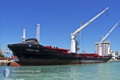
Container Ship
Current Trip
| Time Travelled | 3 days |
|---|---|
| Remaining Time | --- |
| Distance Travelled | 990.51 морская миля |
| Remaining Distance | --- |
| AVG Speed | 13.1 Узлы |
| MAX Speed | 15.5 Узлы |
| AVG Wind | 12.1 knots |
| MAX Wind | 19.3 knots |
| MIN Temp | 18.2°C / 64.76°F |
| MAX Temp | 31.9°C / 89.42°F |
| Осадка | 8.7 м |
| Позиция Получена | 7 h, 23 m тому назад |
Current Position
| Долгота | 13.65035° |
|---|---|
| Широта | 33.27305° |
| Статус | Under way using engine |
| Скорость | 13.2 Узлы |
| Курс | 240.5° |
| Район | Mediterranean Sea - Eastern Basin |
| Станция | T-AIS |
| Позиция Получена | 7 h, 23 m тому назад |
Info
Information
The current position of DIONYSSIS A is in Mediterranean Sea - Eastern Basin with coordinates 33.27305° / 13.65035° as reported on 2024-06-29 01:44 by AIS to our vessel tracker app. The vessel's current speed is 13.2 Узлы
The vessel DIONYSSIS A (IMO: 9356660, MMSI: 271050526) is a Container Ship that was built in 2008 ( 16 лет ). It's sailing under the flag of [TR] Turkey.
In this page you can find informations about the vessels current position, last detected port calls, and current voyage information. If the vessels is not in coverage by AIS you will find the latest position.
The current position of DIONYSSIS A is detected by our AIS receivers and we are not responsible for the reliability of the data. The last position was recorded while the vessel was in Coverage by the Ais receivers of our vessel tracking app.
The current draught of DIONYSSIS A as reported by AIS is 8.7 meters
Weather
| Temperature | 24.4°C / 75.92°F |
|---|---|
| Wind Speed | 12 knots |
| Direction | 84° E |
| Pressure | 1015.3 hPa |
| Humidity | 80.7 % |
| Cloud Coverage | --- |
Featured Company
Last Port Calls
| Port | Arrival | Departure | Time In Port |
|---|---|---|---|
| 2024-06-25 13:54 | 2024-06-26 01:48 | 11 h | |
| 2024-06-24 07:15 | 2024-06-25 08:38 | 1 d | |
| 2024-06-15 08:32 | 2024-06-19 06:20 | 3 d | |
| 2024-06-09 10:05 | 2024-06-12 10:25 | 3 d | |
| 2024-06-01 11:23 | 2024-06-02 03:59 | 16 h | |
| 2024-05-30 20:51 | 2024-06-01 05:27 | 1 d | |
| 2024-05-23 12:20 | 2024-05-25 21:49 | 2 d | |
| 2024-05-18 02:41 | 2024-05-18 21:58 | 19 h | |
| 2024-05-14 15:16 | 2024-05-15 08:52 | 17 h | |
| 2024-05-11 13:59 | 2024-05-12 13:14 | 23 h |
Last Trips
| Origin | Departure | Destination | Arrival | Distance | |
|---|---|---|---|---|---|
| 2024-06-25 08:38 | 2024-06-25 13:54 | 59.53 морская миля | |||
| 2024-06-19 06:20 | 2024-06-24 07:15 | 1036.01 морская миля | |||
| 2024-06-12 10:25 | 2024-06-15 08:32 | 517.11 морская миля | |||
| 2024-06-02 03:59 | 2024-06-09 10:05 | 1471.77 морская миля | |||
| 2024-06-01 05:27 | 2024-06-01 11:23 | 56.71 морская миля | |||
| 2024-05-25 21:49 | 2024-05-30 20:51 | 1430.98 морская миля | |||
| 2024-05-18 21:58 | 2024-05-23 12:20 | 812.98 морская миля | |||
| 2024-05-15 08:52 | 2024-05-18 02:41 | 822.59 морская миля | |||
| 2024-05-12 13:14 | 2024-05-14 15:16 | 473.20 морская миля | |||
| 2024-05-05 16:04 | 2024-05-11 13:59 | 1626.40 морская миля |
Events
| Время | Событие | Детали | Позиция / Направление | Информация |
|---|---|---|---|---|
| 2024-06-29 04:48 | Окончание движения | 1.94 nm, North West of TRIPOLI |
32.93009 / 13.17618
LYTIP
|
Скорость: 0.2 kn Курс: 70° |
| 2024-06-29 01:50 | Статус изменился | Default Under way using engine |
33.26246 / 13.62753
LYTIP
|
Скорость: 13.2 kn Курс: 240.5° |
| 2024-06-29 01:44 | Статус изменился | Under way using engine Default |
33.27305 / 13.65035
LYTIP
|
Скорость: 13.1 kn Курс: 241° |
| 2024-06-29 01:44 | Вне покрытия |
33.27305 / 13.65035
Mediterranean Sea - Eastern Basin
LYTIP
|
Скорость: 13.2 kn Курс: 240.5° |
|
| 2024-06-29 01:34 | Статус изменился | Default Under way using engine |
33.29097 / 13.68874
LYTIP
|
Скорость: 13.2 kn Курс: 240.3° |
| 2024-06-29 01:02 | Статус изменился | Under way using engine Default |
33.34715 / 13.80836
LYTIP
|
Скорость: 13.2 kn Курс: 240° |
| 2024-06-29 00:45 | Статус изменился | Default Under way using engine |
33.37779 / 13.87269
LYTIP
|
Скорость: 13.1 kn Курс: 240.3° |
| 2024-06-28 23:57 | Статус изменился | Under way using engine Default |
33.46597 / 14.05974
LYTIP
|
Скорость: 13.3 kn Курс: 240° |
| 2024-06-28 23:21 | Статус изменился | Default Under way using engine |
33.53014 / 14.19416
LYTIP
|
Скорость: 13.1 kn Курс: 240.3° |
| 2024-06-28 23:06 | Статус изменился | Under way using engine Default |
33.55864 / 14.25396
LYTIP
|
Скорость: 12.9 kn Курс: 240° |