
DIONYSSIS A
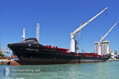
Container Ship
Current Trip
| Time Travelled | 17 h, 29 mins |
|---|---|
| Remaining Time | --- |
| Distance Travelled | 213.11 nm |
| Remaining Distance | --- |
| AVG Speed | 12.9 Noeuds |
| MAX Speed | 15.5 Noeuds |
| AVG Wind | 14.6 knots |
| MAX Wind | 19.1 knots |
| MIN Temp | 18.2°C / 64.76°F |
| MAX Temp | 31.9°C / 89.42°F |
| Tirant d eau | 8.7 m |
| Position reçue | 1 m depuis |
Current Position
| Longitude | 25.67678° |
|---|---|
| Latitude | 39.74181° |
| Etat | Under way using engine |
| Vitesse | 13.6 Noeuds |
| Parcours | 205.9° |
| Zone | Aegean Sea |
| Station | T-AIS |
| Position reçue | 1 m depuis |
Info
Information
The current position of DIONYSSIS A is in Aegean Sea with coordinates 39.74181° / 25.67678° as reported on 2024-06-26 16:16 by AIS to our vessel tracker app. The vessel's current speed is 13.6 Noeuds and is heading at the port of TRIPOLI. The estimated time of arrival as calculated by MyShipTracking vessel tracking app is 2024-06-30 21:00 LT
The vessel DIONYSSIS A (IMO: 9356660, MMSI: 271050526) is a Container Ship that was built in 2008 ( 16 Age ). It's sailing under the flag of [TR] Turkey.
In this page you can find informations about the vessels current position, last detected port calls, and current voyage information. If the vessels is not in coverage by AIS you will find the latest position.
The current position of DIONYSSIS A is detected by our AIS receivers and we are not responsible for the reliability of the data. The last position was recorded while the vessel was in Coverage by the Ais receivers of our vessel tracking app.
The current draught of DIONYSSIS A as reported by AIS is 8.7 meters
Weather
| Temperature | 25.2°C / 77.36°F |
|---|---|
| Wind Speed | 15 knots |
| Direction | 55° NE |
| Pressure | 1010.8 hPa |
| Humidity | 60.6 % |
| Cloud Coverage | --- |
Featured Company
Last Port Calls
| Port | Arrival | Departure | Time In Port |
|---|---|---|---|
| 2024-06-25 10:54 | 2024-06-25 22:48 | 11 h | |
| 2024-06-24 04:15 | 2024-06-25 05:38 | 1 d | |
| 2024-06-15 07:32 | 2024-06-19 05:20 | 3 d | |
| 2024-06-09 09:05 | 2024-06-12 09:25 | 3 d | |
| 2024-06-01 08:23 | 2024-06-02 00:59 | 16 h | |
| 2024-05-30 17:51 | 2024-06-01 02:27 | 1 d | |
| 2024-05-23 11:20 | 2024-05-25 20:49 | 2 d | |
| 2024-05-18 00:41 | 2024-05-18 19:58 | 19 h | |
| 2024-05-14 13:16 | 2024-05-15 06:52 | 17 h | |
| 2024-05-11 10:59 | 2024-05-12 10:14 | 23 h |
Last Trips
| Origin | Departure | Destination | Arrival | Distance | |
|---|---|---|---|---|---|
| 2024-06-25 08:38 | 2024-06-25 13:54 | 59.53 nm | |||
| 2024-06-19 06:20 | 2024-06-24 07:15 | 1036.01 nm | |||
| 2024-06-12 10:25 | 2024-06-15 08:32 | 517.11 nm | |||
| 2024-06-02 03:59 | 2024-06-09 10:05 | 1471.77 nm | |||
| 2024-06-01 05:27 | 2024-06-01 11:23 | 56.71 nm | |||
| 2024-05-25 21:49 | 2024-05-30 20:51 | 1430.98 nm | |||
| 2024-05-18 21:58 | 2024-05-23 12:20 | 812.98 nm | |||
| 2024-05-15 08:52 | 2024-05-18 02:41 | 822.59 nm | |||
| 2024-05-12 13:14 | 2024-05-14 15:16 | 473.20 nm | |||
| 2024-05-05 16:04 | 2024-05-11 13:59 | 1626.40 nm |
Events
| Heure | Evenement | Détails | Position/ Destination | Info |
|---|---|---|---|---|
| 2024-06-26 15:20 | Detecté en mer | Greek part of the Aegean Sea |
39.91417 / 25.82056
Aegean Sea
LYTIP
|
Vitesse: 14.6 kn Parcours: 232.3° |
| 2024-06-26 15:04 | Detecté en mer | Turkish part of the Aegean Sea |
39.95414 / 25.88819
Aegean Sea
LYTIP
|
Vitesse: 14.8 kn Parcours: 232° |
| 2024-06-26 15:04 | Etat Changé | Under way using engine Default |
39.95539 / 25.89032
LYTIP
|
Vitesse: 14.7 kn Parcours: 232° |
| 2024-06-26 14:06 | Etat Changé | Default Under way using engine |
40.02828 / 26.17007
LYTIP
|
Vitesse: 14.2 kn Parcours: 255.8° |
| 2024-06-26 12:06 | Etat Changé | Under way using engine Default |
40.32482 / 26.60696
LYTIP
|
Vitesse: 9.2 kn Parcours: 236° |
| 2024-06-26 12:06 | Dans la zone couverte |
40.32482 / 26.60696
Sea of Marmara
LYTIP
|
Vitesse: 14.6 kn Parcours: 226.9° |
|
| 2024-06-26 09:37 | Etat Changé | Default Under way using engine |
40.53156 / 27.00405
LYTIP
|
Vitesse: 12.3 kn Parcours: 244.1° |
| 2024-06-26 09:30 | Etat Changé | Under way using engine Default |
40.54223 / 27.03373
LYTIP
|
Vitesse: 12.3 kn Parcours: 244° |
| 2024-06-26 09:30 | Hors de la zone couverte |
40.54223 / 27.03373
Sea of Marmara
LYTIP
|
Vitesse: 12.3 kn Parcours: 244.1° |
|
| 2024-06-26 09:22 | Etat Changé | Default Under way using engine |
40.55392 / 27.06517
LYTIP
|
Vitesse: 12.4 kn Parcours: 244.3° |