

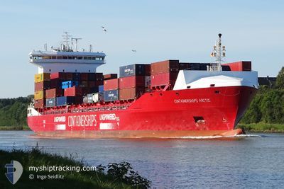
CONTAINERSHIPSARCTIC
Cargo A
Current Trip
| Time Travelled | 1 day |
|---|---|
| Remaining Time | 2 h, 43 mins |
| Distance Travelled | 310.94 морская миля |
| Remaining Distance | 80.37 морская миля |
| AVG Speed | 13.6 Узлы |
| MAX Speed | 16.4 Узлы |
| AVG Wind | 7.1 knots |
| MAX Wind | 21 knots |
| MIN Temp | 2.4°C / 36.32°F |
| MAX Temp | 4.9°C / 40.82°F |
| Осадка | 7.2 м |
| Позиция Получена | 5 h, 46 m тому назад |
Current Position
| Долгота | --- |
|---|---|
| Широта | --- |
| Статус | Under way using engine |
| Скорость | 8 Узлы |
| Курс | 61.6° |
| Район | Baltic Sea |
| Станция | T-AIS |
| Позиция Получена | 5 h, 46 m тому назад |
Information
The current position of CONTAINERSHIPSARCTIC is in Baltic Sea with coordinates 55.10077° / 18.45360° as reported on 2025-03-16 08:02 by AIS to our vessel tracker app. The vessel's current speed is 8 Узлы and is heading at the port of KLAIPEDA. The estimated time of arrival as calculated by MyShipTracking vessel tracking app is 2025-03-16 18:32 LT
The vessel CONTAINERSHIPSARCTIC (IMO: 9818400, MMSI: 209717000) is a Cargo A It's sailing under the flag of [CY] Cyprus.
In this page you can find informations about the vessels current position, last detected port calls, and current voyage information. If the vessels is not in coverage by AIS you will find the latest position.
The current position of CONTAINERSHIPSARCTIC is detected by our AIS receivers and we are not responsible for the reliability of the data. The last position was recorded while the vessel was in Coverage by the Ais receivers of our vessel tracking app.
The current draught of CONTAINERSHIPSARCTIC as reported by AIS is 7.2 meters
Weather
| Temperature | 3.3°C / 37.94°F |
|---|---|
| Wind Speed | 16 knots |
| Direction | 296° WNW |
| Pressure | 1013.2 hPa |
| Humidity | 85.6 % |
| Cloud Coverage | 70 % |
Featured Company
Last Port Calls
| Port | Arrival | Departure | Time In Port |
|---|---|---|---|
| 2025-03-15 11:29 | 2025-03-15 11:32 | 3 m | |
| 2025-03-12 08:48 | 2025-03-14 06:35 | 1 d | |
| 2025-03-11 01:52 | 2025-03-11 20:03 | 18 h | |
| 2025-03-09 18:09 | 2025-03-10 09:26 | 15 h | |
| 2025-03-08 15:33 | 2025-03-08 16:48 | 1 h | |
| 2025-03-06 01:46 | 2025-03-07 05:30 | 1 d | |
| 2025-03-04 20:59 | 2025-03-05 14:22 | 17 h | |
| 2025-02-28 11:19 | 2025-03-01 21:36 | 1 d | |
| 2025-02-25 23:17 | 2025-02-26 22:55 | 23 h | |
| 2025-02-24 19:47 | 2025-02-24 20:06 | 18 m |
Last Trips
| Origin | Departure | Destination | Arrival | Distance | |
|---|---|---|---|---|---|
| 2025-03-14 06:35 | 2025-03-15 11:29 | 331.61 морская миля | |||
| 2025-03-11 20:03 | 2025-03-12 08:48 | 128.32 морская миля | |||
| 2025-03-10 09:26 | 2025-03-11 01:52 | 235.27 морская миля | |||
| 2025-03-08 16:48 | 2025-03-09 18:09 | 376.79 морская миля | |||
| 2025-03-07 05:30 | 2025-03-08 15:33 | 414.71 морская миля | |||
| 2025-03-05 14:22 | 2025-03-06 01:46 | 136.55 морская миля | |||
| 2025-03-01 21:36 | 2025-03-04 20:59 | 853.38 морская миля | |||
| 2025-02-26 22:55 | 2025-02-28 11:19 | 295.99 морская миля | |||
| 2025-02-24 20:06 | 2025-02-25 23:17 | 382.15 морская миля | |||
| 2025-02-23 11:31 | 2025-02-24 19:47 | 414.10 морская миля |
Events
| Время | Событие | Детали | Позиция / Направление | Информация |
|---|---|---|---|---|
| 2025-03-16 08:08 | Статус изменился | Default Under way using engine |
55.10717 / 18.47394
LTKLJ VIA NOK
|
Скорость: 8 kn Курс: 61.6° |
| 2025-03-16 08:02 | Вне покрытия |
55.10077 / 18.45360
Baltic Sea
LTKLJ VIA NOK
|
Скорость: 8 kn Курс: 61.6° |
|
| 2025-03-16 07:53 | Статус изменился | Under way using engine Default |
55.09172 / 18.42481
LTKLJ VIA NOK
|
Скорость: 7.8 kn Курс: 62° |
| 2025-03-16 07:33 | Статус изменился | Default Under way using engine |
55.06933 / 18.35599
LTKLJ VIA NOK
|
Скорость: 7.7 kn Курс: 60.2° |
| 2025-03-16 07:24 | Статус изменился | Under way using engine Default |
55.05967 / 18.32529
LTKLJ VIA NOK
|
Скорость: 15.2 kn Курс: 60° |
| 2025-03-16 07:24 | В покрытии |
55.06161 / 18.33133
Baltic Sea
LTKLJ VIA NOK
|
Скорость: 7.7 kn Курс: 60.2° |
|
| 2025-03-16 03:24 | Статус изменился | Default Under way using engine |
54.79876 / 16.78113
LTKLJ VIA NOK
|
Скорость: 14.9 kn Курс: 82° |
| 2025-03-16 03:22 | Вне покрытия |
54.79740 / 16.76479
Baltic Sea
LTKLJ VIA NOK
|
Скорость: 14.9 kn Курс: 82° |
|
| 2025-03-15 22:59 | Обнаружено в море | Polish part of the Baltic Sea |
54.63806 / 14.87847
Baltic Sea
LTKLJ VIA NOK
|
Скорость: 15 kn Курс: 82.3° |
| 2025-03-15 22:08 | Изменение морского района | Danish part of the Kattegat German part of the Baltic Sea |
54.60574 / 14.51657
Kattegat
LTKLJ VIA NOK
|
Скорость: 14.9 kn Курс: 79.6° |