
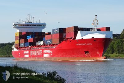
CONTAINERSHIPSARCTIC
Cargo A
Current Trip
| Time Travelled | 1 day |
|---|---|
| Remaining Time | 52 mins |
| Distance Travelled | 232.77 nm |
| Remaining Distance | 5.80 nm |
| AVG Speed | 9.2 Knots |
| MAX Speed | 16.4 Knots |
| AVG Wind | 16.2 knots |
| MAX Wind | 24.3 knots |
| MIN Temp | 7.3°C / 45.14°F |
| MAX Temp | 15.6°C / 60.08°F |
| Draught | 8.1 m |
| Position Received | Now |
Current Position
| Longitude | --- |
|---|---|
| Latitude | --- |
| Status | Under way using engine |
| Speed | 4.7 Knots |
| Course | 59° |
| Area | North Atlantic Ocean |
| Station | T-AIS |
| Position Received | Now |
Info
Information
The current position of CONTAINERSHIPSARCTIC is in North Atlantic Ocean with coordinates 41.12480° / -8.80026° as reported on 2026-01-05 17:10 by AIS to our vessel tracker app. The vessel's current speed is 4.7 Knots and is heading at the port of LEIXOES. The estimated time of arrival as calculated by MyShipTracking vessel tracking app is 2026-01-05 18:03 LT
The vessel CONTAINERSHIPSARCTIC (IMO: 9818400, MMSI: 209717000) is a Cargo A It's sailing under the flag of [CY] Cyprus.
In this page you can find informations about the vessels current position, last detected port calls, and current voyage information. If the vessels is not in coverage by AIS you will find the latest position.
The current position of CONTAINERSHIPSARCTIC is detected by our AIS receivers and we are not responsible for the reliability of the data. The last position was recorded while the vessel was in Coverage by the Ais receivers of our vessel tracking app.
The current draught of CONTAINERSHIPSARCTIC as reported by AIS is 8.1 meters
Weather
| Temperature | 10.7°C / 51.26°F |
|---|---|
| Wind Speed | 14 knots |
| Direction | 350° N |
| Pressure | 1015.2 hPa |
| Humidity | 57.6 % |
| Cloud Coverage | 3 % |
Featured Company
Last Port Calls
| Port | Arrival | Departure | Time In Port |
|---|---|---|---|
| 2026-01-03 05:46 | 2026-01-04 16:34 | 1 d | |
| 2025-12-28 18:33 | 2025-12-30 02:28 | 1 d | |
| 2025-12-27 06:12 | 2025-12-28 03:36 | 21 h | |
| 2025-12-17 15:15 | 2025-12-21 17:17 | 4 d | |
| 2025-12-16 09:55 | 2025-12-17 08:07 | 22 h | |
| 2025-12-12 15:07 | 2025-12-15 12:28 | 2 d | |
| 2025-12-04 15:04 | 2025-12-07 17:09 | 3 d | |
| 2025-12-02 20:52 | 2025-12-03 18:27 | 21 h | |
| 2025-11-27 23:21 | 2025-11-30 02:00 | 2 d | |
| 2025-11-23 18:46 | 2025-11-27 01:00 | 3 d |
Last Trips
| Origin | Departure | Destination | Arrival | Distance | |
|---|---|---|---|---|---|
| 2025-12-30 02:28 | 2026-01-03 05:46 | 1212.47 nm | |||
| 2025-12-28 03:36 | 2025-12-28 18:33 | 168.13 nm | |||
| 2025-12-21 17:17 | 2025-12-27 06:12 | 870.49 nm | |||
| 2025-12-17 08:07 | 2025-12-17 15:15 | 75.71 nm | |||
| 2025-12-15 12:28 | 2025-12-16 09:55 | 231.24 nm | |||
| 2025-12-07 17:09 | 2025-12-12 15:07 | 1233.56 nm | |||
| 2025-12-03 18:27 | 2025-12-04 15:04 | 166.00 nm | |||
| 2025-11-30 02:00 | 2025-12-02 20:52 | 924.79 nm | |||
| 2025-11-27 01:00 | 2025-11-27 23:21 | 216.02 nm | |||
| 2025-11-20 12:50 | 2025-11-23 18:46 | 1188.29 nm |
Events
| Time | Event | Details | Position / Dest | Info |
|---|---|---|---|---|
| 2026-01-05 10:52 | ETA Changed | 2026/01/05 08:00 2026/01/02 08:00 |
41.13696 / -8.88263
PTLEI
|
Speed: 1.5 kn Course: 9° |
| 2026-01-05 07:01 | ETA Changed | 2026/01/02 08:00 2026/01/05 07:00 |
40.92426 / -8.85293
PTLEI
|
Speed: 13.4 kn Course: 24.3° |
| 2026-01-05 04:56 | Status Changed | Under way using engine Default |
40.51273 / -9.08463
PTLEI
|
Speed: 12 kn Course: 26° |
| 2026-01-05 04:46 | Status Changed | Default Under way using engine |
40.47833 / -9.10500
PTLEI
|
Speed: 12.9 kn Course: 26° |
| 2026-01-05 04:33 | Status Changed | Under way using engine Default |
40.43734 / -9.13260
PTLEI
|
Speed: 13 kn Course: 25° |
| 2026-01-05 04:28 | Status Changed | Default Under way using engine |
40.42166 / -9.14167
PTLEI
|
Speed: 13 kn Course: 26.1° |
| 2026-01-05 04:24 | Status Changed | Under way using engine Default |
40.40978 / -9.14986
PTLEI
|
Speed: 13 kn Course: 27° |
| 2026-01-05 04:16 | IN Coverage |
40.40978 / -9.14986
North Atlantic Ocean
PTLEI
|
Speed: 13 kn Course: 26.1° |
|
| 2026-01-04 22:28 | Status Changed | Default Under way using engine |
39.20667 / -9.77167
PTLEI
|
Speed: 14.9 kn Course: 7.6° |
| 2026-01-04 22:25 | OUT of Coverage |
39.19671 / -9.77481
North Atlantic Ocean
PTLEI
|
Speed: 14.9 kn Course: 7.6° |