
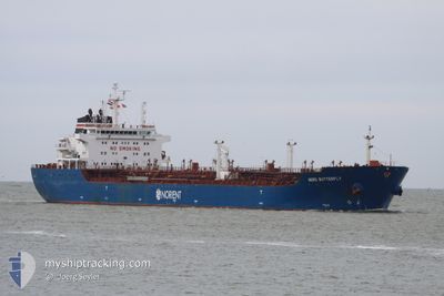
CLOTILDE
Oil/Chemical Tanker
Current Trip
| Time Travelled | 1 day |
|---|---|
| Remaining Time | 22 h, 57 mins |
| Distance Travelled | 389.65 морская миля |
| Remaining Distance | 391.61 морская миля |
| AVG Speed | 12.6 Узлы |
| MAX Speed | 15.3 Узлы |
| AVG Wind | 10.4 knots |
| MAX Wind | 23 knots |
| MIN Temp | 10.7°C / 51.26°F |
| MAX Temp | 16.3°C / 61.34°F |
| Осадка | 10.4 м |
| Позиция Получена | 8 h, 14 m тому назад |
Current Position
| Долгота | 18.26960° |
|---|---|
| Широта | 40.68246° |
| Статус | Under way using engine |
| Скорость | 12.6 Узлы |
| Курс | 319.3° |
| Район | Adriatic Sea |
| Станция | T-AIS |
| Позиция Получена | 8 h, 14 m тому назад |
Info
Information
The current position of CLOTILDE is in Adriatic Sea with coordinates 40.68246° / 18.26960° as reported on 2024-04-26 07:57 by AIS to our vessel tracker app. The vessel's current speed is 12.6 Узлы and is heading at the port of TRIESTE. The estimated time of arrival as calculated by MyShipTracking vessel tracking app is 2024-04-27 15:09 LT
The vessel CLOTILDE (IMO: 9448310, MMSI: 215910000) is a Oil/Chemical Tanker that was built in 2008 ( 16 лет ). It's sailing under the flag of [MT] Malta.
In this page you can find informations about the vessels current position, last detected port calls, and current voyage information. If the vessels is not in coverage by AIS you will find the latest position.
The current position of CLOTILDE is detected by our AIS receivers and we are not responsible for the reliability of the data. The last position was recorded while the vessel was in Coverage by the Ais receivers of our vessel tracking app.
The current draught of CLOTILDE as reported by AIS is 10.4 meters
Weather
| Temperature | 15.7°C / 60.26°F |
|---|---|
| Wind Speed | 13 knots |
| Direction | 123° ESE |
| Pressure | 1013 hPa |
| Humidity | 71.8 % |
| Cloud Coverage | 100 % |
Featured Company
Last Port Calls
| Port | Arrival | Departure | Time In Port |
|---|---|---|---|
| 2024-04-23 16:22 | 2024-04-25 07:36 | 1 d | |
| 2024-04-13 20:30 | 2024-04-16 14:19 | 2 d | |
| 2024-04-09 11:13 | 2024-04-10 15:50 | 1 d | |
| 2024-03-13 09:56 | 2024-03-14 18:35 | 1 d | |
| 2024-02-25 21:20 | 2024-02-27 09:53 | 1 d |
Most Visited Ports (Last year)
| Port | Arrivals | |
|---|---|---|
| 6 | ||
| 3 | ||
| 3 | ||
| 3 | ||
| 2 | ||
| 2 |
Last Trips
| Origin | Departure | Destination | Arrival | Distance | |
|---|---|---|---|---|---|
| 2024-04-16 16:19 | 2024-04-23 18:22 | 768.72 морская миля | |||
| 2024-04-10 17:50 | 2024-04-13 22:30 | 716.65 морская миля | |||
| 2024-03-14 19:35 | 2024-04-09 13:13 | 1619.60 морская миля | |||
| 2024-02-27 11:53 | 2024-03-13 10:56 | 1518.01 морская миля |
Events
| Время | Событие | Детали | Позиция / Направление | Информация |
|---|---|---|---|---|
| 2024-04-26 08:02 | Статус изменился | Default Under way using engine |
40.69478 / 18.25543
IT MLZ > IT TRS
|
Скорость: 12.6 kn Курс: 319.3° |
| 2024-04-26 07:57 | Вне покрытия |
40.68246 / 18.26960
Adriatic Sea
IT MLZ > IT TRS
|
Скорость: 12.6 kn Курс: 319.3° |
|
| 2024-04-26 06:14 | Статус изменился | Under way using engine Default |
40.42338 / 18.60344
IT MLZ > IT TRS
|
Скорость: 12.9 kn Курс: 334° |
| 2024-04-26 06:12 | Статус изменился | Default Under way using engine |
40.41892 / 18.60644
IT MLZ > IT TRS
|
Скорость: 13 kn Курс: 333.5° |
| 2024-04-26 05:06 | ETA изменился | 2024/04/27 15:30 2024/04/27 18:00 |
40.20356 / 18.75186
IT MLZ > IT TRS
|
Скорость: 12.7 kn Курс: 328.3° |
| 2024-04-26 05:03 | Статус изменился | Under way using engine Default |
40.19717 / 18.75711
IT MLZ > IT TRS
|
Скорость: 12.2 kn Курс: 329° |
| 2024-04-26 05:03 | Изменение морского района | Italian part of the Adriatic Sea Italian part of the Ionian Sea |
40.19717 / 18.75711
Adriatic Sea
IT MLZ > IT TRS
|
Скорость: 12.5 kn Курс: 328° |
| 2024-04-26 04:48 | В покрытии |
40.19717 / 18.75711
Adriatic Sea
IT MLZ > IT TRS
|
Скорость: 12.5 kn Курс: 328° |
|
| 2024-04-25 19:47 | Статус изменился | Default Under way using engine |
38.71563 / 17.25984
IT MLZ > IT TRS
|
Скорость: 12.2 kn Курс: 45.6° |
| 2024-04-25 19:44 | Вне покрытия |
38.71037 / 17.25307
Ionian Sea
IT MLZ > IT TRS
|
Скорость: 12.2 kn Курс: 45.6° |