
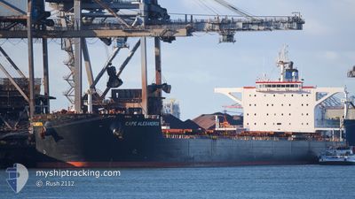
CAPE ALEXANDROS
Bulk Carrier
Current Trip
| Time Travelled | 7 days |
|---|---|
| Remaining Time | 20 days |
| Distance Travelled | 1718.90 морская миля |
| Remaining Distance | 4016.04 морская миля |
| AVG Speed | 10 Узлы |
| MAX Speed | 11.7 Узлы |
| AVG Wind | 11.3 knots |
| MAX Wind | 20 knots |
| MIN Temp | 14.2°C / 57.56°F |
| MAX Temp | 24.5°C / 76.1°F |
| Осадка | 18.2 м |
| Позиция Получена | 6 d тому назад |
Current Position
| Долгота | 19.02457° |
|---|---|
| Широта | -34.88675° |
| Статус | Under way using engine |
| Скорость | 10.6 Узлы |
| Курс | 126° |
| Район | South Atlantic Ocean |
| Станция | T-AIS |
| Позиция Получена | 6 d тому назад |
Info
Information
The current position of CAPE ALEXANDROS is in South Atlantic Ocean with coordinates -34.88675° / 19.02457° as reported on 2024-05-26 10:25 by AIS to our vessel tracker app. The vessel's current speed is 10.6 Узлы and is heading at the port of SINGAPORE. The estimated time of arrival as calculated by MyShipTracking vessel tracking app is 2024-06-22 15:37 LT
The vessel CAPE ALEXANDROS (IMO: 9489302, MMSI: 636014481) is a Bulk Carrier that was built in 2010 ( 14 лет ). It's sailing under the flag of [LR] Liberia.
In this page you can find informations about the vessels current position, last detected port calls, and current voyage information. If the vessels is not in coverage by AIS you will find the latest position.
The current position of CAPE ALEXANDROS is detected by our AIS receivers and we are not responsible for the reliability of the data. The last position was recorded while the vessel was in Coverage by the Ais receivers of our vessel tracking app.
The current draught of CAPE ALEXANDROS as reported by AIS is 18.2 meters
Weather
| Temperature | 24.5°C / 76.1°F |
|---|---|
| Wind Speed | 19 knots |
| Direction | 16° NNE |
| Pressure | 1018 hPa |
| Humidity | 77.2 % |
| Cloud Coverage | --- |
Featured Company
Most Visited Ports (Last year)
| Port | Arrivals | |
|---|---|---|
| 2 | ||
| 1 | ||
| 1 | ||
| 1 | ||
| 1 | ||
| 1 |
Events
| Время | Событие | Детали | Позиция / Направление | Информация |
|---|---|---|---|---|
| 2024-05-26 10:32 | Статус изменился | Default Under way using engine |
-34.89413 / 19.04518
SGSIN
|
Скорость: 10.6 kn Курс: 126° |
| 2024-05-26 10:25 | Вне покрытия |
-34.88675 / 19.02457
South Atlantic Ocean
SGSIN
|
Скорость: 10.6 kn Курс: 126° |
|
| 2024-05-26 09:53 | Статус изменился | Under way using engine Default |
-34.83615 / 18.92502
SGSIN
|
Скорость: 10.7 kn Курс: 122° |
| 2024-05-26 09:47 | В покрытии |
-34.84025 / 18.93337
South Atlantic Ocean
SGSIN
|
Скорость: 10.6 kn Курс: 120° |
|
| 2024-05-26 08:13 | Статус изменился | Default Under way using engine |
-34.67017 / 18.61940
SGSIN
|
Скорость: 10.4 kn Курс: 122° |
| 2024-05-26 08:10 | Вне покрытия |
-34.66563 / 18.61087
South Atlantic Ocean
SGSIN
|
Скорость: 10.4 kn Курс: 122° |
|
| 2024-05-26 07:30 | Статус изменился | Under way using engine Default |
-34.59685 / 18.48980
SGSIN
|
Скорость: 10.7 kn Курс: 126° |
| 2024-05-26 07:22 | Статус изменился | Default Under way using engine |
-34.58340 / 18.46748
SGSIN
|
Скорость: 10.8 kn Курс: 122° |
| 2024-05-26 07:17 | Статус изменился | Under way using engine Default |
-34.57497 / 18.45352
SGSIN
|
Скорость: 10.8 kn Курс: 124° |
| 2024-05-26 07:15 | Статус изменился | Default Under way using engine |
-34.57062 / 18.44525
SGSIN
|
Скорость: 10.7 kn Курс: 125° |