
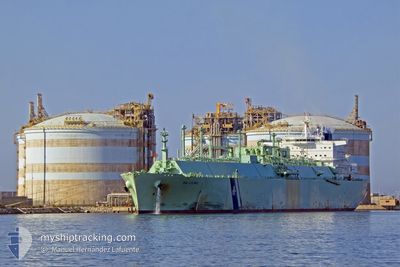
BW LILAC
Tanker
Current Trip
| Time Travelled | 17 days |
|---|---|
| Remaining Time | --- |
| Distance Travelled | 6810.81 морская миля |
| Remaining Distance | --- |
| AVG Speed | 15.9 Узлы |
| MAX Speed | 21 Узлы |
| AVG Wind | 10.4 knots |
| MAX Wind | 31.4 knots |
| MIN Temp | 13.3°C / 55.94°F |
| MAX Temp | 30.1°C / 86.18°F |
| Осадка | 11.1 м |
| Позиция Получена | 3 d тому назад |
Current Position
| Долгота | 17.97911° |
|---|---|
| Широта | -33.75332° |
| Статус | Under way using engine |
| Скорость | 15.9 Узлы |
| Курс | 308.5° |
| Район | South Atlantic Ocean |
| Станция | T-AIS |
| Позиция Получена | 3 d тому назад |
Info
Information
The current position of BW LILAC is in South Atlantic Ocean with coordinates -33.75332° / 17.97911° as reported on 2024-04-23 09:40 by AIS to our vessel tracker app. The vessel's current speed is 15.9 Узлы and is heading at the port of ZEEBRUGGE. The estimated time of arrival as calculated by MyShipTracking vessel tracking app is 2024-05-12 23:51 LT
The vessel BW LILAC (IMO: 9758076, MMSI: 248587000) is a Tanker It's sailing under the flag of [MT] Malta.
In this page you can find informations about the vessels current position, last detected port calls, and current voyage information. If the vessels is not in coverage by AIS you will find the latest position.
The current position of BW LILAC is detected by our AIS receivers and we are not responsible for the reliability of the data. The last position was recorded while the vessel was in Coverage by the Ais receivers of our vessel tracking app.
The current draught of BW LILAC as reported by AIS is 11.1 meters
Weather
| Temperature | 23.9°C / 75.02°F |
|---|---|
| Wind Speed | 13 knots |
| Direction | 123° ESE |
| Pressure | 1012.4 hPa |
| Humidity | 77.2 % |
| Cloud Coverage | 100 % |
Featured Company
Last Port Calls
| Port | Arrival | Departure | Time In Port |
|---|---|---|---|
| 2024-04-08 10:11 | 2024-04-09 10:05 | 23 h | |
| 2024-02-20 15:59 |
Most Visited Ports (Last year)
| Port | Arrivals | |
|---|---|---|
| 2 | ||
| 2 | ||
| 2 | ||
| 1 | ||
| 1 | ||
| 1 |
Last Trips
| Origin | Departure | Destination | Arrival | Distance | |
|---|---|---|---|---|---|
| 2024-02-20 16:59 | 2024-04-08 13:11 | 8070.41 морская миля |
Events
| Время | Событие | Детали | Позиция / Направление | Информация |
|---|---|---|---|---|
| 2024-04-23 09:46 | Статус изменился | Default Under way using engine |
-33.73592 / 17.95254
BE ZEE
|
Скорость: 15.9 kn Курс: 308.5° |
| 2024-04-23 09:40 | Статус изменился | Under way using engine Default |
-33.75332 / 17.97911
BE ZEE
|
Скорость: 15.9 kn Курс: 308° |
| 2024-04-23 09:40 | Вне покрытия |
-33.75332 / 17.97911
South Atlantic Ocean
BE ZEE
|
Скорость: 15.9 kn Курс: 308.5° |
|
| 2024-04-23 09:35 | Статус изменился | Default Under way using engine |
-33.76581 / 17.99821
BE ZEE
|
Скорость: 15.7 kn Курс: 309.4° |
| 2024-04-23 09:20 | Статус изменился | Under way using engine Default |
-33.80700 / 18.06152
BE ZEE
|
Скорость: 15 kn Курс: 308° |
| 2024-04-23 09:15 | Статус изменился | Default Under way using engine |
-33.81798 / 18.07864
BE ZEE
|
Скорость: 14.9 kn Курс: 308.1° |
| 2024-04-23 09:07 | Статус изменился | Under way using engine Default |
-33.83953 / 18.11247
BE ZEE
|
Скорость: 14.5 kn Курс: 308° |
| 2024-04-23 08:51 | Статус изменился | Default Under way using engine |
-33.87861 / 18.16841
BE ZEE
|
Скорость: 12.4 kn Курс: 310.1° |
| 2024-04-23 08:46 | Статус изменился | Under way using engine Default |
-33.89100 / 18.18598
BE ZEE
|
Скорость: 11.7 kn Курс: 297° |
| 2024-04-23 08:43 | Статус изменился | Default Under way using engine |
-33.89595 / 18.19491
BE ZEE
|
Скорость: 6.1 kn Курс: 318.4° |