

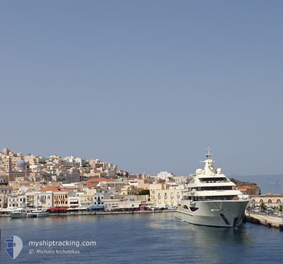
ALAIYA
Pleasure Craft

Current Trip
| Time Travelled | 1 day |
|---|---|
| Remaining Time | --- |
| Distance Travelled | 80.42 морская миля |
| Remaining Distance | --- |
| AVG Speed | 10 Узлы |
| MAX Speed | 14.9 Узлы |
| AVG Wind | 12.3 knots |
| MAX Wind | 18 knots |
| MIN Temp | 21°C / 69.8°F |
| MAX Temp | 26.4°C / 79.52°F |
| Осадка | 4.3 м |
| Позиция Получена | 5 m тому назад |
Current Position
| Долгота | --- |
|---|---|
| Широта | --- |
| Статус | Moored |
| Скорость | |
| Курс | 312° |
| Район | Persian Gulf |
| Станция | T-AIS |
| Позиция Получена | 5 m тому назад |
Information
The current position of ALAIYA is in Persian Gulf with coordinates 25.09860° / 55.14530° as reported on 2025-03-25 07:34 by AIS to our vessel tracker app. The vessel's current speed is 0 Узлы
The vessel ALAIYA (IMO: 1013076, MMSI: 319165800) is a Pleasure Craft It's sailing under the flag of [KY] Cayman Is.
In this page you can find informations about the vessels current position, last detected port calls, and current voyage information. If the vessels is not in coverage by AIS you will find the latest position.
The current position of ALAIYA is detected by our AIS receivers and we are not responsible for the reliability of the data. The last position was recorded while the vessel was in Coverage by the Ais receivers of our vessel tracking app.
The current draught of ALAIYA as reported by AIS is 4.3 meters
Weather
| Temperature | 23.3°C / 73.94°F |
|---|---|
| Wind Speed | 21 knots |
| Direction | 287° WNW |
| Pressure | 1016.2 hPa |
| Humidity | 36.1 % |
| Cloud Coverage | --- |


Featured Company
Events
| Время | Событие | Детали | Позиция / Направление | Информация |
|---|---|---|---|---|
| 2025-03-24 03:37 | Статус изменился | Moored Under way using engine |
25.09985 / 55.14588
ABU DHABI
|
Скорость: Курс: 42° |
| 2025-03-24 02:50 | Окончание движения | 1.42 nm, North of DUBAI MARINA |
25.10148 / 55.14717
ABU DHABI
|
Скорость: 0.3 kn Курс: 80° |
| 2025-03-23 20:16 | ПОРТ ОТПРАВЛЕНИЯ |
|
24.47862 / 54.30663
ABU DHABI
|
Скорость: 7.9 kn Курс: 320° |
| 2025-03-23 10:34 | Статус изменился | At anchor Under way using engine |
24.46793 / 54.31600
[AE] ABU DHABI
|
Скорость: 0.1 kn Курс: 96° |
| 2025-03-23 10:26 | Окончание движения |
24.46775 / 54.31598
[AE] ABU DHABI
|
Скорость: 0.2 kn Курс: 160° |
|
| 2025-03-23 10:15 | Порт |
|
24.47792 / 54.30833
[AE] ABU DHABI
|
Скорость: 3.8 kn Курс: 164° |
| 2025-03-23 08:36 | Начало движения | 8.52 nm, North East of ABU DHABI |
24.62792 / 54.38223
ABU DHABI
|
Скорость: 8.9 kn Курс: 287.8° |
| 2025-03-23 08:32 | Статус изменился | Under way using engine At anchor |
24.62790 / 54.38648
ABU DHABI
|
Скорость: 0.8 kn Курс: 178° |
| 2025-03-23 06:09 | Статус изменился | At anchor Under way using engine |
24.62870 / 54.38603
ABU DHABI
|
Скорость: 0.1 kn Курс: 154° |
| 2025-03-23 04:04 | Окончание движения | 8.6 nm, North East of ABU DHABI |
24.62792 / 54.38617
ABU DHABI
|
Скорость: 0.3 kn Курс: 168° |