
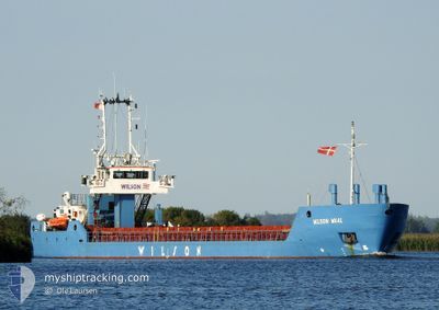
WILSON WAAL
General Cargo
Current Trip
| Time Travelled | 3 days |
|---|---|
| Remaining Time | --- |
| Distance Travelled | 728.02 nm |
| Remaining Distance | --- |
| AVG Speed | 9.3 Knopen |
| MAX Speed | 14.4 Knopen |
| AVG Wind | 15.1 knots |
| MAX Wind | 30 knots |
| MIN Temp | 4.3°C / 39.74°F |
| MAX Temp | 9.3°C / 48.74°F |
| Diepgang | 4.5 M |
| Positie ontvangen | 1 m geleden |
Current Position
| Lengtegraad | --- |
|---|---|
| Breedtegraat | --- |
| Status | At anchor |
| Snelheid | |
| Koers | 237° |
| Gebied | Inner Seas off the West Coast of Scotland |
| Station | T-AIS |
| Positie ontvangen | 1 m geleden |
Information
The current position of WILSON WAAL is in Inner Seas off the West Coast of Scotland with coordinates 57.26708° / -5.81173° as reported on 2025-03-27 21:06 by AIS to our vessel tracker app. The vessel's current speed is 0 Knopen
The vessel WILSON WAAL (IMO: 9178446, MMSI: 314262000) is a General Cargo that was built in 1999 ( 26 Jaar oud ). It's sailing under the flag of [BB] Barbados.
In this page you can find informations about the vessels current position, last detected port calls, and current voyage information. If the vessels is not in coverage by AIS you will find the latest position.
The current position of WILSON WAAL is detected by our AIS receivers and we are not responsible for the reliability of the data. The last position was recorded while the vessel was in Coverage by the Ais receivers of our vessel tracking app.
The current draught of WILSON WAAL as reported by AIS is 4.5 meters
Weather
| Temperature | 7.1°C / 44.78°F |
|---|---|
| Wind Speed | 16 knots |
| Direction | 237° WSW |
| Pressure | 998.2 hPa |
| Humidity | 82.3 % |
| Cloud Coverage | 100 % |
Featured Company
Last Port Calls
| Port | Arrival | Departure | Time In Port |
|---|---|---|---|
| 2025-03-24 02:51 | 2025-03-24 09:24 | 6 h | |
| 2025-03-21 23:46 | 2025-03-22 13:03 | 13 h | |
| 2025-03-14 02:52 | 2025-03-17 18:37 | 3 d | |
| 2025-03-07 01:07 | |||
| 2025-03-02 17:20 | 2025-03-06 18:16 | 4 d | |
| 2025-02-27 20:19 | 2025-02-28 19:11 | 22 h | |
| 2025-02-22 03:39 | 2025-02-24 01:17 | 1 d | |
| 2025-02-09 18:30 | 2025-02-10 17:33 | 23 h | |
| 2025-02-01 19:31 | 2025-02-04 07:03 | 2 d | |
| 2025-01-28 02:46 | 2025-01-29 12:02 | 1 d |
Last Trips
| Origin | Departure | Destination | Arrival | Distance | |
|---|---|---|---|---|---|
| 2025-03-22 14:03 | 2025-03-24 03:51 | 384.71 nm | |||
| 2025-03-17 19:37 | 2025-03-22 00:46 | 793.71 nm | |||
| 2025-03-06 18:16 | 2025-03-07 01:07 | 74.70 nm | |||
| 2025-02-28 20:11 | 2025-03-02 17:20 | 469.06 nm | |||
| 2025-02-24 02:17 | 2025-02-27 21:19 | 778.90 nm | |||
| 2025-02-10 18:33 | 2025-02-22 04:39 | 785.94 nm | |||
| 2025-02-04 08:03 | 2025-02-09 19:30 | 746.17 nm | |||
| 2025-01-29 13:02 | 2025-02-01 20:31 | 743.85 nm | |||
| 2025-01-28 02:47 | 2025-01-28 03:46 | 7.75 nm | |||
| 2025-01-27 14:30 | 2025-01-28 02:23 | 110.07 nm |
Events
| Tijd | Evenement | Details | Positie / Bestemming | Info |
|---|---|---|---|---|
| 2025-03-27 20:05 | Status Changed | At anchor Under way using engine |
57.26740 / -5.81214
GBKYL
|
Snelheid: Koers: 221° |
| 2025-03-27 19:00 | Stop beweging | 2.97 nm, West of KYLEAKIN |
57.26584 / -5.81367
GBKYL
|
Snelheid: 0.3 kn Koers: 227° |
| 2025-03-27 16:17 | Status Changed | Under way using engine Default |
57.64417 / -5.89891
GBKYL
|
Snelheid: 8.8 kn Koers: 182° |
| 2025-03-27 16:16 | Status Changed | Default Under way using engine |
57.64782 / -5.89881
GBKYL
|
Snelheid: 8.5 kn Koers: 181.1° |
| 2025-03-27 16:08 | Gevonden in zee | United Kingdom part of the Inner Seas off the West Coast of Scotland |
57.66747 / -5.89842
Inner Seas off the West Coast of Scotland
GBKYL
|
Snelheid: 8.5 kn Koers: 181.1° |
| 2025-03-27 16:08 | Status Changed | Under way using engine Default |
57.66747 / -5.89842
GBKYL
|
Snelheid: 8.4 kn Koers: 180° |
| 2025-03-27 16:04 | Binnenbereik |
57.66747 / -5.89842
Inner Seas off the West Coast of Scotland
GBKYL
|
Snelheid: 8.5 kn Koers: 181.1° |
|
| 2025-03-27 04:12 | Status Changed | Default Under way using engine |
58.68613 / -3.97445
GBKYL
|
Snelheid: 8.4 kn Koers: 267.8° |
| 2025-03-27 04:04 | Buitenbereik |
58.68654 / -3.93963
North Atlantic Ocean
GBKYL
|
Snelheid: 8.4 kn Koers: 267.8° |
|
| 2025-03-27 02:47 | Status Changed | Under way using engine Default |
58.69807 / -3.59387
GBKYL
|
Snelheid: 9.2 kn Koers: 268° |