
VERIGE
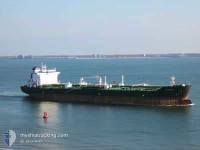
Oil/Chemical Tanker
Current Trip
| Time Travelled | 14 days |
|---|---|
| Remaining Time | --- |
| Distance Travelled | 3473.18 nm |
| Remaining Distance | --- |
| AVG Speed | 10.2 Knopen |
| MAX Speed | 14.1 Knopen |
| AVG Wind | 15.3 knots |
| MAX Wind | 36.8 knots |
| MIN Temp | -1.1°C / 30.02°F |
| MAX Temp | 15.2°C / 59.36°F |
| Diepgang | 11.5 M |
| Positie ontvangen | 6 d geleden |
Current Position
| Lengtegraad | -4.59843° |
|---|---|
| Breedtegraat | 49.72260° |
| Status | Under way using engine |
| Snelheid | 10.7 Knopen |
| Koers | 253.6° |
| Gebied | English Channel |
| Station | T-AIS |
| Positie ontvangen | 6 d geleden |
Info
Information
The current position of VERIGE is in English Channel with coordinates 49.72260° / -4.59843° as reported on 2024-04-29 13:07 by AIS to our vessel tracker app. The vessel's current speed is 10.7 Knopen and is heading at the port of WILMINGTON. The estimated time of arrival as calculated by MyShipTracking vessel tracking app is 2024-05-11 07:00 LT
The vessel VERIGE (IMO: 9401128, MMSI: 238265000) is a Oil/Chemical Tanker that was built in 2010 ( 14 Jaar oud ). It's sailing under the flag of [HR] Croatia.
In this page you can find informations about the vessels current position, last detected port calls, and current voyage information. If the vessels is not in coverage by AIS you will find the latest position.
The current position of VERIGE is detected by our AIS receivers and we are not responsible for the reliability of the data. The last position was recorded while the vessel was in Coverage by the Ais receivers of our vessel tracking app.
The current draught of VERIGE as reported by AIS is 11.5 meters
Weather
| Temperature | 13.6°C / 56.48°F |
|---|---|
| Wind Speed | 32 knots |
| Direction | 49° NE |
| Pressure | 1010.1 hPa |
| Humidity | 89.5 % |
| Cloud Coverage | 100 % |
Featured Company
Last Port Calls
| Port | Arrival | Departure | Time In Port |
|---|---|---|---|
| 2024-04-19 17:48 | 2024-04-21 08:52 | 1 d | |
| 2024-04-08 21:37 | 2024-04-13 11:20 | 4 d | |
| 2024-04-02 18:01 | 2024-04-06 01:18 | 3 d |
Most Visited Ports (Last year)
| Port | Arrivals | |
|---|---|---|
| 3 | ||
| 2 | ||
| 2 | ||
| 2 | ||
| 2 | ||
| 2 |
Last Trips
| Origin | Departure | Destination | Arrival | Distance | |
|---|---|---|---|---|---|
| 2024-04-13 12:20 | 2024-04-19 20:48 | 1794.31 nm | |||
| 2024-04-06 03:18 | 2024-04-08 22:37 | 726.86 nm | |||
| 2024-02-05 01:55 | 2024-04-02 20:01 | 9171.80 nm |
Events
| Tijd | Evenement | Details | Positie / Bestemming | Info |
|---|---|---|---|---|
| 2024-04-29 13:14 | Status Changed | Default Under way using engine |
49.71650 / -4.63105
US ILM
|
Snelheid: 10.7 kn Koers: 253.6° |
| 2024-04-29 13:07 | Buitenbereik |
49.72260 / -4.59843
English Channel
US ILM
|
Snelheid: 10.7 kn Koers: 253.6° |
|
| 2024-04-29 07:27 | Gevonden in zee | United Kingdom part of the English Channel |
49.95208 / -3.12590
English Channel
US ILM
|
Snelheid: 10.8 kn Koers: 256.2° |
| 2024-04-29 07:27 | Status Changed | Under way using engine Default |
49.95232 / -3.12440
US ILM
|
Snelheid: 10.8 kn Koers: 256° |
| 2024-04-29 07:10 | Binnenbereik |
49.95208 / -3.12590
English Channel
US ILM
|
Snelheid: 10.8 kn Koers: 256.2° |
|
| 2024-04-29 06:26 | Status Changed | Default Under way using engine |
49.99802 / -2.84082
US ILM
|
Snelheid: 12.1 kn Koers: 255.2° |
| 2024-04-29 06:18 | Buitenbereik |
50.00522 / -2.80007
English Channel
US ILM
|
Snelheid: 12.1 kn Koers: 255.2° |
|
| 2024-04-29 05:57 | Wijzig zee gebeid | Guernsey part of the English Channel United Kingdom part of the English Channel |
50.02367 / -2.69402
English Channel
US ILM
|
Snelheid: 12.4 kn Koers: 255.1° |
| 2024-04-29 05:57 | Status Changed | Under way using engine Default |
50.02412 / -2.69143
US ILM
|
Snelheid: 12.5 kn Koers: 256° |
| 2024-04-29 05:42 | Binnenbereik |
50.02367 / -2.69402
English Channel
US ILM
|
Snelheid: 12.4 kn Koers: 255.1° |