
VERIGE
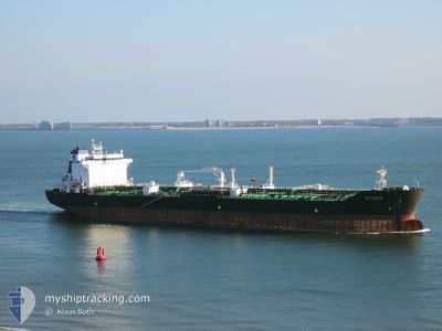
Oil/Chemical Tanker
Current Trip
| Time Travelled | 4 days |
|---|---|
| Remaining Time | 20 h, 24 mins |
| Distance Travelled | 1260.91 nm |
| Remaining Distance | 259.91 nm |
| AVG Speed | 10.8 Knop |
| MAX Speed | 12.7 Knop |
| AVG Wind | 13.1 knots |
| MAX Wind | 30 knots |
| MIN Temp | -1.1°C / 30.02°F |
| MAX Temp | 7.4°C / 45.32°F |
| Djupgående | 10.8 m |
| Position mottagen | 2 h, 12 m sen |
Current Position
| Longitud | 5.78397° |
|---|---|
| Latitude | 55.27903° |
| Status | Under way using engine |
| Fart | 11.2 Knop |
| Kurs | 215.4° |
| Område | North Sea |
| Station | T-AIS |
| Position mottagen | 2 h, 12 m sen |
Info
Information
The current position of VERIGE is in North Sea with coordinates 55.27903° / 5.78397° as reported on 2024-04-25 20:59 by AIS to our vessel tracker app. The vessel's current speed is 11.2 Knop and is heading at the port of VLISSINGEN. The estimated time of arrival as calculated by MyShipTracking vessel tracking app is 2024-04-26 19:35 LT
The vessel VERIGE (IMO: 9401128, MMSI: 238265000) is a Oil/Chemical Tanker that was built in 2010 ( 14 År gammal ). It's sailing under the flag of [HR] Croatia.
In this page you can find informations about the vessels current position, last detected port calls, and current voyage information. If the vessels is not in coverage by AIS you will find the latest position.
The current position of VERIGE is detected by our AIS receivers and we are not responsible for the reliability of the data. The last position was recorded while the vessel was in Coverage by the Ais receivers of our vessel tracking app.
The current draught of VERIGE as reported by AIS is 10.8 meters
Weather
| Temperature | 4.6°C / 40.28°F |
|---|---|
| Wind Speed | 16 knots |
| Direction | 95° E |
| Pressure | 999.9 hPa |
| Humidity | 95.6 % |
| Cloud Coverage | 99 % |
Featured Company
Last Port Calls
| Port | Arrival | Departure | Time In Port |
|---|---|---|---|
| 2024-04-19 17:48 | 2024-04-21 08:52 | 1 d | |
| 2024-04-08 21:37 | 2024-04-13 11:20 | 4 d | |
| 2024-04-02 18:01 | 2024-04-06 01:18 | 3 d | |
| 2024-02-02 06:16 | 2024-02-04 15:55 | 2 d |
Most Visited Ports (Last year)
| Port | Arrivals | |
|---|---|---|
| 3 | ||
| 2 | ||
| 2 | ||
| 2 | ||
| 2 | ||
| 2 |
Last Trips
| Origin | Departure | Destination | Arrival | Distance | |
|---|---|---|---|---|---|
| 2024-04-13 12:20 | 2024-04-19 20:48 | 1794.31 nm | |||
| 2024-04-06 03:18 | 2024-04-08 22:37 | 726.86 nm | |||
| 2024-02-05 01:55 | 2024-04-02 20:01 | 9171.80 nm | |||
| 2023-12-24 09:24 | 2024-02-02 16:16 | 3253.83 nm |
Events
| Tid | Event | Detaljer | Position / Dest | Information |
|---|---|---|---|---|
| 2024-04-25 21:20 | Status ändrad | Default Under way using engine |
55.22500 / 5.72167
NL VLI
|
Fart: 11.2 kn Kurs: 215.4° |
| 2024-04-25 20:59 | UTANFÖR täckningsområde |
55.27903 / 5.78397
North Sea
NL VLI
|
Fart: 11.2 kn Kurs: 215.4° |
|
| 2024-04-25 20:39 | Status ändrad | Under way using engine Default |
55.33203 / 5.84452
NL VLI
|
Fart: 11 kn Kurs: 214° |
| 2024-04-25 20:35 | Status ändrad | Default Under way using engine |
55.34333 / 5.85667
NL VLI
|
Fart: 11.2 kn Kurs: 211.6° |
| 2024-04-25 20:24 | Upptäckt i hav | German part of the North Sea |
55.37117 / 5.88848
North Sea
NL VLI
|
Fart: 11.2 kn Kurs: 211.6° |
| 2024-04-25 20:24 | Status ändrad | Under way using engine Default |
55.37117 / 5.88848
NL VLI
|
Fart: 11 kn Kurs: 214° |
| 2024-04-25 20:05 | I täckningsområde |
55.37117 / 5.88848
North Sea
NL VLI
|
Fart: 11.2 kn Kurs: 211.6° |
|
| 2024-04-25 14:07 | Status ändrad | Default Under way using engine |
56.37137 / 7.07135
NL VLI
|
Fart: 12 kn Kurs: 216.4° |
| 2024-04-25 13:44 | UTANFÖR täckningsområde |
56.43083 / 7.14893
North Sea
NL VLI
|
Fart: 12 kn Kurs: 216.4° |
|
| 2024-04-25 08:05 | Byter havsområde | Danish part of the North Sea Danish part of the Skaggerak |
57.28720 / 8.30238
North Sea
NL VLI
|
Fart: 10.9 kn Kurs: 217.2° |