
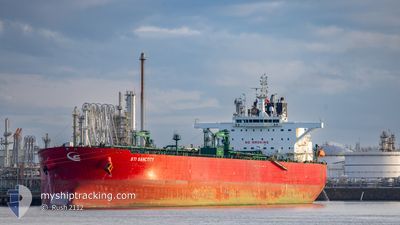
STI SANCTITY
Tanker
Current Trip
BEANR>>AUBTB
| Time Travelled | 46 days |
|---|---|
| Remaining Time | --- |
| Distance Travelled | 8819.31 nm |
| Remaining Distance | --- |
| AVG Speed | 11.3 Knopen |
| MAX Speed | 13.5 Knopen |
| AVG Wind | 15.3 knots |
| MAX Wind | 27.3 knots |
| MIN Temp | 11.5°C / 52.7°F |
| MAX Temp | 28.9°C / 84.02°F |
| Diepgang | 12.7 M |
| Positie ontvangen | Nu |
Current Position
| Lengtegraad | 151.38364° |
|---|---|
| Breedtegraat | -34.36693° |
| Status | Under way using engine |
| Snelheid | 9.6 Knopen |
| Koers | 4.7° |
| Gebied | Tasman Sea |
| Station | T-AIS |
| Positie ontvangen | Nu |
Info
Information
The current position of STI SANCTITY is in Tasman Sea with coordinates -34.36693° / 151.38364° as reported on 2024-05-03 12:08 by AIS to our vessel tracker app. The vessel's current speed is 9.6 Knopen
The vessel STI SANCTITY (IMO: 9719707, MMSI: 538006078) is a Tanker It's sailing under the flag of [MH] Marshall Is.
In this page you can find informations about the vessels current position, last detected port calls, and current voyage information. If the vessels is not in coverage by AIS you will find the latest position.
The current position of STI SANCTITY is detected by our AIS receivers and we are not responsible for the reliability of the data. The last position was recorded while the vessel was in Coverage by the Ais receivers of our vessel tracking app.
The current draught of STI SANCTITY as reported by AIS is 12.7 meters
Weather
| Temperature | 19.5°C / 67.1°F |
|---|---|
| Wind Speed | 12 knots |
| Direction | 146° SE |
| Pressure | 1026.4 hPa |
| Humidity | 60.2 % |
| Cloud Coverage | 98 % |
Featured Company
Last Port Calls
| Port | Arrival | Departure | Time In Port |
|---|---|---|---|
| 2024-03-13 04:43 | 2024-03-18 11:24 | 5 d | |
| 2024-03-03 12:16 | 2024-03-03 12:32 | 16 m | |
| 2024-03-03 12:01 |
Most Visited Ports (Last year)
| Port | Arrivals | |
|---|---|---|
| 7 | ||
| 3 | ||
| 3 | ||
| 2 | ||
| 2 | ||
| 2 |
Last Trips
| Origin | Departure | Destination | Arrival | Distance | |
|---|---|---|---|---|---|
| 2024-03-03 13:32 | 2024-03-13 05:43 | 219.19 nm | |||
| 2024-03-03 13:01 | 2024-03-03 13:16 | 0.76 nm |
Events
| Tijd | Evenement | Details | Positie / Bestemming | Info |
|---|---|---|---|---|
| 2024-05-03 11:53 | ETA Changed | 2024/05/03 13:30 2024/05/03 13:00 |
-34.40691 / 151.38116
BEANR>>AUBTB
|
Snelheid: 9.4 kn Koers: 2.6° |
| 2024-05-03 11:40 | Status Changed | Under way using engine Default |
-34.44098 / 151.37967
BEANR>>AUBTB
|
Snelheid: 9.5 kn Koers: 3° |
| 2024-05-03 11:38 | Status Changed | Default Under way using engine |
-34.44681 / 151.37933
BEANR>>AUBTB
|
Snelheid: 9.7 kn Koers: 2.9° |
| 2024-05-03 11:33 | Wijzig zee gebeid | Australian part of the Tasman Sea Australian part of the Bass Strait |
-34.45880 / 151.37868
Tasman Sea
BEANR>>AUBTB
|
Snelheid: 9.7 kn Koers: 2.9° |
| 2024-05-03 11:33 | Status Changed | Under way using engine Default |
-34.45930 / 151.37866
BEANR>>AUBTB
|
Snelheid: 9.8 kn Koers: 4° |
| 2024-05-03 11:33 | Binnenbereik |
-34.45880 / 151.37868
Tasman Sea
BEANR>>AUBTB
|
Snelheid: 9.7 kn Koers: 2.9° |
|
| 2024-05-02 02:39 | Status Changed | Default Under way using engine |
-39.17115 / 146.85994
BEANR>>AUBTB
|
Snelheid: 12.3 kn Koers: 64.2° |
| 2024-05-02 02:33 | Status Changed | Under way using engine Default |
-39.17959 / 146.83741
BEANR>>AUBTB
|
Snelheid: 12.3 kn Koers: 64° |
| 2024-05-02 02:33 | Buitenbereik |
-39.17959 / 146.83741
Bass Strait
BEANR>>AUBTB
|
Snelheid: 12.3 kn Koers: 64.2° |
|
| 2024-05-02 02:23 | Status Changed | Default Under way using engine |
-39.19433 / 146.79837
BEANR>>AUBTB
|
Snelheid: 12.5 kn Koers: 63.4° |