

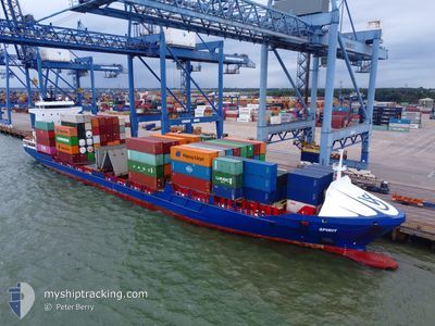
SPIRIT
Container Ship

Current Trip
| Time Travelled | 8 h, 19 mins |
|---|---|
| Remaining Time | 1 day |
| Distance Travelled | 88.31 nm |
| Remaining Distance | 301.46 nm |
| AVG Speed | 10.3 Knopen |
| MAX Speed | 15.3 Knopen |
| AVG Wind | 15.8 knots |
| MAX Wind | 18 knots |
| MIN Temp | 7.5°C / 45.5°F |
| MAX Temp | 9.4°C / 48.92°F |
| Diepgang | 6.9 M |
| Positie ontvangen | Nu |
Current Position
| Lengtegraad | --- |
|---|---|
| Breedtegraat | --- |
| Status | Under way using engine |
| Snelheid | 8.9 Knopen |
| Koers | 148.1° |
| Gebied | North Sea |
| Station | T-AIS |
| Positie ontvangen | Nu |
Information
The current position of SPIRIT is in North Sea with coordinates 55.53271° / -1.40888° as reported on 2025-03-02 22:09 by AIS to our vessel tracker app. The vessel's current speed is 8.9 Knopen and is heading at the port of ROTTERDAM. The estimated time of arrival as calculated by MyShipTracking vessel tracking app is 2025-03-04 11:13 LT
The vessel SPIRIT (IMO: 9302255, MMSI: 244850968) is a Container Ship that was built in 2005 ( 20 Jaar oud ). It's sailing under the flag of [NL] Netherlands.
In this page you can find informations about the vessels current position, last detected port calls, and current voyage information. If the vessels is not in coverage by AIS you will find the latest position.
The current position of SPIRIT is detected by our AIS receivers and we are not responsible for the reliability of the data. The last position was recorded while the vessel was in Coverage by the Ais receivers of our vessel tracking app.
The current draught of SPIRIT as reported by AIS is 6.9 meters
Weather
| Temperature | 7.6°C / 45.68°F |
|---|---|
| Wind Speed | 15 knots |
| Direction | 235° SW |
| Pressure | 1025.9 hPa |
| Humidity | 79.4 % |
| Cloud Coverage | 59 % |


Featured Company
Last Port Calls
| Port | Arrival | Departure | Time In Port |
|---|---|---|---|
| 2025-02-28 02:35 | 2025-03-02 13:51 | 2 d | |
| 2025-02-25 23:26 | 2025-02-26 17:58 | 18 h | |
| 2025-02-24 13:55 | 2025-02-25 01:08 | 11 h | |
| 2025-02-22 18:35 | 2025-02-24 03:17 | 1 d | |
| 2025-02-16 22:24 | 2025-02-22 10:29 | 5 d | |
| 2025-02-14 03:03 | 2025-02-15 16:17 | 1 d | |
| 2025-02-12 16:51 | 2025-02-13 15:49 | 22 h | |
| 2025-02-11 05:08 | 2025-02-11 11:11 | 6 h | |
| 2025-02-09 10:20 | 2025-02-09 22:32 | 12 h | |
| 2025-02-03 06:22 | 2025-02-06 21:00 | 3 d |
Most Visited Ports (Last year)
| Port | Arrivals | |
|---|---|---|
| 48 | ||
| 28 | ||
| 27 | ||
| 24 | ||
| 21 | ||
| 15 |
Last Trips
| Origin | Departure | Destination | Arrival | Distance | |
|---|---|---|---|---|---|
| 2025-02-26 17:58 | 2025-02-28 02:35 | 145.93 nm | |||
| 2025-02-25 01:08 | 2025-02-25 23:26 | 289.23 nm | |||
| 2025-02-24 03:17 | 2025-02-24 13:55 | 88.42 nm | |||
| 2025-02-22 10:29 | 2025-02-22 18:35 | 110.56 nm | |||
| 2025-02-15 16:17 | 2025-02-16 22:24 | 394.10 nm | |||
| 2025-02-13 15:49 | 2025-02-14 03:03 | 144.48 nm | |||
| 2025-02-11 11:11 | 2025-02-12 16:51 | 306.69 nm | |||
| 2025-02-09 22:32 | 2025-02-11 05:08 | 99.39 nm | |||
| 2025-02-06 21:00 | 2025-02-09 10:20 | 115.63 nm | |||
| 2025-01-31 12:59 | 2025-02-03 06:22 | 399.81 nm |
Events
| Tijd | Evenement | Details | Positie / Bestemming | Info |
|---|---|---|---|---|
| 2025-03-02 18:34 | Status Changed | Under way using engine Default |
55.93947 / -2.14873
ROTTERDAM
|
Snelheid: 11.5 kn Koers: 119° |
| 2025-03-02 17:39 | Status Changed | Default Under way using engine |
56.02421 / -2.42582
ROTTERDAM
|
Snelheid: 11.7 kn Koers: 118° |
| 2025-03-02 16:56 | Status Changed | Under way using engine Default |
56.09041 / -2.64206
ROTTERDAM
|
Snelheid: 11.6 kn Koers: 86° |
| 2025-03-02 16:44 | Status Changed | Default Under way using engine |
56.08821 / -2.71205
ROTTERDAM
|
Snelheid: 11.5 kn Koers: 86.1° |
| 2025-03-02 14:30 | Status Changed | Under way using engine Default |
56.00999 / -3.45003
ROTTERDAM
|
Snelheid: 13.8 kn Koers: 119° |
| 2025-03-02 14:24 | Status Changed | Default Under way using engine |
56.02233 / -3.48954
ROTTERDAM
|
Snelheid: 13.5 kn Koers: 108.5° |
| 2025-03-02 14:17 | Status Changed | Under way using engine Default |
56.03108 / -3.53414
ROTTERDAM
|
Snelheid: 13.5 kn Koers: 106° |
| 2025-03-02 14:12 | Status Changed | Default Under way using engine |
56.03617 / -3.56596
ROTTERDAM
|
Snelheid: 12.1 kn Koers: 87.9° |
| 2025-03-02 13:52 | Status Changed | Under way using engine Default |
56.03797 / -3.67423
ROTTERDAM
|
Snelheid: 7.7 kn Koers: 80° |
| 2025-03-02 13:52 | Draught Changed | 6.9 6.4 |
56.03531 / -3.68418
[GB] GRANGEMOUTH
|
Snelheid: 2.1 kn Koers: 64° |