
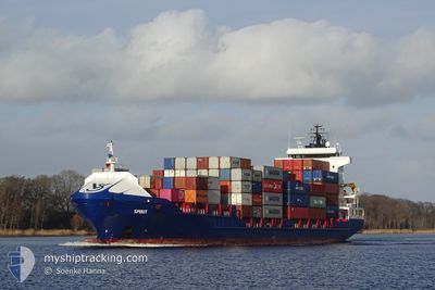
SPIRIT
Container Ship
Current Trip
| Trip Time | 2 days |
|---|---|
| Trip Distance | 963.01 nm |
| AVG Speed | 14.2 Knots |
| MAX Speed | 18 Knots |
| Dybgang | 6.7 m |
| AVG Wind | 14.5 knots |
| MAX Wind | 29 knots |
| MIN Temp | 11.6°C / 52.88°F |
| MAX Temp | 17.8°C / 64.04°F |
| Position Modtaget | 1 m siden |
Current Position
| Longitude | 4.42586° |
|---|---|
| Latitude | 51.87739° |
| Status | Moored |
| Fart | |
| Kurs | 288° |
| Område | North Sea |
| Station | T-AIS |
| Position Modtaget | 1 m siden |
Info
Information
The current position of SPIRIT is in North Sea with coordinates 51.87739° / 4.42586° as reported on 2024-05-01 09:26 by AIS to our vessel tracker app. The vessel's current speed is 0 Knots and is currently inside the port of ROTTERDAM WAALHAVEN.
The vessel SPIRIT (IMO: 9302255, MMSI: 244850968) is a Container Ship that was built in 2005 ( 19 år gamle ). It's sailing under the flag of [NL] Netherlands.
In this page you can find informations about the vessels current position, last detected port calls, and current voyage information. If the vessels is not in coverage by AIS you will find the latest position.
The current position of SPIRIT is detected by our AIS receivers and we are not responsible for the reliability of the data. The last position was recorded while the vessel was in Coverage by the Ais receivers of our vessel tracking app.
The current draught of SPIRIT as reported by AIS is 6.7 meters
Weather
| Temperature | 17.7°C / 63.86°F |
|---|---|
| Wind Speed | 9 knots |
| Direction | 346° NNW |
| Pressure | 1008.2 hPa |
| Humidity | 69.9 % |
| Cloud Coverage | 31 % |
Featured Company
Last Port Calls
| Port | Arrival | Departure | Time In Port |
|---|---|---|---|
| 2024-05-01 09:16 | |||
| 2024-04-27 16:21 | 2024-04-28 19:21 | 1 d | |
| 2024-04-25 22:28 | 2024-04-26 22:47 | 1 d | |
| 2024-04-25 09:26 | 2024-04-25 21:59 | 12 h | |
| 2024-04-20 14:56 | 2024-04-21 05:00 | 14 h | |
| 2024-04-19 17:12 | 2024-04-20 13:25 | 20 h | |
| 2024-04-18 03:31 | 2024-04-19 15:21 | 1 d | |
| 2024-04-16 05:27 | 2024-04-16 12:00 | 6 h | |
| 2024-04-14 05:48 | 2024-04-15 15:53 | 1 d | |
| 2024-04-11 22:45 | 2024-04-12 19:02 | 20 h |
Most Visited Ports (Last year)
| Port | Arrivals | |
|---|---|---|
| 32 | ||
| 30 | ||
| 26 | ||
| 26 | ||
| 25 | ||
| 21 |
Last Trips
| Origin | Departure | Destination | Arrival | Distance | |
|---|---|---|---|---|---|
| 2024-04-28 20:21 | 2024-05-01 11:16 | 963.01 nm | |||
| 2024-04-26 23:47 | 2024-04-27 17:21 | 201.39 nm | |||
| 2024-04-25 22:59 | 2024-04-25 23:28 | 2.61 nm | |||
| 2024-04-21 07:00 | 2024-04-25 10:26 | 1156.93 nm | |||
| 2024-04-20 15:25 | 2024-04-20 16:56 | 15.91 nm | |||
| 2024-04-19 17:21 | 2024-04-19 19:12 | 17.07 nm | |||
| 2024-04-16 13:00 | 2024-04-18 05:31 | 270.16 nm | |||
| 2024-04-15 16:53 | 2024-04-16 06:27 | 145.13 nm | |||
| 2024-04-12 20:02 | 2024-04-14 06:48 | 356.56 nm | |||
| 2024-04-11 10:12 | 2024-04-11 23:45 | 65.31 nm |
Events
| Tid | Hændelsen | Detaljer | Position / Dest | Info |
|---|---|---|---|---|
| 2024-05-01 09:24 | Destination er ændret | GRANGEMOUTH ROTTERDAM |
51.87743 / 4.42586
[NL] ROTTERDAM WAALHAVEN
|
Fart: Kurs: 289° |
| 2024-05-01 09:24 | Status er ændret | Moored Under way using engine |
51.87743 / 4.42586
[NL] ROTTERDAM WAALHAVEN
|
Fart: Kurs: 289° |
| 2024-05-01 09:17 | STOP Sejllads |
51.87751 / 4.42589
[NL] ROTTERDAM WAALHAVEN
|
Fart: 0.3 kn Kurs: 296° |
|
| 2024-05-01 09:16 | Skibe i havn |
|
51.87754 / 4.42575
[NL] ROTTERDAM WAALHAVEN
|
Fart: 0.6 kn Kurs: 303° |
| 2024-05-01 04:35 | Ændre havområde | Dutch part of the North Sea Belgian part of the North Sea |
51.77711 / 2.71614
North Sea
ROTTERDAM
|
Fart: 17 kn Kurs: 67.1° |
| 2024-05-01 03:11 | Ændre havområde | Belgian part of the North Sea French part of the North Sea |
51.50504 / 2.27239
North Sea
ROTTERDAM
|
Fart: 16.6 kn Kurs: 41.2° |
| 2024-05-01 02:28 | Ændre havområde | French part of the North Sea United Kingdom part of the North Sea |
51.36984 / 2.05554
North Sea
ROTTERDAM
|
Fart: 16.2 kn Kurs: 48.1° |
| 2024-05-01 00:59 | Ændre havområde | United Kingdom part of the North Sea French part of the North Sea |
51.07055 / 1.63851
North Sea
ROTTERDAM
|
Fart: 15.7 kn Kurs: 38.2° |
| 2024-05-01 00:46 | Ændre havområde | French part of the North Sea French part of the English Channel |
51.02741 / 1.58463
North Sea
ROTTERDAM
|
Fart: 15.4 kn Kurs: 36.2° |
| 2024-04-30 22:30 | Status er ændret | Under way using engine Default |
50.55078 / 1.07658
ROTTERDAM
|
Fart: 15.7 kn Kurs: 48° |