

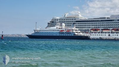
SEADREAM 1
Not available

Current Trip
| Time Travelled | 2 days |
|---|---|
| Remaining Time | 4 h, 48 mins |
| Distance Travelled | 184.36 nm |
| Remaining Distance | 61.04 nm |
| AVG Speed | 8.3 Knopen |
| MAX Speed | 11.9 Knopen |
| AVG Wind | 16.7 knots |
| MAX Wind | 20 knots |
| MIN Temp | 25°C / 77°F |
| MAX Temp | 27.9°C / 82.22°F |
| Diepgang | 4 M |
| Positie ontvangen | 3 h, 51 m geleden |
Current Position
| Lengtegraad | --- |
|---|---|
| Breedtegraat | --- |
| Status | Under way using engine |
| Snelheid | 9 Knopen |
| Koers | 87.8° |
| Gebied | Caribbean Sea |
| Station | T-AIS |
| Positie ontvangen | 3 h, 51 m geleden |
Information
The current position of SEADREAM 1 is in Caribbean Sea with coordinates 13.00326° / -60.99366° as reported on 2025-03-29 01:32 by AIS to our vessel tracker app. The vessel's current speed is 9 Knopen and is heading at the port of BRIDGETOWN. The estimated time of arrival as calculated by MyShipTracking vessel tracking app is 2025-03-29 06:11 LT
The vessel SEADREAM 1 (MMSI: 308908000) is a Not available It's sailing under the flag of [BS] Bahamas.
In this page you can find informations about the vessels current position, last detected port calls, and current voyage information. If the vessels is not in coverage by AIS you will find the latest position.
The current position of SEADREAM 1 is detected by our AIS receivers and we are not responsible for the reliability of the data. The last position was recorded while the vessel was in Coverage by the Ais receivers of our vessel tracking app.
The current draught of SEADREAM 1 as reported by AIS is 4 meters
Weather
| Temperature | 26.2°C / 79.16°F |
|---|---|
| Wind Speed | 16 knots |
| Direction | 78° ENE |
| Pressure | 1013.8 hPa |
| Humidity | 72 % |
| Cloud Coverage | 78 % |


Featured Company
Last Port Calls
| Port | Arrival | Departure | Time In Port |
|---|---|---|---|
| 2025-03-26 07:31 | 2025-03-26 14:40 | 7 h | |
| 2025-03-22 06:07 | 2025-03-22 19:44 | 13 h | |
| 2025-03-20 07:44 | 2025-03-20 14:18 | 6 h | |
| 2025-03-15 06:35 | 2025-03-15 18:44 | 12 h | |
| 2025-03-08 06:46 | 2025-03-08 18:13 | 11 h | |
| 2025-03-05 07:19 | 2025-03-05 14:38 | 7 h | |
| 2025-03-01 05:08 | 2025-03-01 18:52 | 13 h | |
| 2025-02-22 07:26 | 2025-02-22 18:10 | 10 h | |
| 2025-02-20 06:38 | 2025-02-20 15:54 | 9 h | |
| 2025-02-18 11:45 | 2025-02-18 18:46 | 7 h |
Most Visited Ports (Last year)
| Port | Arrivals | |
|---|---|---|
| 12 | ||
| 8 | ||
| 8 | ||
| 6 | ||
| 6 | ||
| 6 |
Last Trips
| Origin | Departure | Destination | Arrival | Distance | |
|---|---|---|---|---|---|
| 2025-03-22 19:44 | 2025-03-26 07:31 | 373.68 nm | |||
| 2025-03-20 14:18 | 2025-03-22 06:07 | 215.26 nm | |||
| 2025-03-15 18:44 | 2025-03-20 07:44 | 389.44 nm | |||
| 2025-03-08 18:13 | 2025-03-15 06:35 | 696.15 nm | |||
| 2025-03-05 14:38 | 2025-03-08 06:46 | 249.65 nm | |||
| 2025-03-01 18:52 | 2025-03-05 07:19 | 439.17 nm | |||
| 2025-02-22 18:10 | 2025-03-01 05:08 | 679.22 nm | |||
| 2025-02-20 15:54 | 2025-02-22 07:26 | 92.01 nm | |||
| 2025-02-18 18:46 | 2025-02-20 06:38 | 133.84 nm | |||
| 2025-02-17 18:23 | 2025-02-18 11:45 | 202.06 nm |
Events
| Tijd | Evenement | Details | Positie / Bestemming | Info |
|---|---|---|---|---|
| 2025-03-29 01:40 | Status Changed | Default Under way using engine |
13.00377 / -60.97257
BB BGI
|
Snelheid: 9 kn Koers: 87.8° |
| 2025-03-29 01:32 | Buitenbereik |
13.00326 / -60.99366
Caribbean Sea
|
Snelheid: 9 kn Koers: 87.8° |
|
| 2025-03-29 00:22 | Destination Changed | BB BGI SOUFRIERE,LC |
12.97668 / -61.17169
BB BGI
|
Snelheid: 8.9 kn Koers: 34° |
| 2025-03-29 00:13 | Status Changed | Under way using engine Default |
12.95876 / -61.18357
SOUFRIERE,LC
|
Snelheid: 9.3 kn Koers: 43° |
| 2025-03-28 23:27 | Status Changed | Default Under way using engine |
12.87101 / -61.26100
SOUFRIERE,LC
|
Snelheid: 9 kn Koers: 44.5° |
| 2025-03-28 23:22 | Status Changed | Under way using engine Default |
12.86132 / -61.27046
SOUFRIERE,LC
|
Snelheid: 9.4 kn Koers: 34° |
| 2025-03-28 22:58 | Status Changed | Default Under way using engine |
12.81212 / -61.31272
SOUFRIERE,LC
|
Snelheid: 9.9 kn Koers: 33.7° |
| 2025-03-28 22:43 | Status Changed | Under way using engine Default |
12.78057 / -61.33867
SOUFRIERE,LC
|
Snelheid: 9.5 kn Koers: 37° |
| 2025-03-28 22:38 | Status Changed | Default Under way using engine |
12.76957 / -61.34687
SOUFRIERE,LC
|
Snelheid: 10 kn Koers: 43.1° |
| 2025-03-28 21:22 | Start beweging | 19.19 nm, South West of MUSTIQUE |
12.63526 / -61.40272
SOUFRIERE,LC
|
Snelheid: 3.2 kn Koers: 282° |