
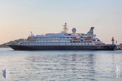
SEADREAM 1
Passengers Ship
Current Trip
IT GIA
| Time Travelled | 20 h, 30 mins |
|---|---|
| Remaining Time | --- |
| Distance Travelled | 75.77 nm |
| Remaining Distance | --- |
| AVG Speed | 8.5 Knots |
| MAX Speed | 12.4 Knots |
| AVG Wind | 4 knots |
| MAX Wind | 12 knots |
| MIN Temp | 18.4°C / 65.12°F |
| MAX Temp | 27.2°C / 80.96°F |
| Draught | 4.3 m |
| Position Received | 11 h, 39 m ago |
Current Position
| Longitude | 15.35333° |
|---|---|
| Latitude | 37.86300° |
| Status | Under way using engine |
| Speed | 9.2 Knots |
| Course | 227.7° |
| Area | Ionian Sea |
| Station | T-AIS |
| Position Received | 11 h, 39 m ago |
Info
Information
The current position of SEADREAM 1 is in Ionian Sea with coordinates 37.86300° / 15.35333° as reported on 2024-06-08 05:11 by AIS to our vessel tracker app. The vessel's current speed is 9.2 Knots
The vessel SEADREAM 1 (IMO: 8203438, MMSI: 308908000) is a Passengers Ship that was built in 1984 ( 40 years old ). It's sailing under the flag of [BS] Bahamas.
In this page you can find informations about the vessels current position, last detected port calls, and current voyage information. If the vessels is not in coverage by AIS you will find the latest position.
The current position of SEADREAM 1 is detected by our AIS receivers and we are not responsible for the reliability of the data. The last position was recorded while the vessel was in Coverage by the Ais receivers of our vessel tracking app.
The current draught of SEADREAM 1 as reported by AIS is 4.3 meters
Weather
| Temperature | 25.9°C / 78.62°F |
|---|---|
| Wind Speed | 3 knots |
| Direction | 154° SSE |
| Pressure | 1013.1 hPa |
| Humidity | 40.9 % |
| Cloud Coverage | 3 % |
Featured Company
Last Port Calls
| Port | Arrival | Departure | Time In Port |
|---|---|---|---|
| 2024-06-07 05:49 | 2024-06-07 20:20 | 14 h | |
| 2024-06-03 05:30 | 2024-06-03 15:29 | 9 h | |
| 2024-06-02 05:40 | 2024-06-02 16:10 | 10 h | |
| 2024-05-31 05:10 | 2024-05-31 21:36 | 16 h | |
| 2024-05-29 05:07 | 2024-05-30 20:38 | 1 d | |
| 2024-05-27 04:36 | 2024-05-27 18:22 | 13 h | |
| 2024-05-24 05:16 | 2024-05-24 20:32 | 15 h | |
| 2024-05-23 08:07 | 2024-05-23 20:22 | 12 h | |
| 2024-05-22 07:06 | 2024-05-22 15:08 | 8 h | |
| 2024-05-21 04:38 | 2024-05-21 14:14 | 9 h |
Most Visited Ports (Last year)
| Port | Arrivals | |
|---|---|---|
| 10 | ||
| 9 | ||
| 8 | ||
| 7 | ||
| 6 | ||
| 6 |
Last Trips
| Origin | Departure | Destination | Arrival | Distance | |
|---|---|---|---|---|---|
| 2024-06-03 17:29 | 2024-06-07 07:49 | 403.35 nm | |||
| 2024-06-02 18:10 | 2024-06-03 07:30 | 131.37 nm | |||
| 2024-05-31 23:36 | 2024-06-02 07:40 | 111.68 nm | |||
| 2024-05-30 22:38 | 2024-05-31 07:10 | 49.86 nm | |||
| 2024-05-27 20:22 | 2024-05-29 07:07 | 173.40 nm | |||
| 2024-05-24 22:32 | 2024-05-27 06:36 | 295.54 nm | |||
| 2024-05-23 22:22 | 2024-05-24 07:16 | 105.16 nm | |||
| 2024-05-22 17:08 | 2024-05-23 10:07 | 198.56 nm | |||
| 2024-05-21 16:14 | 2024-05-22 09:06 | 191.02 nm | |||
| 2024-05-20 19:24 | 2024-05-21 06:38 | 106.78 nm |
Events
| Time | Event | Details | Position / Dest | Info |
|---|---|---|---|---|
| 2024-06-08 16:04 | START Moving |
37.82130 / 15.28377
IT GIA
|
Speed: 10.8 kn Course: 163° |
|
| 2024-06-08 05:57 | STOP Moving | 21.5 nm, South West of TREMESTIERI |
37.83104 / 15.28042
IT GIA
|
Speed: 0.2 kn Course: 292° |
| 2024-06-08 05:14 | Status Changed | Default Under way using engine |
37.85728 / 15.34459
IT GIA
|
Speed: 9.2 kn Course: 227.7° |
| 2024-06-08 05:11 | OUT of Coverage |
37.86300 / 15.35333
Ionian Sea
IT GIA
|
Speed: 9.2 kn Course: 227.7° |
|
| 2024-06-08 05:08 | Status Changed | Under way using engine Default |
37.86858 / 15.35996
IT GIA
|
Speed: 9 kn Course: 219° |
| 2024-06-08 04:45 | Status Changed | Default Under way using engine |
37.91320 / 15.40739
IT GIA
|
Speed: 9.2 kn Course: 218.1° |
| 2024-06-08 04:29 | Status Changed | Under way using engine Default |
37.94644 / 15.44038
IT GIA
|
Speed: 9.2 kn Course: 218° |
| 2024-06-08 04:01 | Status Changed | Default Under way using engine |
38.00438 / 15.49558
IT GIA
|
Speed: 9.5 kn Course: 205.2° |
| 2024-06-08 02:20 | Change Sea Area | Italian part of the Ionian Sea Italian part of the Tyrrhenian Sea |
38.25655 / 15.64845
Ionian Sea
IT GIA
|
Speed: 9.4 kn Course: 246.1° |
| 2024-06-07 20:20 | PORT DEPARTURE |
|
38.46530 / 14.96547
IT GIA
|
Speed: 4 kn Course: 124° |