

SE MARINA
Cargo

Current Trip
| Time Travelled | 10 days |
|---|---|
| Remaining Time | --- |
| Distance Travelled | 1092.50 nm |
| Remaining Distance | --- |
| AVG Speed | 10.5 Knopen |
| MAX Speed | 14.1 Knopen |
| AVG Wind | 13.4 knots |
| MAX Wind | 32 knots |
| MIN Temp | 21.8°C / 71.24°F |
| MAX Temp | 30.3°C / 86.54°F |
| Diepgang | 8.7 M |
| Positie ontvangen | 3 h, 43 m geleden |
Current Position
| Lengtegraad | --- |
|---|---|
| Breedtegraat | --- |
| Status | At anchor |
| Snelheid | 0.1 Knopen |
| Koers | 219° |
| Gebied | Indian Ocean |
| Station | T-AIS |
| Positie ontvangen | 3 h, 43 m geleden |
Information
The current position of SE MARINA is in Indian Ocean with coordinates -20.40575° / 116.56992° as reported on 2025-02-19 20:10 by AIS to our vessel tracker app. The vessel's current speed is 0.1 Knopen
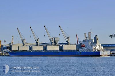
The vessel SE MARINA (IMO: 9701047, MMSI: 370677000) is a Cargo It's sailing under the flag of [PA] Panama.
In this page you can find informations about the vessels current position, last detected port calls, and current voyage information. If the vessels is not in coverage by AIS you will find the latest position.
The current position of SE MARINA is detected by our AIS receivers and we are not responsible for the reliability of the data. The last position was recorded while the vessel was in Coverage by the Ais receivers of our vessel tracking app.
The current draught of SE MARINA as reported by AIS is 8.7 meters
Weather
| Temperature | 29.8°C / 85.64°F |
|---|---|
| Wind Speed | 13 knots |
| Direction | 214° SW |
| Pressure | 1010.3 hPa |
| Humidity | 60.8 % |
| Cloud Coverage | 41 % |


Featured Company
Last Port Calls
| Port | Arrival | Departure | Time In Port |
|---|---|---|---|
| 2025-02-07 01:51 | 2025-02-09 19:27 | 2 d | |
| 2025-01-31 17:43 | 2025-02-02 06:22 | 1 d | |
| 2025-01-24 04:39 | 2025-01-28 07:50 | 4 d | |
| 2025-01-12 16:56 | 2025-01-19 20:39 | 7 d | |
| 2025-01-02 23:54 | 2025-01-09 12:34 | 6 d | |
| 2024-12-10 16:24 | 2024-12-13 14:25 | 2 d |
Most Visited Ports (Last year)
| Port | Arrivals | |
|---|---|---|
| 3 | ||
| 2 | ||
| 1 | ||
| 1 | ||
| 1 | ||
| 1 |
Last Trips
| Origin | Departure | Destination | Arrival | Distance | |
|---|---|---|---|---|---|
| 2025-02-02 16:52 | 2025-02-07 09:51 | 1372.51 nm | |||
| 2025-01-28 18:50 | 2025-02-01 04:13 | 1048.02 nm | |||
| 2025-01-20 07:39 | 2025-01-24 15:39 | 257.09 nm | |||
| 2025-01-09 23:34 | 2025-01-13 03:56 | 160.65 nm | |||
| 2024-12-13 22:25 | 2025-01-03 10:54 | 5703.51 nm | |||
| 2024-10-09 18:52 | 2024-12-11 00:24 | 11417.47 nm |
Events
| Tijd | Evenement | Details | Positie / Bestemming | Info |
|---|---|---|---|---|
| 2025-02-19 20:16 | Status Changed | Default At anchor |
-20.40598 / 116.57013
AUDAM
|
Snelheid: 0.1 kn Koers: 219° |
| 2025-02-19 20:10 | Status Changed | At anchor Default |
-20.40575 / 116.56992
AUDAM
|
Snelheid: 0.2 kn Koers: 233° |
| 2025-02-19 20:10 | Buitenbereik |
-20.40575 / 116.56992
Indian Ocean
|
Snelheid: 0.1 kn Koers: 318.7° |
|
| 2025-02-19 19:58 | Binnenbereik |
-20.40575 / 116.56992
Indian Ocean
|
Snelheid: 0.1 kn Koers: 318.7° |
|
| 2025-02-16 00:37 | ETA Changed | 2025/02/12 20:00 2025/02/13 08:00 |
-20.40737 / 116.57014
AUDAM
|
Snelheid: 0.1 kn Koers: 281° |
| 2025-02-14 19:01 | Stop beweging | 16.56 nm, North West of DAMPIER |
-20.40527 / 116.56660
AUDAM
|
Snelheid: 0.3 kn Koers: 145° |
| 2025-02-14 07:28 | Start beweging |
-20.16779 / 114.49407
AUDAM
|
Snelheid: 3.7 kn Koers: 77° |
|
| 2025-02-14 05:45 | Stop beweging |
-20.18217 / 114.47580
AUDAM
|
Snelheid: 0.3 kn Koers: 161° |
|
| 2025-02-14 00:50 | Start beweging |
-20.22625 / 114.54041
AUDAM
|
Snelheid: 3.4 kn Koers: 283° |
|
| 2025-02-14 00:40 | Stop beweging |
-20.22702 / 114.54478
AUDAM
|
Snelheid: 0.2 kn Koers: 200° |