
RIO GRANDE
Container Ship
Current Trip
| Time Travelled | 3 days |
|---|---|
| Remaining Time | --- |
| Distance Travelled | 1424.15 nm |
| Remaining Distance | 534.31 nm |
| AVG Speed | 16 Knopen |
| MAX Speed | 20.7 Knopen |
| AVG Wind | 9.9 knots |
| MAX Wind | 14.9 knots |
| MIN Temp | 26.4°C / 79.52°F |
| MAX Temp | 30.5°C / 86.9°F |
| Diepgang | 8.5 M |
| Positie ontvangen | Nu |
Current Position
| Lengtegraad | 104.41059° |
|---|---|
| Breedtegraat | 1.38965° |
| Status | Under way using engine |
| Snelheid | 9.3 Knopen |
| Koers | 230.4° |
| Gebied | South China Sea |
| Station | T-AIS |
| Positie ontvangen | Nu |
Info
Information
The current position of RIO GRANDE is in South China Sea with coordinates 1.38965° / 104.41059° as reported on 2024-06-06 11:42 by AIS to our vessel tracker app. The vessel's current speed is 9.3 Knopen and is heading at the port of PORT KLANG. The estimated time of arrival as calculated by MyShipTracking vessel tracking app is 2024-06-06 16:00 LT
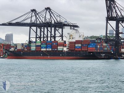
The vessel RIO GRANDE (IMO: 9363376, MMSI: 249253000) is a Container Ship that was built in 2008 ( 16 Jaar oud ). It's sailing under the flag of [MT] Malta.
In this page you can find informations about the vessels current position, last detected port calls, and current voyage information. If the vessels is not in coverage by AIS you will find the latest position.
The current position of RIO GRANDE is detected by our AIS receivers and we are not responsible for the reliability of the data. The last position was recorded while the vessel was in Coverage by the Ais receivers of our vessel tracking app.
The current draught of RIO GRANDE as reported by AIS is 8.5 meters
Weather
| Temperature | 30°C / 86°F |
|---|---|
| Wind Speed | 5 knots |
| Direction | 123° ESE |
| Pressure | 1009.4 hPa |
| Humidity | 69.9 % |
| Cloud Coverage | 22 % |
Featured Company
Last Port Calls
| Port | Arrival | Departure | Time In Port |
|---|---|---|---|
| 2024-06-01 22:36 | 2024-06-03 00:16 | 1 d | |
| 2024-05-31 02:38 | 2024-05-31 19:09 | 16 h | |
| 2024-05-19 21:43 | 2024-05-21 03:52 | 1 d | |
| 2024-05-15 04:39 | 2024-05-16 10:37 | 1 d | |
| 2024-05-09 21:32 | 2024-05-11 23:35 | 2 d | |
| 2024-04-27 11:48 | 2024-04-28 06:19 | 18 h | |
| 2024-04-25 12:05 | 2024-04-26 07:26 | 19 h | |
| 2024-04-11 13:51 | 2024-04-12 22:39 | 1 d | |
| 2024-04-08 03:26 | 2024-04-09 04:47 | 1 d |
Last Trips
| Origin | Departure | Destination | Arrival | Distance | |
|---|---|---|---|---|---|
| 2024-05-31 19:09 | 2024-06-01 22:36 | 159.36 nm | |||
| 2024-05-21 03:52 | 2024-05-31 02:38 | 4095.32 nm | |||
| 2024-05-16 10:37 | 2024-05-19 21:43 | 1114.05 nm | |||
| 2024-05-11 23:35 | 2024-05-15 04:39 | 652.94 nm | |||
| 2024-04-28 06:19 | 2024-05-09 21:32 | 4550.33 nm | |||
| 2024-04-26 07:26 | 2024-04-27 11:48 | 56.67 nm | |||
| 2024-04-12 22:39 | 2024-04-25 12:05 | 4275.70 nm | |||
| 2024-04-09 04:47 | 2024-04-11 13:51 | 1101.80 nm | |||
| 2024-04-01 09:18 | 2024-04-08 03:26 | 852.56 nm |
Events
| Tijd | Evenement | Details | Positie / Bestemming | Info |
|---|---|---|---|---|
| 2024-06-06 11:35 | Gevonden in zee | Malaysian part of the South China Sea |
1.40150 / 104.42465
South China Sea
PORT KELANG
|
Snelheid: 9.3 kn Koers: 230.4° |
| 2024-06-06 11:35 | Binnenbereik |
1.40150 / 104.42465
South China Sea
PORT KELANG
|
Snelheid: 9.3 kn Koers: 230.4° |
|
| 2024-06-02 19:30 | Status Changed | Default Under way using engine |
21.92324 / 114.36595
PORT KELANG
|
Snelheid: 19.8 kn Koers: 175° |
| 2024-06-02 19:26 | Status Changed | Under way using engine Default |
21.94477 / 114.36647
PORT KELANG
|
Snelheid: 20 kn Koers: 174° |
| 2024-06-02 19:26 | Buitenbereik |
21.94477 / 114.36647
South China Sea
PORT KELANG
|
Snelheid: 19.8 kn Koers: 175° |
|
| 2024-06-02 19:22 | Status Changed | Default Under way using engine |
21.96746 / 114.36436
PORT KELANG
|
Snelheid: 19.7 kn Koers: 175.7° |
| 2024-06-02 19:17 | Status Changed | Under way using engine Default |
21.99357 / 114.36217
PORT KELANG
|
Snelheid: 19.4 kn Koers: 176° |
| 2024-06-02 19:14 | Status Changed | Default Under way using engine |
22.01108 / 114.36073
PORT KELANG
|
Snelheid: 18.6 kn Koers: 170.2° |
| 2024-06-02 16:39 | Status Changed | Under way using engine Default |
22.38323 / 113.89522
PORT KELANG
|
Snelheid: 9.6 kn Koers: 170° |
| 2024-06-02 16:34 | Status Changed | Default Under way using engine |
22.40196 / 113.88933
PORT KELANG
|
Snelheid: 7.4 kn Koers: 167.8° |