

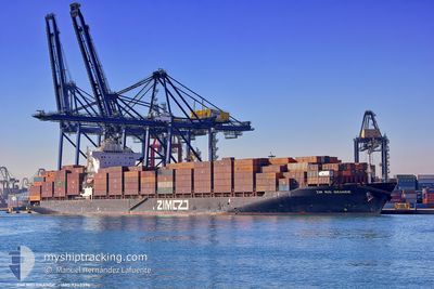
RIO GRANDE
Container Ship

Current Trip
| Time Travelled | 10 days |
|---|---|
| Remaining Time | --- |
| Distance Travelled | 3781.84 nm |
| Remaining Distance | 51.97 nm |
| AVG Speed | 14.3 Knop |
| MAX Speed | 18.8 Knop |
| AVG Wind | 14 knots |
| MAX Wind | 27 knots |
| MIN Temp | 23°C / 73.4°F |
| MAX Temp | 29°C / 84.2°F |
| Djupgående | 12 m |
| Position mottagen | 3 m sen |
Current Position
| Longitud | --- |
|---|---|
| Latitude | --- |
| Status | At anchor |
| Fart | 0.2 Knop |
| Kurs | 135° |
| Område | Coral Sea |
| Station | T-AIS |
| Position mottagen | 3 m sen |
Information
The current position of RIO GRANDE is in Coral Sea with coordinates -26.80048° / 153.27519° as reported on 2025-03-18 08:04 by AIS to our vessel tracker app. The vessel's current speed is 0.2 Knop and is heading at the port of BRISBANE. The estimated time of arrival as calculated by MyShipTracking vessel tracking app is 2025-03-21 22:00 LT
The vessel RIO GRANDE (IMO: 9363376, MMSI: 249253000) is a Container Ship that was built in 2008 ( 17 År gammal ). It's sailing under the flag of [MT] Malta.
In this page you can find informations about the vessels current position, last detected port calls, and current voyage information. If the vessels is not in coverage by AIS you will find the latest position.
The current position of RIO GRANDE is detected by our AIS receivers and we are not responsible for the reliability of the data. The last position was recorded while the vessel was in Coverage by the Ais receivers of our vessel tracking app.
The current draught of RIO GRANDE as reported by AIS is 12 meters
Weather
| Temperature | 23.7°C / 74.66°F |
|---|---|
| Wind Speed | 20 knots |
| Direction | 137° SE |
| Pressure | 1019.3 hPa |
| Humidity | 67.8 % |
| Cloud Coverage | 100 % |


Featured Company
Last Port Calls
| Port | Arrival | Departure | Time In Port |
|---|---|---|---|
| 2025-03-07 08:07 | 2025-03-08 01:24 | 17 h | |
| 2025-03-05 02:45 | 2025-03-05 21:45 | 18 h | |
| 2025-02-28 16:28 | 2025-03-02 13:56 | 1 d | |
| 2025-02-13 11:41 | 2025-02-14 12:41 | 1 d | |
| 2025-02-10 20:07 | 2025-02-11 22:14 | 1 d | |
| 2025-02-07 10:39 | 2025-02-08 11:53 | 1 d | |
| 2025-02-04 21:29 | 2025-02-05 23:38 | 1 d | |
| 2025-01-23 13:59 | 2025-01-24 18:35 | 1 d | |
| 2025-01-20 11:57 | 2025-01-21 13:01 | 1 d | |
| 2025-01-17 01:48 | 2025-01-18 05:32 | 1 d |
Last Trips
| Origin | Departure | Destination | Arrival | Distance | |
|---|---|---|---|---|---|
| 2025-03-05 21:45 | 2025-03-07 08:07 | 209.24 nm | |||
| 2025-03-02 13:56 | 2025-03-05 02:45 | 777.50 nm | |||
| 2025-02-14 12:41 | 2025-02-28 16:28 | 3369.16 nm | |||
| 2025-02-11 22:14 | 2025-02-13 11:41 | 511.75 nm | |||
| 2025-02-08 11:53 | 2025-02-10 20:07 | 618.15 nm | |||
| 2025-02-05 23:38 | 2025-02-07 10:39 | 546.45 nm | |||
| 2025-01-24 18:35 | 2025-02-04 21:29 | 3851.28 nm | |||
| 2025-01-21 13:01 | 2025-01-23 13:59 | 195.82 nm | |||
| 2025-01-18 05:32 | 2025-01-20 11:57 | 772.55 nm | |||
| 2025-01-06 14:18 | 2025-01-17 01:48 | 3127.26 nm |
Events
| Tid | Event | Detaljer | Position / Dest | Information |
|---|---|---|---|---|
| 2025-03-18 02:34 | Status ändrad | At anchor Default |
-26.80050 / 153.27519
SGSIN>AUBNE
|
Fart: 0.1 kn Kurs: 129° |
| 2025-03-18 02:31 | Status ändrad | Default At anchor |
-26.80050 / 153.27522
SGSIN>AUBNE
|
Fart: 0.1 kn Kurs: 130° |
| 2025-03-18 01:58 | Status ändrad | At anchor Default |
-26.80031 / 153.27547
SGSIN>AUBNE
|
Fart: 0.4 kn Kurs: 124° |
| 2025-03-18 01:55 | Status ändrad | Default At anchor |
-26.80054 / 153.27537
SGSIN>AUBNE
|
Fart: 0.3 kn Kurs: 112° |
| 2025-03-18 00:46 | Status ändrad | At anchor Default |
-26.80125 / 153.27452
SGSIN>AUBNE
|
Fart: 0.4 kn Kurs: 122° |
| 2025-03-18 00:43 | Status ändrad | Default At anchor |
-26.80115 / 153.27467
SGSIN>AUBNE
|
Fart: 0.5 kn Kurs: 135° |
| 2025-03-18 00:22 | Status ändrad | At anchor Default |
-26.80131 / 153.27452
SGSIN>AUBNE
|
Fart: 0.5 kn Kurs: 129° |
| 2025-03-18 00:19 | Status ändrad | Default At anchor |
-26.80106 / 153.27475
SGSIN>AUBNE
|
Fart: 0.3 kn Kurs: 142° |
| 2025-03-17 20:34 | Status ändrad | At anchor Default |
-26.80021 / 153.27563
SGSIN>AUBNE
|
Fart: 0.6 kn Kurs: 120° |
| 2025-03-17 20:31 | Status ändrad | Default At anchor |
-26.80054 / 153.27533
SGSIN>AUBNE
|
Fart: 0.3 kn Kurs: 109° |