
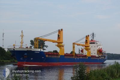
OBIRIX
General Cargo
Current Trip
| Time Travelled | 9 days |
|---|---|
| Remaining Time | --- |
| Distance Travelled | 1444.05 nm |
| Remaining Distance | --- |
| AVG Speed | 8.9 Knopen |
| MAX Speed | 12.7 Knopen |
| AVG Wind | 11.1 knots |
| MAX Wind | 26 knots |
| MIN Temp | 1.9°C / 35.42°F |
| MAX Temp | 17.5°C / 63.5°F |
| Diepgang | 7.2 M |
| Positie ontvangen | 3 d geleden |
Current Position
| Lengtegraad | --- |
|---|---|
| Breedtegraat | --- |
| Status | Under way using engine |
| Snelheid | 8 Knopen |
| Koers | 282.6° |
| Gebied | Mediterranean Sea - Eastern Basin |
| Station | T-AIS |
| Positie ontvangen | 3 d geleden |
Info
Information
The current position of OBIRIX is in Mediterranean Sea - Eastern Basin with coordinates 36.28161° / 14.06488° as reported on 2025-01-11 04:00 by AIS to our vessel tracker app. The vessel's current speed is 8 Knopen and is heading at the port of MONROVIA. The estimated time of arrival as calculated by MyShipTracking vessel tracking app is 2025-01-24 12:00 LT
The vessel OBIRIX (IMO: 9504267, MMSI: 314558000) is a General Cargo that was built in 2008 ( 17 Jaar oud ). It's sailing under the flag of [BB] Barbados.
In this page you can find informations about the vessels current position, last detected port calls, and current voyage information. If the vessels is not in coverage by AIS you will find the latest position.
The current position of OBIRIX is detected by our AIS receivers and we are not responsible for the reliability of the data. The last position was recorded while the vessel was in Coverage by the Ais receivers of our vessel tracking app.
The current draught of OBIRIX as reported by AIS is 7.2 meters
Weather
| Temperature | 12.4°C / 54.32°F |
|---|---|
| Wind Speed | 10 knots |
| Direction | 84° E |
| Pressure | 1023.1 hPa |
| Humidity | 72.8 % |
| Cloud Coverage | 100 % |
Featured Company
Most Visited Ports (Last year)
| Port | Arrivals | |
|---|---|---|
| 3 | ||
| 2 | ||
| 2 | ||
| 2 | ||
| 2 | ||
| 1 |
Events
| Tijd | Evenement | Details | Positie / Bestemming | Info |
|---|---|---|---|---|
| 2025-01-11 04:00 | Buitenbereik |
36.28161 / 14.06488
Mediterranean Sea - Eastern Basin
MONROVIA
|
Snelheid: 8 kn Koers: 282.6° |
|
| 2025-01-11 04:00 | Status Changed | Under way using engine Default |
36.28161 / 14.06488
MONROVIA
|
Snelheid: 8 kn Koers: 280° |
| 2025-01-11 03:37 | Status Changed | Default Under way using engine |
36.27064 / 14.12828
MONROVIA
|
Snelheid: 8 kn Koers: 281.1° |
| 2025-01-11 02:56 | Status Changed | Under way using engine Default |
36.25400 / 14.23765
MONROVIA
|
Snelheid: 7.8 kn Koers: 281° |
| 2025-01-11 02:48 | Status Changed | Default Under way using engine |
36.25010 / 14.25838
MONROVIA
|
Snelheid: 7.7 kn Koers: 282.9° |
| 2025-01-11 01:23 | Status Changed | Under way using engine Default |
36.22745 / 14.47951
MONROVIA
|
Snelheid: 7.8 kn Koers: 271° |
| 2025-01-11 01:21 | Status Changed | Default Under way using engine |
36.22755 / 14.48580
MONROVIA
|
Snelheid: 7.8 kn Koers: 271.2° |
| 2025-01-11 01:13 | Gevonden in zee | Maltese part of the Mediterranean Sea - Eastern Basin |
36.22783 / 14.50614
Mediterranean Sea - Eastern Basin
MONROVIA
|
Snelheid: 7.8 kn Koers: 271.2° |
| 2025-01-11 01:13 | Status Changed | Under way using engine Default |
36.22783 / 14.50614
MONROVIA
|
Snelheid: 7.7 kn Koers: 272° |
| 2025-01-11 01:01 | Binnenbereik |
36.22783 / 14.50614
Mediterranean Sea - Eastern Basin
MONROVIA
|
Snelheid: 7.8 kn Koers: 271.2° |