

OBIRIX
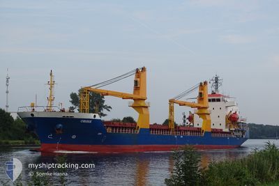
General Cargo

Current Trip
| Time Travelled | 7 days |
|---|---|
| Remaining Time | --- |
| Distance Travelled | 1500.44 nm |
| Remaining Distance | --- |
| AVG Speed | 9.3 Knop |
| MAX Speed | 11.1 Knop |
| AVG Wind | 9.5 knots |
| MAX Wind | 26.7 knots |
| MIN Temp | 6.5°C / 43.7°F |
| MAX Temp | 16.5°C / 61.7°F |
| Djupgående | 7.5 m |
| Position mottagen | 5 d sen |
Current Position
| Longitud | --- |
|---|---|
| Latitude | --- |
| Status | Under way using engine |
| Fart | 10 Knop |
| Kurs | 275.4° |
| Område | Mediterranean Sea - Eastern Basin |
| Station | T-AIS |
| Position mottagen | 5 d sen |
Information
The current position of OBIRIX is in Mediterranean Sea - Eastern Basin with coordinates 36.65620° / 14.31501° as reported on 2025-03-21 13:33 by AIS to our vessel tracker app. The vessel's current speed is 10 Knop
The vessel OBIRIX (IMO: 9504267, MMSI: 314558000) is a General Cargo that was built in 2008 ( 17 År gammal ). It's sailing under the flag of [BB] Barbados.
In this page you can find informations about the vessels current position, last detected port calls, and current voyage information. If the vessels is not in coverage by AIS you will find the latest position.
The current position of OBIRIX is detected by our AIS receivers and we are not responsible for the reliability of the data. The last position was recorded while the vessel was in Coverage by the Ais receivers of our vessel tracking app.
The current draught of OBIRIX as reported by AIS is 7.5 meters
Weather
| Temperature | 16.1°C / 60.98°F |
|---|---|
| Wind Speed | 12 knots |
| Direction | 280° W |
| Pressure | 1019.1 hPa |
| Humidity | 70.1 % |
| Cloud Coverage | 6 % |


Featured Company
Most Visited Ports (Last year)
| Port | Arrivals | |
|---|---|---|
| 3 | ||
| 2 | ||
| 2 | ||
| 2 | ||
| 1 | ||
| 1 |
Last Trips
| Origin | Departure | Destination | Arrival | Distance | |
|---|---|---|---|---|---|
| 2025-03-12 08:33 | 2025-03-13 10:13 | 277.60 nm | |||
| 2025-02-25 14:50 | 2025-03-07 10:37 | 1897.06 nm | |||
| 2025-02-04 12:05 | 2025-02-23 18:22 | 2744.60 nm | |||
| 2025-01-04 19:57 | 2025-01-27 14:39 | 4365.37 nm | |||
| 2024-12-19 05:31 | 2025-01-02 03:33 | 980.14 nm |
Events
| Tid | Event | Detaljer | Position / Dest | Information |
|---|---|---|---|---|
| 2025-03-21 13:37 | Status ändrad | Default Under way using engine |
36.65733 / 14.30001
DZ AZW
|
Fart: 10 kn Kurs: 275.4° |
| 2025-03-21 13:33 | UTANFÖR täckningsområde |
36.65620 / 14.31501
Mediterranean Sea - Eastern Basin
DZ AZW
|
Fart: 10 kn Kurs: 275.4° |
|
| 2025-03-21 13:31 | Status ändrad | Under way using engine Default |
36.65572 / 14.32071
DZ AZW
|
Fart: 9.9 kn Kurs: 274° |
| 2025-03-21 13:17 | Status ändrad | Default Under way using engine |
36.65250 / 14.36885
DZ AZW
|
Fart: 9.9 kn Kurs: 274.1° |
| 2025-03-21 12:24 | Status ändrad | Under way using engine Default |
36.63954 / 14.55260
DZ AZW
|
Fart: 9.9 kn Kurs: 274° |
| 2025-03-21 12:06 | I täckningsområde |
36.63975 / 14.54913
Mediterranean Sea - Eastern Basin
DZ AZW
|
Fart: 10 kn Kurs: 274.3° |
|
| 2025-03-21 09:43 | Status ändrad | Default Under way using engine |
36.59904 / 15.10632
DZ AZW
|
Fart: 9.8 kn Kurs: 251.8° |
| 2025-03-21 09:37 | UTANFÖR täckningsområde |
36.59701 / 15.12813
Mediterranean Sea - Eastern Basin
DZ AZW
|
Fart: 9.8 kn Kurs: 251.8° |
|
| 2025-03-21 09:06 | Byter havsområde | Italian part of the Mediterranean Sea - Eastern Basin Italian part of the Ionian Sea |
36.64299 / 15.21935
Mediterranean Sea - Eastern Basin
DZ AZW
|
Fart: 10.2 kn Kurs: 238.8° |
| 2025-03-21 08:47 | Status ändrad | Under way using engine Default |
36.68016 / 15.26592
DZ AZW
|
Fart: 10.2 kn Kurs: 217° |