
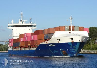
NORDICA
Container Ship
Current Trip
| Time Travelled | 6 days |
|---|---|
| Remaining Time | 6 h, 14 mins |
| Distance Travelled | 1470.48 nm |
| Remaining Distance | 95.59 nm |
| AVG Speed | 11 Knopen |
| MAX Speed | 18.3 Knopen |
| AVG Wind | 10.9 knots |
| MAX Wind | 25 knots |
| MIN Temp | 0.5°C / 32.9°F |
| MAX Temp | 19.9°C / 67.82°F |
| Diepgang | 8 M |
| Positie ontvangen | 1 d geleden |
Current Position
| Lengtegraad | 21.51695° |
|---|---|
| Breedtegraat | 59.06860° |
| Status | Under way using engine |
| Snelheid | 13.4 Knopen |
| Koers | 200.1° |
| Gebied | Baltic Sea |
| Station | T-AIS |
| Positie ontvangen | 1 d geleden |
Info
Information
The current position of NORDICA is in Baltic Sea with coordinates 59.06860° / 21.51695° as reported on 2024-04-28 08:16 by AIS to our vessel tracker app. The vessel's current speed is 13.4 Knopen and is heading at the port of RIGA. The estimated time of arrival as calculated by MyShipTracking vessel tracking app is 2024-04-30 00:54 LT
The vessel NORDICA (IMO: 9483695, MMSI: 244201000) is a Container Ship that was built in 2011 ( 13 Jaar oud ). It's sailing under the flag of [NL] Netherlands.
In this page you can find informations about the vessels current position, last detected port calls, and current voyage information. If the vessels is not in coverage by AIS you will find the latest position.
The current position of NORDICA is detected by our AIS receivers and we are not responsible for the reliability of the data. The last position was recorded while the vessel was in Coverage by the Ais receivers of our vessel tracking app.
The current draught of NORDICA as reported by AIS is 8 meters
Weather
| Temperature | 6.7°C / 44.06°F |
|---|---|
| Wind Speed | 12 knots |
| Direction | 223° SW |
| Pressure | 1025.1 hPa |
| Humidity | 91.2 % |
| Cloud Coverage | 100 % |
Featured Company
Last Port Calls
| Port | Arrival | Departure | Time In Port |
|---|---|---|---|
| 2024-04-23 02:43 | 2024-04-23 14:48 | 12 h | |
| 2024-04-22 14:31 | 2024-04-23 02:38 | 12 h | |
| 2024-04-21 14:43 | 2024-04-22 12:45 | 22 h | |
| 2024-04-19 19:51 | 2024-04-21 13:01 | 1 d | |
| 2024-04-18 03:48 | 2024-04-18 19:14 | 15 h | |
| 2024-04-11 21:47 | 2024-04-12 10:42 | 12 h | |
| 2024-04-07 15:37 | 2024-04-08 02:08 | 10 h | |
| 2024-04-05 17:16 | 2024-04-06 17:54 | 1 d | |
| 2024-04-05 11:12 | 2024-04-05 15:45 | 4 h | |
| 2024-04-03 22:09 | 2024-04-05 09:31 | 1 d |
Most Visited Ports (Last year)
| Port | Arrivals | |
|---|---|---|
| 35 | ||
| 12 | ||
| 12 | ||
| 12 | ||
| 10 | ||
| 9 |
Last Trips
| Origin | Departure | Destination | Arrival | Distance | |
|---|---|---|---|---|---|
| 2024-04-23 04:38 | 2024-04-23 04:43 | 0.94 nm | |||
| 2024-04-22 14:45 | 2024-04-22 16:31 | 16.03 nm | |||
| 2024-04-21 15:01 | 2024-04-21 16:43 | 16.61 nm | |||
| 2024-04-18 21:14 | 2024-04-19 21:51 | 303.67 nm | |||
| 2024-04-12 13:42 | 2024-04-18 05:48 | 862.58 nm | |||
| 2024-04-08 04:08 | 2024-04-12 00:47 | 789.72 nm | |||
| 2024-04-06 19:54 | 2024-04-07 17:37 | 242.57 nm | |||
| 2024-04-05 17:45 | 2024-04-05 19:16 | 16.32 nm | |||
| 2024-04-05 11:31 | 2024-04-05 13:12 | 16.69 nm | |||
| 2024-04-03 22:45 | 2024-04-04 00:09 | 15.56 nm |
Events
| Tijd | Evenement | Details | Positie / Bestemming | Info |
|---|---|---|---|---|
| 2024-04-29 11:08 | Start beweging | 3.98 nm, North of RIGA |
57.01433 / 24.08938
RIGA
|
Snelheid: 8.4 kn Koers: 356° |
| 2024-04-28 21:23 | Stop beweging | 3.54 nm, North of RIGA |
57.00717 / 24.09605
RIGA
|
Snelheid: 0.1 kn Koers: 171° |
| 2024-04-28 08:20 | Status Changed | Default Under way using engine |
59.05220 / 21.50485
RIGA
|
Snelheid: 13.4 kn Koers: 200.1° |
| 2024-04-28 08:16 | Buitenbereik |
59.06860 / 21.51695
Baltic Sea
RIGA
|
Snelheid: 13.4 kn Koers: 200.1° |
|
| 2024-04-28 07:42 | Status Changed | Under way using engine Default |
59.16538 / 21.67664
RIGA
|
Snelheid: 13.6 kn Koers: 227° |
| 2024-04-28 07:41 | Status Changed | Default Under way using engine |
59.16886 / 21.68387
RIGA
|
Snelheid: 13.6 kn Koers: 227.2° |
| 2024-04-28 06:19 | Wijzig zee gebeid | Estonian part of the Baltic Sea Finnish part of the Baltic Sea |
59.37118 / 22.13424
Baltic Sea
RIGA
|
Snelheid: 13.6 kn Koers: 229.4° |
| 2024-04-28 03:56 | Wijzig zee gebeid | Finnish part of the Baltic Sea Finnish part of the Gulf of Finland |
59.59920 / 23.08351
Baltic Sea
RIGA
|
Snelheid: 13.7 kn Koers: 253.2° |
| 2024-04-28 00:10 | Gevonden in zee | Finnish part of the Gulf of Finland |
59.81056 / 24.69530
Gulf of Finland
RIGA
|
Snelheid: 13.3 kn Koers: 256.4° |
| 2024-04-27 22:47 | Wijzig zee gebeid | Estonian part of the Gulf of Finland Finnish part of the Gulf of Finland |
59.88040 / 25.28866
Gulf of Finland
RIGA
|
Snelheid: 13.6 kn Koers: 258.1° |