
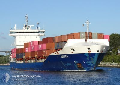
NORDICA
Container Ship
Current Trip
| Time Travelled | 1 h, 17 mins |
|---|---|
| Remaining Time | 5 days |
| Distance Travelled | 1.29 nm |
| Remaining Distance | 363.68 nm |
| AVG Speed | 3.4 Knots |
| MAX Speed | 3.6 Knots |
| AVG Wind | 14.3 knots |
| MAX Wind | 14.9 knots |
| MIN Temp | 18.4°C / 65.12°F |
| MAX Temp | 19.3°C / 66.74°F |
| Draught | 8.1 m |
| Position Received | Now |
Current Position
| Longitude | 10.06151° |
|---|---|
| Latitude | 54.36131° |
| Status | Under way using engine |
| Speed | 3.8 Knots |
| Course | 243° |
| Area | Baltic Sea |
| Station | T-AIS |
| Position Received | Now |
Info
Information
The current position of NORDICA is in Baltic Sea with coordinates 54.36131° / 10.06151° as reported on 2024-05-16 10:07 by AIS to our vessel tracker app. The vessel's current speed is 3.8 Knots and is heading at the port of ROTTERDAM. The estimated time of arrival as calculated by MyShipTracking vessel tracking app is 2024-05-21 17:35 LT
The vessel NORDICA (IMO: 9483695, MMSI: 244201000) is a Container Ship that was built in 2011 ( 13 years old ). It's sailing under the flag of [NL] Netherlands.
In this page you can find informations about the vessels current position, last detected port calls, and current voyage information. If the vessels is not in coverage by AIS you will find the latest position.
The current position of NORDICA is detected by our AIS receivers and we are not responsible for the reliability of the data. The last position was recorded while the vessel was in Coverage by the Ais receivers of our vessel tracking app.
The current draught of NORDICA as reported by AIS is 8.1 meters
Weather
| Temperature | 19.4°C / 66.92°F |
|---|---|
| Wind Speed | 15 knots |
| Direction | 102° ESE |
| Pressure | 1011.2 hPa |
| Humidity | 63.3 % |
| Cloud Coverage | 1 % |
Featured Company
Last Port Calls
| Port | Arrival | Departure | Time In Port |
|---|---|---|---|
| 2024-05-16 07:49 | 2024-05-16 08:51 | 1 h | |
| 2024-05-14 07:40 | 2024-05-14 14:14 | 6 h | |
| 2024-05-08 06:43 | 2024-05-08 12:26 | 5 h | |
| 2024-05-07 17:40 | 2024-05-08 04:42 | 11 h | |
| 2024-05-06 22:22 | 2024-05-07 17:38 | 19 h | |
| 2024-05-04 23:12 | 2024-05-06 22:13 | 1 d | |
| 2024-05-04 12:44 | 2024-05-04 21:46 | 9 h | |
| 2024-05-04 00:26 | 2024-05-04 11:02 | 10 h | |
| 2024-05-03 22:31 | 2024-05-04 00:22 | 1 h | |
| 2024-05-01 06:15 | 2024-05-01 07:05 | 49 m |
Most Visited Ports (Last year)
| Port | Arrivals | |
|---|---|---|
| 38 | ||
| 14 | ||
| 11 | ||
| 11 | ||
| 11 | ||
| 10 |
Last Trips
| Origin | Departure | Destination | Arrival | Distance | |
|---|---|---|---|---|---|
| 2024-05-14 17:14 | 2024-05-16 09:49 | 627.76 nm | |||
| 2024-05-08 14:26 | 2024-05-14 10:40 | 1340.33 nm | |||
| 2024-05-08 06:42 | 2024-05-08 08:43 | 16.89 nm | |||
| 2024-05-07 19:38 | 2024-05-07 19:40 | 0.35 nm | |||
| 2024-05-07 00:13 | 2024-05-07 00:22 | 0.37 nm | |||
| 2024-05-04 23:46 | 2024-05-05 01:12 | 15.49 nm | |||
| 2024-05-04 13:02 | 2024-05-04 14:44 | 16.29 nm | |||
| 2024-05-04 02:22 | 2024-05-04 02:26 | 0.93 nm | |||
| 2024-05-01 09:05 | 2024-05-04 00:31 | 325.07 nm | |||
| 2024-04-23 16:48 | 2024-05-01 08:15 | 1932.57 nm |
Events
| Time | Event | Details | Position / Dest | Info |
|---|---|---|---|---|
| 2024-05-16 10:07 | START Moving | 3.77 nm, North West of KIEL |
54.36143 / 10.06189
NLRTM
|
Speed: 3.5 kn Course: 242° |
| 2024-05-16 09:39 | STOP Moving | 3.69 nm, North West of KIEL |
54.36232 / 10.06487
NLRTM
|
Speed: 0.3 kn Course: 242° |
| 2024-05-16 08:51 | PORT DEPARTURE |
|
54.36664 / 10.13503
NLRTM
|
Speed: 4.7 kn Course: 291° |
| 2024-05-16 08:48 | START Moving |
54.36588 / 10.13998
[DE] KIEL
|
Speed: 3.1 kn Course: 284° |
|
| 2024-05-16 08:03 | STOP Moving |
54.36532 / 10.14391
[DE] KIEL
|
Speed: 0.3 kn Course: 284° |
|
| 2024-05-16 07:49 | PORT ARRIVAL |
|
54.36335 / 10.16051
[DE] KIEL
|
Speed: 4.1 kn Course: 263° |
| 2024-05-16 07:42 | START Moving | 0.73 nm, South of STICKENHΟRN SPORT |
54.37079 / 10.16705
NLRTM
|
Speed: 3.2 kn Course: 191° |
| 2024-05-16 07:14 | STOP Moving | 0.53 nm, South of STICKENHΟRN SPORT |
54.37443 / 10.17211
NLRTM
|
Speed: 0.3 kn Course: 185° |
| 2024-05-16 05:25 | Change Sea Area | German part of the Baltic Sea Danish part of the Baltic Sea |
54.56110 / 10.54653
Baltic Sea
NLRTM
|
Speed: 16.1 kn Course: 246.3° |
| 2024-05-16 04:52 | Change Sea Area | Danish part of the Baltic Sea German part of the Baltic Sea |
54.58261 / 10.79026
Baltic Sea
NLRTM
|
Speed: 15.8 kn Course: 267° |