
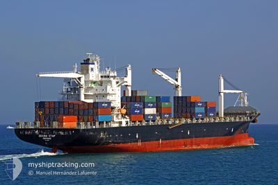
MSC CAPUCINE R
Container Ship
Current Trip
CRMON
| Time Travelled | 5 days |
|---|---|
| Remaining Time | --- |
| Distance Travelled | 1712.32 nm |
| Remaining Distance | --- |
| AVG Speed | 14 Knopen |
| MAX Speed | 17.2 Knopen |
| AVG Wind | 11.1 knots |
| MAX Wind | 19 knots |
| MIN Temp | 10.6°C / 51.08°F |
| MAX Temp | 27.8°C / 82.04°F |
| Diepgang | 8.4 M |
| Positie ontvangen | 5 d geleden |
Current Position
| Lengtegraad | --- |
|---|---|
| Breedtegraat | --- |
| Status | Under way using engine |
| Snelheid | 16.5 Knopen |
| Koers | 30.2° |
| Gebied | Caribbean Sea |
| Station | T-AIS |
| Positie ontvangen | 5 d geleden |
Info
Information
The current position of MSC CAPUCINE R is in Caribbean Sea with coordinates 9.82133° / -79.66950° as reported on 2024-12-29 05:52 by AIS to our vessel tracker app. The vessel's current speed is 16.5 Knopen
The vessel MSC CAPUCINE R (IMO: 9210086, MMSI: 636016415) is a Container Ship that was built in 2001 ( 24 Jaar oud ). It's sailing under the flag of [LR] Liberia.
In this page you can find informations about the vessels current position, last detected port calls, and current voyage information. If the vessels is not in coverage by AIS you will find the latest position.
The current position of MSC CAPUCINE R is detected by our AIS receivers and we are not responsible for the reliability of the data. The last position was recorded while the vessel was in Coverage by the Ais receivers of our vessel tracking app.
The current draught of MSC CAPUCINE R as reported by AIS is 8.4 meters
Weather
| Temperature | 11°C / 51.8°F |
|---|---|
| Wind Speed | 18 knots |
| Direction | 318° NW |
| Pressure | 1022.3 hPa |
| Humidity | 53.3 % |
| Cloud Coverage | 11 % |
Featured Company
Last Port Calls
| Port | Arrival | Departure | Time In Port |
|---|---|---|---|
| 2024-12-26 23:11 | 2024-12-28 22:39 | 1 d | |
| 2024-12-17 11:56 | 2024-12-18 00:50 | 12 h | |
| 2024-12-14 07:27 | 2024-12-14 20:53 | 13 h | |
| 2024-12-05 11:29 | 2024-12-08 07:13 | 2 d | |
| 2024-12-03 06:31 | 2024-12-04 03:27 | 20 h | |
| 2024-11-22 15:11 | 2024-11-23 15:52 | 1 d | |
| 2024-11-14 19:54 | 2024-11-17 06:50 | 2 d | |
| 2024-11-11 04:37 | 2024-11-11 04:42 | 4 m | |
| 2024-11-10 18:28 | 2024-11-11 04:29 | 10 h | |
| 2024-11-10 18:02 | 2024-11-10 18:13 | 11 m |
Most Visited Ports (Last year)
| Port | Arrivals | |
|---|---|---|
| 17 | ||
| 13 | ||
| 8 | ||
| 8 | ||
| 5 | ||
| 4 |
Last Trips
| Origin | Departure | Destination | Arrival | Distance | |
|---|---|---|---|---|---|
| 2024-12-18 00:50 | 2024-12-26 23:11 | 1941.65 nm | |||
| 2024-12-14 20:53 | 2024-12-17 11:56 | 756.04 nm | |||
| 2024-12-08 07:13 | 2024-12-14 07:27 | 1958.85 nm | |||
| 2024-12-04 03:27 | 2024-12-05 11:29 | 16.75 nm | |||
| 2024-11-23 15:52 | 2024-12-03 06:31 | 2270.49 nm | |||
| 2024-11-17 06:50 | 2024-11-22 15:11 | 1955.35 nm | |||
| 2024-11-11 04:42 | 2024-11-14 19:54 | 1311.00 nm | |||
| 2024-11-11 04:29 | 2024-11-11 04:37 | 0.60 nm | |||
| 2024-11-10 18:13 | 2024-11-10 18:28 | 0.75 nm | |||
| 2024-11-08 00:25 | 2024-11-10 18:02 | 959.39 nm |
Events
| Tijd | Evenement | Details | Positie / Bestemming | Info |
|---|---|---|---|---|
| 2024-12-29 05:55 | Status Changed | Default Under way using engine |
9.83217 / -79.66303
CRMON
|
Snelheid: 16.5 kn Koers: 30.2° |
| 2024-12-29 05:52 | Status Changed | Under way using engine Default |
9.82133 / -79.66950
CRMON
|
Snelheid: 16.4 kn Koers: 30° |
| 2024-12-29 05:52 | Buitenbereik |
9.82133 / -79.66950
Caribbean Sea
|
Snelheid: 16.5 kn Koers: 30.2° |
|
| 2024-12-29 05:42 | Status Changed | Default Under way using engine |
9.78390 / -79.69134
CRMON
|
Snelheid: 16.3 kn Koers: 29.6° |
| 2024-12-29 05:33 | Status Changed | Under way using engine Default |
9.74607 / -79.71288
CRMON
|
Snelheid: 16.2 kn Koers: 29° |
| 2024-12-29 05:26 | Status Changed | Default Under way using engine |
9.71622 / -79.72945
CRMON
|
Snelheid: 16.1 kn Koers: 30.4° |
| 2024-12-29 05:19 | Status Changed | Under way using engine Default |
9.69007 / -79.74471
CRMON
|
Snelheid: 16 kn Koers: 30° |
| 2024-12-29 05:14 | Status Changed | Default Under way using engine |
9.66988 / -79.75669
CRMON
|
Snelheid: 16 kn Koers: 29.9° |
| 2024-12-29 05:03 | Status Changed | Under way using engine Default |
9.62676 / -79.78168
CRMON
|
Snelheid: 16 kn Koers: 29° |
| 2024-12-29 04:55 | Status Changed | Default Under way using engine |
9.59544 / -79.79945
CRMON
|
Snelheid: 15.9 kn Koers: 29.4° |