
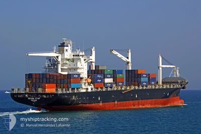
MSC CAPUCINE R
Container Ship
Current Trip
| Time Travelled | 1 day |
|---|---|
| Remaining Time | --- |
| Distance Travelled | 409.80 nm |
| Remaining Distance | 1605.55 nm |
| AVG Speed | 10.3 Noeuds |
| MAX Speed | 17.6 Noeuds |
| AVG Wind | 19.2 knots |
| MAX Wind | 24 knots |
| MIN Temp | 12.2°C / 53.96°F |
| MAX Temp | 19°C / 66.2°F |
| Tirant d eau | 7.9 m |
| Position reçue | 1 d depuis |
Current Position
| Longitude | -74.61980° |
|---|---|
| Latitude | 38.06913° |
| Etat | Under way using engine |
| Vitesse | 10.9 Noeuds |
| Parcours | 167.2° |
| Zone | North Atlantic Ocean |
| Station | T-AIS |
| Position reçue | 1 d depuis |
Info
Information
The current position of MSC CAPUCINE R is in North Atlantic Ocean with coordinates 38.06913° / -74.61980° as reported on 2024-05-10 17:29 by AIS to our vessel tracker app. The vessel's current speed is 10.9 Noeuds and is heading at the port of MOIN. The estimated time of arrival as calculated by MyShipTracking vessel tracking app is 2024-05-19 09:00 LT
The vessel MSC CAPUCINE R (IMO: 9210086, MMSI: 636016415) is a Container Ship that was built in 2001 ( 23 Age ). It's sailing under the flag of [LR] Liberia.
In this page you can find informations about the vessels current position, last detected port calls, and current voyage information. If the vessels is not in coverage by AIS you will find the latest position.
The current position of MSC CAPUCINE R is detected by our AIS receivers and we are not responsible for the reliability of the data. The last position was recorded while the vessel was in Coverage by the Ais receivers of our vessel tracking app.
The current draught of MSC CAPUCINE R as reported by AIS is 7.9 meters
Weather
| Temperature | 19°C / 66.2°F |
|---|---|
| Wind Speed | 15 knots |
| Direction | 337° NNW |
| Pressure | 1009.8 hPa |
| Humidity | 71.7 % |
| Cloud Coverage | 39 % |
Featured Company
Last Port Calls
| Port | Arrival | Departure | Time In Port |
|---|---|---|---|
| 2024-05-09 13:53 | 2024-05-10 07:54 | 18 h | |
| 2024-05-08 20:02 | 2024-05-09 11:21 | 15 h | |
| 2024-05-01 16:45 | 2024-05-03 19:21 | 2 d | |
| 2024-04-18 21:07 | 2024-04-20 09:26 | 1 d | |
| 2024-04-17 22:50 | 2024-04-18 12:18 | 13 h | |
| 2024-04-09 10:15 | 2024-04-11 12:52 | 2 d | |
| 2024-04-02 01:15 | 2024-04-02 07:11 | 5 h | |
| 2024-03-28 19:50 | 2024-03-29 21:19 | 1 d | |
| 2024-03-28 03:33 | 2024-03-28 16:22 | 12 h | |
| 2024-03-20 03:10 | 2024-03-21 12:02 | 1 d |
Most Visited Ports (Last year)
| Port | Arrivals | |
|---|---|---|
| 13 | ||
| 11 | ||
| 11 | ||
| 4 | ||
| 3 | ||
| 3 |
Last Trips
| Origin | Departure | Destination | Arrival | Distance | |
|---|---|---|---|---|---|
| 2024-05-09 07:21 | 2024-05-09 09:53 | 21.78 nm | |||
| 2024-05-03 14:21 | 2024-05-08 16:02 | 1957.13 nm | |||
| 2024-04-20 05:26 | 2024-05-01 11:45 | 2258.42 nm | |||
| 2024-04-18 08:18 | 2024-04-18 17:07 | 21.95 nm | |||
| 2024-04-11 07:52 | 2024-04-17 18:50 | 1959.20 nm | |||
| 2024-04-02 03:11 | 2024-04-09 05:15 | 1586.94 nm | |||
| 2024-03-29 17:19 | 2024-04-01 21:15 | 880.47 nm | |||
| 2024-03-28 12:22 | 2024-03-28 15:50 | 21.61 nm | |||
| 2024-03-21 07:02 | 2024-03-27 23:33 | 2179.24 nm | |||
| 2024-03-12 19:13 | 2024-03-19 22:10 | 1442.83 nm |
Events
| Heure | Evenement | Détails | Position/ Destination | Info |
|---|---|---|---|---|
| 2024-05-10 17:33 | Etat Changé | Default Under way using engine |
38.05833 / -74.61667
CRMOB
|
Vitesse: 10.9 kn Parcours: 167.2° |
| 2024-05-10 17:29 | Hors de la zone couverte |
38.06913 / -74.61980
North Atlantic Ocean
CRMOB
|
Vitesse: 10.9 kn Parcours: 167.2° |
|
| 2024-05-10 13:54 | Changement d'ETA | 2024/05/19 09:00 2024/05/19 11:00 |
38.61272 / -74.87781
CRMOB
|
Vitesse: 8.9 kn Parcours: 150.1° |
| 2024-05-10 13:48 | Changement d'ETA | 2024/05/19 11:00 2024/05/18 11:00 |
38.62525 / -74.88949
CRMOB
|
Vitesse: 8.4 kn Parcours: 135.9° |
| 2024-05-10 12:16 | Tirant d'eau modifié | 7.9 8.2 |
38.80158 / -75.04886
CRMOB
|
Vitesse: 7.7 kn Parcours: 148.9° |
| 2024-05-10 12:16 | Changement de destination | CRMOB USISL |
38.80158 / -75.04886
CRMOB
|
Vitesse: 7.7 kn Parcours: 148.9° |
| 2024-05-10 12:16 | Changement d'ETA | 2024/05/18 11:00 2024/05/09 14:00 |
38.80158 / -75.04886
CRMOB
|
Vitesse: 7.7 kn Parcours: 148.9° |
| 2024-05-10 11:55 | Etat Changé | Under way using engine Default |
38.83991 / -75.08438
USISL
|
Vitesse: 9.2 kn Parcours: 190° |
| 2024-05-10 11:35 | Etat Changé | Default Under way using engine |
38.90673 / -75.09308
USISL
|
Vitesse: 14.4 kn Parcours: 155.8° |
| 2024-05-10 11:24 | Etat Changé | Under way using engine Default |
38.94653 / -75.11138
USISL
|
Vitesse: 14.4 kn Parcours: 156° |