
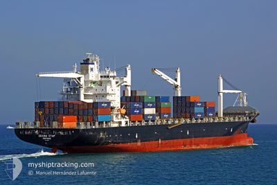
MSC CAPUCINE R
Container Ship
Current Trip
| Time Travelled | 7 days |
|---|---|
| Remaining Time | --- |
| Distance Travelled | 2007.88 nm |
| Remaining Distance | --- |
| AVG Speed | 10.9 Knoten |
| MAX Speed | 16.9 Knoten |
| AVG Wind | 14.1 knots |
| MAX Wind | 27.3 knots |
| MIN Temp | 10.4°C / 50.72°F |
| MAX Temp | 28.5°C / 83.3°F |
| Tiefgang | 8.9 m |
| Position erhalten | 3 d alt |
Current Position
| Länge | -74.20335° |
|---|---|
| Breite | 20.81155° |
| Zustand | Under way using engine |
| Geschwindigkeit | 10.6 Knoten |
| Kurs | 159.8° |
| Gebiet | North Atlantic Ocean |
| Station | T-AIS |
| Position erhalten | 3 d alt |
Info
Information
Die aktuelle Position von MSC CAPUCINE R befindet sich in North Atlantic Ocean mit den Koordinaten 20.81155° / -74.20335°, wie von AIS am 2024-04-24 18:37 an unsere Schiffsverfolgungs-App. Die aktuelle Geschwindigkeit des Schiffes betragt 10.6 Knoten
Das Schiff MSC CAPUCINE R (IMO: 9210086, MMSI: 636016415) ist Container Ship das wurde im Jahr 2001 ( 23 Jahre alt ) gebaut. Es segelt unter der Flagge [LR] Liberia.
Auf dieser Seite finden Sie Informationen zur aktuellen Position des Schiffes, zu den zuletzt erkannten Hafenanlaufen und zu aktuellen Reiseinformationen. Wenn die Schiffe nicht von AIS abgedeckt werden, finden Sie die neueste Position.
Die aktuelle Position von MSC CAPUCINE R wird von unseren AIS-Empfangern erkannt und wir sind nicht fur die Zuverlassigkeit der Daten verantwortlich. Die letzte Position wurde von den Ais-Empfangern unserer Schiffsverfolgungs-App aufgezeichnet, wahrend sich das Schiff in Deckung befand.
Der aktuelle Entwurf von MSC CAPUCINE R, wie von AIS gemeldet, betragt 8.9 meter
Weather
| Temperature | 27.5°C / 81.5°F |
|---|---|
| Wind Speed | 2 knots |
| Direction | 344° NNW |
| Pressure | 1011.5 hPa |
| Humidity | 75.8 % |
| Cloud Coverage | 100 % |
Featured Company
Last Port Calls
| Port | Arrival | Departure | Time In Port |
|---|---|---|---|
| 2024-04-18 21:07 | 2024-04-20 09:26 | 1 d | |
| 2024-04-17 22:50 | 2024-04-18 12:18 | 13 h | |
| 2024-04-09 10:15 | 2024-04-11 12:52 | 2 d | |
| 2024-04-02 01:15 | 2024-04-02 07:11 | 5 h | |
| 2024-03-28 19:50 | 2024-03-29 21:19 | 1 d | |
| 2024-03-28 03:33 | 2024-03-28 16:22 | 12 h | |
| 2024-03-20 03:10 | 2024-03-21 12:02 | 1 d | |
| 2024-03-12 03:51 | 2024-03-12 23:13 | 19 h | |
| 2024-03-07 08:35 | 2024-03-08 03:49 | 19 h | |
| 2024-03-06 12:08 | 2024-03-07 05:45 | 17 h |
Most Visited Ports (Last year)
| Port | Arrivals | |
|---|---|---|
| 12 | ||
| 11 | ||
| 10 | ||
| 3 | ||
| 3 | ||
| 3 |
Last Trips
| Origin | Departure | Destination | Arrival | Distance | |
|---|---|---|---|---|---|
| 2024-04-18 08:18 | 2024-04-18 17:07 | 21.95 nm | |||
| 2024-04-11 07:52 | 2024-04-17 18:50 | 1959.20 nm | |||
| 2024-04-02 03:11 | 2024-04-09 05:15 | 1586.94 nm | |||
| 2024-03-29 17:19 | 2024-04-01 21:15 | 880.47 nm | |||
| 2024-03-28 12:22 | 2024-03-28 15:50 | 21.61 nm | |||
| 2024-03-21 07:02 | 2024-03-27 23:33 | 2179.24 nm | |||
| 2024-03-12 19:13 | 2024-03-19 22:10 | 1442.83 nm | |||
| 2024-03-07 22:49 | 2024-03-11 23:51 | 937.50 nm | |||
| 2024-03-07 00:45 | 2024-03-07 03:35 | 21.26 nm | |||
| 2024-02-29 20:37 | 2024-03-06 07:08 | 1947.72 nm |
Events
| Zeit | Ereignis | Details | Position / Ziel | Information |
|---|---|---|---|---|
| 2024-04-28 03:21 | STOP Bewegung | 11.27 nm, North of MOIN |
10.18500 / -83.01500
CRMOB
|
Geschwindigkeit: Kurs: -1° |
| 2024-04-28 02:16 | START Bewegung | 7.11 nm, North East of LIMON |
10.07260 / -82.93832
CRMOB
|
Geschwindigkeit: 4.1 kn Kurs: 322° |
| 2024-04-27 18:27 | STOP Bewegung | 11.73 nm, North of LIMON |
10.17167 / -82.95333
CRMOB
|
Geschwindigkeit: Kurs: -1° |
| 2024-04-24 18:45 | geänderter Status | Default Under way using engine |
20.78667 / -74.19334
CRMOB
|
Geschwindigkeit: 10.6 kn Kurs: 159.8° |
| 2024-04-24 18:37 | außerhalb Abdeckung |
20.81155 / -74.20335
North Atlantic Ocean
CRMOB
|
Geschwindigkeit: 10.6 kn Kurs: 159.8° |
|
| 2024-04-24 18:29 | Ändere Seegebiet | Cuban part of the North Atlantic Ocean Bahamas part of the North Atlantic Ocean |
20.83271 / -74.21123
North Atlantic Ocean
CRMOB
|
Geschwindigkeit: 10 kn Kurs: 161° |
| 2024-04-24 15:23 | Ändere Seegebiet | Bahamas part of the North Atlantic Ocean United States part of the North Atlantic Ocean |
21.34857 / -74.42980
North Atlantic Ocean
CRMOB
|
Geschwindigkeit: 10.8 kn Kurs: 158.4° |
| 2024-04-24 15:23 | geänderter Status | Under way using engine Default |
21.34857 / -74.42980
CRMOB
|
Geschwindigkeit: 12 kn Kurs: 157° |
| 2024-04-24 15:19 | in Abdeckung |
21.34857 / -74.42980
North Atlantic Ocean
CRMOB
|
Geschwindigkeit: 10.8 kn Kurs: 158.4° |
|
| 2024-04-20 16:56 | außerhalb Abdeckung |
38.45638 / -74.73623
North Atlantic Ocean
CRMOB
|
Geschwindigkeit: 10.9 kn Kurs: 147.2° |