
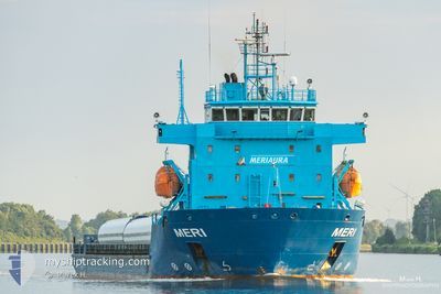
MERI
Heavy Load Carrier
Current Trip
| Trip Time | 4 days |
|---|---|
| Trip Distance | 1000.62 nm |
| AVG Speed | 9.3 Knopen |
| MAX Speed | 12.4 Knopen |
| Diepgang | 4 M |
| AVG Wind | 12.5 knots |
| MAX Wind | 24.1 knots |
| MIN Temp | -1°C / 30.2°F |
| MAX Temp | 9.9°C / 49.82°F |
| Positie ontvangen | 8 d geleden |
Current Position
| Lengtegraad | 19.03540° |
|---|---|
| Breedtegraat | 60.37541° |
| Status | Under way using engine |
| Snelheid | 9.6 Knopen |
| Koers | 6.4° |
| Gebied | Gulf of Bothnia |
| Station | T-AIS |
| Positie ontvangen | 8 d geleden |
Info
Information
The current position of MERI is in Gulf of Bothnia with coordinates 60.37541° / 19.03540° as reported on 2024-04-21 01:53 by AIS to our vessel tracker app. The vessel's current speed is 9.6 Knopen and is currently inside the port of MANTYLUOTO.
The vessel MERI (IMO: 9622502, MMSI: 230941700) is a Heavy Load Carrier that was built in 2012 ( 12 Jaar oud ). It's sailing under the flag of [FI] Finland.
In this page you can find informations about the vessels current position, last detected port calls, and current voyage information. If the vessels is not in coverage by AIS you will find the latest position.
The current position of MERI is detected by our AIS receivers and we are not responsible for the reliability of the data. The last position was recorded while the vessel was in Coverage by the Ais receivers of our vessel tracking app.
The current draught of MERI as reported by AIS is 4 meters
Weather
| Temperature | 3.4°C / 38.12°F |
|---|---|
| Wind Speed | 9 knots |
| Direction | 203° SSW |
| Pressure | 1020.9 hPa |
| Humidity | 99 % |
| Cloud Coverage | 100 % |
Featured Company
Last Port Calls
| Port | Arrival | Departure | Time In Port |
|---|---|---|---|
| 2024-04-21 11:40 | |||
| 2024-04-16 03:36 | 2024-04-17 10:37 | 1 d | |
| 2024-04-13 20:03 | 2024-04-14 13:51 | 17 h | |
| 2024-04-11 03:53 | 2024-04-11 18:24 | 14 h | |
| 2024-04-06 18:57 | 2024-04-08 13:05 | 1 d | |
| 2024-03-31 06:25 | 2024-04-04 04:38 | 3 d | |
| 2024-03-14 05:23 | 2024-03-18 07:13 | 4 d | |
| 2024-03-11 04:40 | 2024-03-12 11:08 | 1 d | |
| 2024-03-06 04:15 | 2024-03-09 11:14 | 3 d | |
| 2024-02-29 05:07 | 2024-03-01 11:22 | 1 d |
Last Trips
| Origin | Departure | Destination | Arrival | Distance | |
|---|---|---|---|---|---|
| 2024-04-17 12:37 | 2024-04-21 14:40 | 1000.62 nm | |||
| 2024-04-14 15:51 | 2024-04-16 05:36 | 339.83 nm | |||
| 2024-04-11 20:24 | 2024-04-13 22:03 | 462.72 nm | |||
| 2024-04-08 16:05 | 2024-04-11 05:53 | 589.56 nm | |||
| 2024-04-04 06:38 | 2024-04-06 21:57 | 494.65 nm | |||
| 2024-03-18 08:13 | 2024-03-31 08:25 | 2377.04 nm | |||
| 2024-03-12 13:08 | 2024-03-14 06:23 | 465.03 nm | |||
| 2024-03-09 12:14 | 2024-03-11 06:40 | 466.12 nm | |||
| 2024-03-01 12:22 | 2024-03-06 05:15 | 777.77 nm | |||
| 2024-02-24 16:49 | 2024-02-29 06:07 | 917.81 nm |
Events
| Tijd | Evenement | Details | Positie / Bestemming | Info |
|---|---|---|---|---|
| 2024-04-21 11:52 | Stop beweging |
61.60058 / 21.49640
[FI] MANTYLUOTO
|
Snelheid: 0.2 kn Koers: 359° |
|
| 2024-04-21 11:40 | Aankomsthaven |
|
61.60004 / 21.48010
[FI] MANTYLUOTO
|
Snelheid: 8 kn Koers: 71° |
| 2024-04-21 02:00 | Status Changed | Default Under way using engine |
60.39493 / 19.03986
FIPOR
|
Snelheid: 9.6 kn Koers: 6.4° |
| 2024-04-21 01:53 | Buitenbereik |
60.37541 / 19.03540
Gulf of Bothnia
FIPOR
|
Snelheid: 9.6 kn Koers: 6.4° |
|
| 2024-04-21 01:42 | Status Changed | Under way using engine Default |
60.34567 / 19.02949
FIPOR
|
Snelheid: 9.4 kn Koers: 7° |
| 2024-04-21 01:40 | Status Changed | Default Under way using engine |
60.33878 / 19.02814
FIPOR
|
Snelheid: 9.7 kn Koers: 8° |
| 2024-04-21 00:50 | Wijzig zee gebeid | Swedish part of the Gulf of Bothnia Finnish part of the Gulf of Bothnia |
60.21091 / 19.09011
Gulf of Bothnia
FIPOR
|
Snelheid: 9.7 kn Koers: 338.9° |
| 2024-04-20 21:44 | Wijzig zee gebeid | Finnish part of the Gulf of Bothnia Finnish part of the Baltic Sea |
59.78718 / 19.77632
Gulf of Bothnia
FIPOR
|
Snelheid: 10.8 kn Koers: 319.2° |
| 2024-04-20 20:57 | Status Changed | Under way using engine Default |
59.67826 / 19.95044
FIPOR
|
Snelheid: 10.4 kn Koers: 320° |
| 2024-04-20 20:56 | Status Changed | Default Under way using engine |
59.67604 / 19.95412
FIPOR
|
Snelheid: 10.3 kn Koers: 319.4° |