
MERI
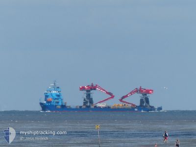
Heavy Load Carrier
Current Trip
| Time Travelled | 1 day |
|---|---|
| Remaining Time | --- |
| Distance Travelled | 281.26 nm |
| Remaining Distance | --- |
| AVG Speed | 9.6 Knots |
| MAX Speed | 10.7 Knots |
| AVG Wind | 14 knots |
| MAX Wind | 23.8 knots |
| MIN Temp | 3.5°C / 38.3°F |
| MAX Temp | 9.6°C / 49.28°F |
| Draught | 4 m |
| Position Received | 1 m ago |
Current Position
| Longitude | --- |
|---|---|
| Latitude | --- |
| Status | Under way using engine |
| Speed | 8.5 Knots |
| Course | 255.3° |
| Area | Bay of Biscay |
| Station | T-AIS |
| Position Received | 1 m ago |
Info
Information
The current position of MERI is in Bay of Biscay with coordinates 43.94002° / -7.47928° as reported on 2026-01-04 23:48 by AIS to our vessel tracker app. The vessel's current speed is 8.5 Knots and is heading at the port of SAGUNTO. The estimated time of arrival as calculated by MyShipTracking vessel tracking app is 2026-01-10 08:00 LT
The vessel MERI (IMO: 9622502, MMSI: 230941700) is a Heavy Load Carrier that was built in 2012 ( 14 years old ). It's sailing under the flag of [FI] Finland.
In this page you can find informations about the vessels current position, last detected port calls, and current voyage information. If the vessels is not in coverage by AIS you will find the latest position.
The current position of MERI is detected by our AIS receivers and we are not responsible for the reliability of the data. The last position was recorded while the vessel was in Coverage by the Ais receivers of our vessel tracking app.
The current draught of MERI as reported by AIS is 4 meters
Weather
| Temperature | 9.6°C / 49.28°F |
|---|---|
| Wind Speed | 18 knots |
| Direction | 74° ENE |
| Pressure | 1016.8 hPa |
| Humidity | 58.1 % |
| Cloud Coverage | 100 % |
Featured Company
Last Port Calls
| Port | Arrival | Departure | Time In Port |
|---|---|---|---|
| 2026-01-03 08:58 | 2026-01-03 17:44 | 8 h | |
| 2026-01-02 07:17 | 2026-01-02 23:29 | 16 h | |
| 2025-12-28 07:16 | 2025-12-28 08:26 | 1 h | |
| 2025-12-24 21:27 | 2025-12-27 23:29 | 3 d | |
| 2025-12-17 09:55 | 2025-12-21 13:18 | 4 d | |
| 2025-12-11 08:49 | 2025-12-12 15:28 | 1 d | |
| 2025-12-05 06:10 | 2025-12-05 21:38 | 15 h | |
| 2025-12-02 07:11 | 2025-12-02 22:21 | 15 h | |
| 2025-11-21 13:28 | 2025-11-21 20:24 | 6 h | |
| 2025-11-20 13:42 | 2025-11-21 10:11 | 20 h |
Last Trips
| Origin | Departure | Destination | Arrival | Distance | |
|---|---|---|---|---|---|
| 2026-01-02 23:29 | 2026-01-03 08:58 | 84.98 nm | |||
| 2025-12-28 08:26 | 2026-01-02 07:17 | 1063.45 nm | |||
| 2025-12-27 23:29 | 2025-12-28 07:16 | 83.35 nm | |||
| 2025-12-21 13:18 | 2025-12-24 21:27 | 722.96 nm | |||
| 2025-12-12 15:28 | 2025-12-17 09:55 | 895.39 nm | |||
| 2025-12-05 21:38 | 2025-12-11 08:49 | 854.80 nm | |||
| 2025-12-02 22:21 | 2025-12-05 06:10 | 263.26 nm | |||
| 2025-11-21 20:24 | 2025-12-02 07:11 | 1205.04 nm | |||
| 2025-11-21 10:11 | 2025-11-21 13:28 | 3.25 nm | |||
| 2025-11-20 10:18 | 2025-11-20 13:42 | 3.01 nm |
Events
| Time | Event | Details | Position / Dest | Info |
|---|---|---|---|---|
| 2026-01-04 22:41 | Status Changed | Under way using engine Default |
43.98293 / -7.27625
ESSAG
|
Speed: 8.1 kn Course: 254° |
| 2026-01-04 22:41 | IN Coverage |
43.98280 / -7.27690
Bay of Biscay
ESSAG
|
Speed: 8.1 kn Course: 255.2° |
|
| 2026-01-04 09:51 | Status Changed | Default Under way using engine |
43.77976 / -5.80796
ESSAG
|
Speed: 9.9 kn Course: 274.8° |
| 2026-01-04 09:45 | Status Changed | Under way using engine Default |
43.77795 / -5.78685
ESSAG
|
Speed: 9.9 kn Course: 276° |
| 2026-01-04 09:45 | OUT of Coverage |
43.77795 / -5.78685
Bay of Biscay
ESSAG
|
Speed: 9.9 kn Course: 274.8° |
|
| 2026-01-04 09:31 | Status Changed | Default Under way using engine |
43.77333 / -5.73217
ESSAG
|
Speed: 10.1 kn Course: 276.6° |
| 2026-01-04 09:24 | Status Changed | Under way using engine Default |
43.77132 / -5.70811
ESSAG
|
Speed: 10.1 kn Course: 276° |
| 2026-01-04 09:19 | Status Changed | Default Under way using engine |
43.76943 / -5.68648
ESSAG
|
Speed: 10 kn Course: 275.7° |
| 2026-01-04 08:50 | Status Changed | Under way using engine Default |
43.76216 / -5.57230
ESSAG
|
Speed: 10.2 kn Course: 274° |
| 2026-01-04 08:38 | Status Changed | Default Under way using engine |
43.75960 / -5.52944
ESSAG
|
Speed: 10.2 kn Course: 274.9° |