
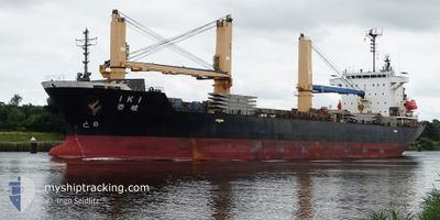
IKI
Ro-Ro Cargo
Current Trip
| Time Travelled | 2 days |
|---|---|
| Remaining Time | 2 days |
| Distance Travelled | 633.58 nm |
| Remaining Distance | 875.68 nm |
| AVG Speed | 9.9 Knopen |
| MAX Speed | 13.6 Knopen |
| AVG Wind | 14.9 knots |
| MAX Wind | 20.2 knots |
| MIN Temp | 28°C / 82.4°F |
| MAX Temp | 33.6°C / 92.48°F |
| Diepgang | 7.9 M |
| Positie ontvangen | 14 d geleden |
Current Position
| Lengtegraad | 76.38002° |
|---|---|
| Breedtegraat | 8.60198° |
| Status | Under way using engine |
| Snelheid | 8.6 Knopen |
| Koers | 40° |
| Gebied | Laccadive Sea |
| Station | T-AIS |
| Positie ontvangen | 14 d geleden |
Info
Information
The current position of IKI is in Laccadive Sea with coordinates 8.60198° / 76.38002° as reported on 2024-05-30 04:06 by AIS to our vessel tracker app. The vessel's current speed is 8.6 Knopen and is heading at the port of MUMBAI. The estimated time of arrival as calculated by MyShipTracking vessel tracking app is 2024-06-16 07:09 LT
The vessel IKI (IMO: 9300881, MMSI: 356641000) is a Ro-Ro Cargo that was built in 2005 ( 19 Jaar oud ). It's sailing under the flag of [PA] Panama.
In this page you can find informations about the vessels current position, last detected port calls, and current voyage information. If the vessels is not in coverage by AIS you will find the latest position.
The current position of IKI is detected by our AIS receivers and we are not responsible for the reliability of the data. The last position was recorded while the vessel was in Coverage by the Ais receivers of our vessel tracking app.
The current draught of IKI as reported by AIS is 7.9 meters
Weather
| Temperature | 32.2°C / 89.96°F |
|---|---|
| Wind Speed | 7 knots |
| Direction | 68° ENE |
| Pressure | 999 hPa |
| Humidity | 72.6 % |
| Cloud Coverage | --- |
Featured Company
Last Port Calls
| Port | Arrival | Departure | Time In Port |
|---|---|---|---|
| 2024-06-09 14:01 | 2024-06-10 19:43 | 1 d | |
| 2024-06-03 06:30 | 2024-06-06 03:30 | 2 d | |
| 2024-05-07 08:32 | 2024-05-09 22:44 | 2 d | |
| 2024-05-01 22:50 | 2024-05-02 22:40 | 23 h | |
| 2024-04-21 21:10 | 2024-04-26 05:58 | 4 d | |
| 2024-04-07 13:13 | 2024-04-09 05:01 | 1 d | |
| 2024-04-02 23:58 | 2024-04-04 14:37 | 1 d |
Last Trips
| Origin | Departure | Destination | Arrival | Distance | |
|---|---|---|---|---|---|
| 2024-06-06 09:00 | 2024-06-09 19:31 | 356.25 nm | |||
| 2024-05-10 07:44 | 2024-06-03 12:00 | 5340.40 nm | |||
| 2024-05-03 07:40 | 2024-05-07 17:32 | 316.25 nm | |||
| 2024-04-26 14:58 | 2024-05-02 07:50 | 389.43 nm | |||
| 2024-04-09 13:01 | 2024-04-22 06:10 | 1292.05 nm | |||
| 2024-04-04 22:37 | 2024-04-07 21:13 | 345.03 nm | |||
| 2024-03-19 15:38 | 2024-04-03 07:58 | 3393.35 nm |
Events
| Tijd | Evenement | Details | Positie / Bestemming | Info |
|---|---|---|---|---|
| 2024-06-10 19:45 | Start beweging | 1.59 nm, East of MUNDRA |
22.73315 / 69.71735
IN BOM
|
Snelheid: 4 kn Koers: 125° |
| 2024-06-10 19:43 | Vertrekhaven |
|
22.73315 / 69.71735
IN BOM
|
Snelheid: Koers: 76° |
| 2024-06-09 14:01 | Stop beweging |
22.73398 / 69.71465
[IN] MUNDRA
|
Snelheid: Koers: 75° |
|
| 2024-06-09 14:01 | Aankomsthaven |
|
22.73398 / 69.71465
[IN] MUNDRA
|
Snelheid: 0.6 kn Koers: 56° |
| 2024-06-09 12:57 | Start beweging | 4.96 nm, South East of MUNDRA |
22.66882 / 69.74165
IN BOM
|
Snelheid: 6.5 kn Koers: 356° |
| 2024-06-07 19:14 | Stop beweging | 5.51 nm, South East of MUNDRA |
22.66026 / 69.74567
IN BOM
|
Snelheid: 0.2 kn Koers: 270° |
| 2024-06-06 03:30 | Vertrekhaven |
|
19.54533 / 72.46146
IN BOM
|
Snelheid: Koers: 193° |