
IKI
Ro-Ro Cargo
Current Trip
JP FKY
| Time Travelled | 7 days |
|---|---|
| Remaining Time | --- |
| Distance Travelled | 1725.04 nm |
| Remaining Distance | --- |
| AVG Speed | 10 Noeuds |
| MAX Speed | 13.5 Noeuds |
| AVG Wind | 12 knots |
| MAX Wind | 22 knots |
| MIN Temp | 14.1°C / 57.38°F |
| MAX Temp | 30.3°C / 86.54°F |
| Tirant d eau | 6.3 m |
| Position reçue | 12 d depuis |
Current Position
| Longitude | 133.86053° |
|---|---|
| Latitude | 34.38968° |
| Etat | Under way using engine |
| Vitesse | 10.6 Noeuds |
| Parcours | 237° |
| Zone | Inland Sea |
| Station | T-AIS |
| Position reçue | 12 d depuis |
Info
Information
The current position of IKI is in Inland Sea with coordinates 34.38968° / 133.86053° as reported on 2024-05-05 02:11 by AIS to our vessel tracker app. The vessel's current speed is 10.6 Noeuds
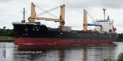
The vessel IKI (IMO: 9300881, MMSI: 356641000) is a Ro-Ro Cargo that was built in 2005 ( 19 Age ). It's sailing under the flag of [PA] Panama.
In this page you can find informations about the vessels current position, last detected port calls, and current voyage information. If the vessels is not in coverage by AIS you will find the latest position.
The current position of IKI is detected by our AIS receivers and we are not responsible for the reliability of the data. The last position was recorded while the vessel was in Coverage by the Ais receivers of our vessel tracking app.
The current draught of IKI as reported by AIS is 6.3 meters
Weather
| Temperature | 30.1°C / 86.18°F |
|---|---|
| Wind Speed | 1 knots |
| Direction | 107° ESE |
| Pressure | 1007.9 hPa |
| Humidity | 70.5 % |
| Cloud Coverage | 38 % |
Featured Company
Last Port Calls
| Port | Arrival | Departure | Time In Port |
|---|---|---|---|
| 2024-05-07 17:32 | 2024-05-10 07:44 | 2 d | |
| 2024-05-02 07:50 | 2024-05-03 07:40 | 23 h | |
| 2024-04-22 06:10 | 2024-04-26 14:58 | 4 d | |
| 2024-04-07 21:13 | 2024-04-09 13:01 | 1 d | |
| 2024-04-03 07:58 | 2024-04-04 22:37 | 1 d | |
| 2024-03-18 10:12 | 2024-03-19 15:38 | 1 d | |
| 2024-03-15 22:09 | |||
| 2024-03-08 05:29 | 2024-03-09 02:58 | 21 h | |
| 2024-03-02 14:50 |
Last Trips
| Origin | Departure | Destination | Arrival | Distance | |
|---|---|---|---|---|---|
| 2024-05-03 07:40 | 2024-05-07 17:32 | 316.25 nm | |||
| 2024-04-26 14:58 | 2024-05-02 07:50 | 389.43 nm | |||
| 2024-04-09 13:01 | 2024-04-22 06:10 | 1292.05 nm | |||
| 2024-04-04 22:37 | 2024-04-07 21:13 | 345.03 nm | |||
| 2024-03-19 15:38 | 2024-04-03 07:58 | 3393.35 nm | |||
| 2024-03-09 02:58 | 2024-03-15 22:09 | 1840.36 nm | |||
| 2024-02-22 09:35 | 2024-03-02 14:50 | 2328.94 nm |
Events
| Heure | Evenement | Détails | Position/ Destination | Info |
|---|---|---|---|---|
| 2024-05-09 22:44 | PORT DE DEPART |
|
34.41682 / 133.44643
JP FKY
|
Vitesse: 10.4 kn Parcours: 181° |
| 2024-05-09 22:25 | Démarrage |
34.46903 / 133.45184
[JP] FUKUYAMA
|
Vitesse: 5 kn Parcours: 201° |
|
| 2024-05-07 09:10 | Arret |
34.47243 / 133.45499
[JP] FUKUYAMA
|
Vitesse: 0.1 kn Parcours: 182° |
|
| 2024-05-07 08:32 | Port d'arrivée |
|
34.42980 / 133.44707
[JP] FUKUYAMA
|
Vitesse: 9.6 kn Parcours: 352° |
| 2024-05-07 08:20 | Démarrage | 1.5 nm, South of FUKUYAMA |
34.40452 / 133.45453
JP FKY
|
Vitesse: 4.1 kn Parcours: 345° |