
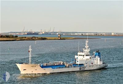
HELLE
Lpg Tanker
Current Trip
| Time Travelled | 7 h, 1 mins |
|---|---|
| Remaining Time | 5 h, 31 mins |
| Distance Travelled | 82.17 nm |
| Remaining Distance | 60.71 nm |
| AVG Speed | 12.4 Knopen |
| MAX Speed | 14.1 Knopen |
| AVG Wind | 6.4 knots |
| MAX Wind | 9.9 knots |
| MIN Temp | 2°C / 35.6°F |
| MAX Temp | 7.8°C / 46.04°F |
| Diepgang | 3.6 M |
| Positie ontvangen | 1 m geleden |
Current Position
| Lengtegraad | 2.41206° |
|---|---|
| Breedtegraat | 51.33642° |
| Status | Under way using engine |
| Snelheid | 8.7 Knopen |
| Koers | 64.6° |
| Gebied | North Sea |
| Station | T-AIS |
| Positie ontvangen | 1 m geleden |
Info
Information
The current position of HELLE is in North Sea with coordinates 51.33642° / 2.41206° as reported on 2024-04-26 09:24 by AIS to our vessel tracker app. The vessel's current speed is 8.7 Knopen and is heading at the port of SLUISKIL. The estimated time of arrival as calculated by MyShipTracking vessel tracking app is 2024-04-26 14:57 LT
The vessel HELLE (IMO: 9201906, MMSI: 257510000) is a Lpg Tanker that was built in 1999 ( 25 Jaar oud ). It's sailing under the flag of [NO] Norway.
In this page you can find informations about the vessels current position, last detected port calls, and current voyage information. If the vessels is not in coverage by AIS you will find the latest position.
The current position of HELLE is detected by our AIS receivers and we are not responsible for the reliability of the data. The last position was recorded while the vessel was in Coverage by the Ais receivers of our vessel tracking app.
The current draught of HELLE as reported by AIS is 3.6 meters
Weather
| Temperature | 7.8°C / 46.04°F |
|---|---|
| Wind Speed | 6 knots |
| Direction | 28° NNE |
| Pressure | 1004.1 hPa |
| Humidity | 66.4 % |
| Cloud Coverage | 89 % |
Featured Company
Last Port Calls
| Port | Arrival | Departure | Time In Port |
|---|---|---|---|
| 2024-04-25 10:46 | 2024-04-26 02:25 | 15 h | |
| 2024-04-24 12:49 | 2024-04-24 13:55 | 1 h | |
| 2024-04-23 14:15 | 2024-04-24 12:39 | 22 h | |
| 2024-04-21 19:24 | 2024-04-22 06:50 | 11 h | |
| 2024-04-20 10:15 | 2024-04-20 11:59 | 1 h | |
| 2024-04-18 20:38 | 2024-04-20 10:07 | 1 d | |
| 2024-04-17 13:56 | 2024-04-18 04:51 | 14 h | |
| 2024-04-16 21:21 | 2024-04-16 22:30 | 1 h | |
| 2024-04-16 21:09 | 2024-04-16 21:16 | 7 m | |
| 2024-04-14 23:35 | 2024-04-16 20:55 | 1 d |
Last Trips
| Origin | Departure | Destination | Arrival | Distance | |
|---|---|---|---|---|---|
| 2024-04-24 15:55 | 2024-04-25 11:46 | 141.55 nm | |||
| 2024-04-24 14:39 | 2024-04-24 14:49 | 0.97 nm | |||
| 2024-04-22 07:50 | 2024-04-23 16:15 | 290.98 nm | |||
| 2024-04-20 13:59 | 2024-04-21 20:24 | 283.29 nm | |||
| 2024-04-20 12:07 | 2024-04-20 12:15 | 0.86 nm | |||
| 2024-04-18 05:51 | 2024-04-18 22:38 | 141.13 nm | |||
| 2024-04-17 00:30 | 2024-04-17 14:56 | 137.93 nm | |||
| 2024-04-16 23:16 | 2024-04-16 23:21 | 0.75 nm | |||
| 2024-04-16 22:55 | 2024-04-16 23:09 | 0.72 nm | |||
| 2024-04-14 08:36 | 2024-04-15 01:35 | 141.54 nm |
Events
| Tijd | Evenement | Details | Positie / Bestemming | Info |
|---|---|---|---|---|
| 2024-04-26 09:11 | Wijzig zee gebeid | Belgian part of the North Sea French part of the North Sea |
51.32323 / 2.36430
North Sea
NL SLU
|
Snelheid: 8.9 kn Koers: 65.3° |
| 2024-04-26 08:59 | Status Changed | Under way using engine Default |
51.31119 / 2.32239
NL SLU
|
Snelheid: 7 kn Koers: 68° |
| 2024-04-26 08:08 | Status Changed | Default Under way using engine |
51.32649 / 2.12903
NL SLU
|
Snelheid: 10.4 kn Koers: 116.1° |
| 2024-04-26 07:50 | Gevonden in zee | French part of the North Sea |
51.35183 / 2.04948
North Sea
NL SLU
|
Snelheid: 10.5 kn Koers: 117.4° |
| 2024-04-26 07:29 | Start beweging | 20.56 nm, East of RAMSGATE |
51.38161 / 1.96054
NL SLU
|
Snelheid: 11.5 kn Koers: 112.8° |
| 2024-04-26 07:28 | Stop beweging | 20.46 nm, East of RAMSGATE |
51.38259 / 1.95743
NL SLU
|
Snelheid: Koers: 107° |
| 2024-04-26 02:25 | Vertrekhaven |
|
51.44921 / .34147
NL SLU
|
Snelheid: 9.1 kn Koers: 109° |
| 2024-04-26 02:21 | Start beweging |
51.45506 / .33729
[GB] TILBURY
|
Snelheid: 3.2 kn Koers: 258° |
|
| 2024-04-26 01:23 | Status Changed | Under way using engine Moored |
51.45937 / .35127
[GB] TILBURY
|
Snelheid: Koers: 327° |
| 2024-04-26 01:23 | Draught Changed | 3.6 4 |
51.45937 / .35127
[GB] TILBURY
|
Snelheid: Koers: 327° |