
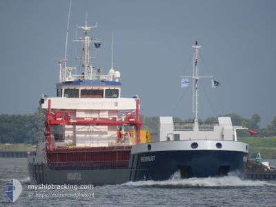
HEENVLIET
General Cargo
Current Trip
| Time Travelled | 1 day |
|---|---|
| Remaining Time | --- |
| Distance Travelled | 275.79 nm |
| Remaining Distance | --- |
| AVG Speed | 8.6 Knopen |
| MAX Speed | 10.9 Knopen |
| AVG Wind | 11.5 knots |
| MAX Wind | 23 knots |
| MIN Temp | 9.8°C / 49.64°F |
| MAX Temp | 20.6°C / 69.08°F |
| Diepgang | 3.3 M |
| Positie ontvangen | 1 m geleden |
Current Position
| Lengtegraad | 28.85792° |
|---|---|
| Breedtegraat | 40.95029° |
| Status | At anchor |
| Snelheid | 0.1 Knopen |
| Koers | 32° |
| Gebied | Sea of Marmara |
| Station | T-AIS |
| Positie ontvangen | 1 m geleden |
Info
Information
The current position of HEENVLIET is in Sea of Marmara with coordinates 40.95029° / 28.85792° as reported on 2024-04-27 20:16 by AIS to our vessel tracker app. The vessel's current speed is 0.1 Knopen
The vessel HEENVLIET (IMO: 9536076, MMSI: 258049000) is a General Cargo that was built in 2011 ( 13 Jaar oud ). It's sailing under the flag of [NO] Norway.
In this page you can find informations about the vessels current position, last detected port calls, and current voyage information. If the vessels is not in coverage by AIS you will find the latest position.
The current position of HEENVLIET is detected by our AIS receivers and we are not responsible for the reliability of the data. The last position was recorded while the vessel was in Coverage by the Ais receivers of our vessel tracking app.
The current draught of HEENVLIET as reported by AIS is 3.3 meters
Weather
| Temperature | 13.1°C / 55.58°F |
|---|---|
| Wind Speed | 12 knots |
| Direction | 40° NE |
| Pressure | 1018.1 hPa |
| Humidity | 79.3 % |
| Cloud Coverage | 100 % |
Featured Company
Last Port Calls
| Port | Arrival | Departure | Time In Port |
|---|---|---|---|
| 2024-04-25 05:34 | 2024-04-26 10:17 | 1 d | |
| 2024-04-15 23:10 | 2024-04-16 02:13 | 3 h | |
| 2024-04-02 16:36 | 2024-04-06 15:02 | 3 d | |
| 2024-03-28 14:37 | 2024-03-28 21:35 | 6 h | |
| 2024-03-27 06:08 | 2024-03-27 15:13 | 9 h | |
| 2024-03-26 04:09 | 2024-03-26 19:33 | 15 h | |
| 2024-03-22 11:26 | 2024-03-23 00:26 | 13 h | |
| 2024-03-11 12:42 | 2024-03-15 06:30 | 3 d | |
| 2024-03-08 05:14 | 2024-03-08 13:10 | 7 h | |
| 2024-02-27 11:39 | 2024-02-29 05:32 | 1 d |
Most Visited Ports (Last year)
| Port | Arrivals | |
|---|---|---|
| 3 | ||
| 3 | ||
| 2 | ||
| 2 | ||
| 2 | ||
| 2 |
Last Trips
| Origin | Departure | Destination | Arrival | Distance | |
|---|---|---|---|---|---|
| 2024-04-16 04:13 | 2024-04-25 08:34 | 1633.68 nm | |||
| 2024-04-06 17:02 | 2024-04-16 01:10 | 1879.39 nm | |||
| 2024-03-28 22:35 | 2024-04-02 18:36 | 468.29 nm | |||
| 2024-03-27 16:13 | 2024-03-28 15:37 | 255.73 nm | |||
| 2024-03-26 20:33 | 2024-03-27 07:08 | 105.09 nm | |||
| 2024-03-23 01:26 | 2024-03-26 05:09 | 738.73 nm | |||
| 2024-03-15 07:30 | 2024-03-22 12:26 | 1616.20 nm | |||
| 2024-03-08 14:10 | 2024-03-11 13:42 | 536.07 nm | |||
| 2024-02-29 07:32 | 2024-03-08 06:14 | 1166.23 nm | |||
| 2024-02-08 18:13 | 2024-02-27 13:39 | 3192.20 nm |
Events
| Tijd | Evenement | Details | Positie / Bestemming | Info |
|---|---|---|---|---|
| 2024-04-27 17:18 | Status Changed | At anchor Under way using engine |
40.95038 / 28.85806
ISTANBUL ROADS
|
Snelheid: 0.6 kn Koers: 10° |
| 2024-04-27 17:11 | Stop beweging | 1.53 nm, East of YESILKOY |
40.95097 / 28.85890
ISTANBUL ROADS
|
Snelheid: 0.2 kn Koers: 40° |
| 2024-04-27 07:23 | Status Changed | Under way using engine Default |
40.57810 / 27.22009
ISTANBUL ROADS
|
Snelheid: 9.7 kn Koers: 71° |
| 2024-04-27 07:22 | ETA Changed | 2024/04/27 16:00 2024/04/27 12:00 |
40.56296 / 27.17254
ISTANBUL ROADS
|
Snelheid: 9.7 kn Koers: 71° |
| 2024-04-27 07:03 | Status Changed | Default Under way using engine |
40.55819 / 27.15533
ISTANBUL ROADS
|
Snelheid: 9.8 kn Koers: 68.9° |
| 2024-04-27 06:41 | Status Changed | Under way using engine Default |
40.53825 / 27.08238
ISTANBUL ROADS
|
Snelheid: 9.9 kn Koers: 68° |
| 2024-04-27 06:36 | Status Changed | Default Under way using engine |
40.53377 / 27.06634
ISTANBUL ROADS
|
Snelheid: 9.9 kn Koers: 66.7° |
| 2024-04-27 06:31 | Status Changed | Under way using engine Default |
40.52836 / 27.04955
ISTANBUL ROADS
|
Snelheid: 9.9 kn Koers: 63° |
| 2024-04-27 06:31 | Binnenbereik |
40.52836 / 27.04955
Sea of Marmara
ISTANBUL ROADS
|
Snelheid: 9.9 kn Koers: 66.7° |
|
| 2024-04-27 04:12 | Buitenbereik |
40.34271 / 26.64338
Sea of Marmara
ISTANBUL ROADS
|
Snelheid: 9.8 kn Koers: 43.6° |