

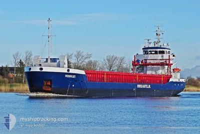
HEENVLIET
General Cargo

Current Trip
BGVAR
| Time Travelled | 12 h, 52 mins |
|---|---|
| Remaining Time | --- |
| Distance Travelled | 26.63 nm |
| Remaining Distance | --- |
| AVG Speed | 9.6 Knop |
| MAX Speed | 11.1 Knop |
| AVG Wind | 13.4 knots |
| MAX Wind | 19 knots |
| MIN Temp | 8.8°C / 47.84°F |
| MAX Temp | 10.4°C / 50.72°F |
| Djupgående | 3.3 m |
| Position mottagen | 12 m sen |
Current Position
| Longitud | --- |
|---|---|
| Latitude | --- |
| Status | At anchor |
| Fart | 0.6 Knop |
| Kurs | 80° |
| Område | Black Sea |
| Station | T-AIS |
| Position mottagen | 12 m sen |
Information
The current position of HEENVLIET is in Black Sea with coordinates 43.37935° / 28.38440° as reported on 2025-03-28 07:25 by AIS to our vessel tracker app. The vessel's current speed is 0.6 Knop
The vessel HEENVLIET (IMO: 9536076, MMSI: 258049000) is a General Cargo that was built in 2011 ( 14 År gammal ). It's sailing under the flag of [NO] Norway.
In this page you can find informations about the vessels current position, last detected port calls, and current voyage information. If the vessels is not in coverage by AIS you will find the latest position.
The current position of HEENVLIET is detected by our AIS receivers and we are not responsible for the reliability of the data. The last position was recorded while the vessel was in Coverage by the Ais receivers of our vessel tracking app.
The current draught of HEENVLIET as reported by AIS is 3.3 meters
Weather
| Temperature | 10.4°C / 50.72°F |
|---|---|
| Wind Speed | 19 knots |
| Direction | 41° NE |
| Pressure | 1010.3 hPa |
| Humidity | 83.4 % |
| Cloud Coverage | 100 % |


Featured Company
Last Port Calls
| Port | Arrival | Departure | Time In Port |
|---|---|---|---|
| 2025-03-26 15:12 | 2025-03-27 20:45 | 1 d | |
| 2025-03-22 08:11 | 2025-03-22 15:59 | 7 h | |
| 2025-03-03 09:26 | 2025-03-04 15:49 | 1 d | |
| 2025-03-02 17:22 | 2025-03-02 17:25 | 2 m | |
| 2025-02-11 16:06 | 2025-03-01 13:20 | 17 d | |
| 2025-02-09 10:04 | 2025-02-10 17:12 | 1 d | |
| 2025-01-22 12:05 | 2025-01-23 17:09 | 1 d |
Last Trips
| Origin | Departure | Destination | Arrival | Distance | |
|---|---|---|---|---|---|
| 2025-03-22 15:59 | 2025-03-26 15:12 | 246.24 nm | |||
| 2025-03-04 15:49 | 2025-03-22 08:11 | 3824.45 nm | |||
| 2025-03-02 17:25 | 2025-03-03 09:26 | 162.28 nm | |||
| 2025-03-01 13:20 | 2025-03-02 17:22 | 251.27 nm | |||
| 2025-02-10 17:12 | 2025-02-11 16:06 | 227.24 nm | |||
| 2025-01-23 17:09 | 2025-02-09 10:04 | 3726.42 nm | |||
| 2024-12-30 04:30 | 2025-01-22 12:05 | 78.32 nm |
Events
| Tid | Event | Detaljer | Position / Dest | Information |
|---|---|---|---|---|
| 2025-03-28 06:49 | Status ändrad | At anchor Default |
43.37940 / 28.38431
BGVAR
|
Fart: 0.2 kn Kurs: 72° |
| 2025-03-28 06:43 | Status ändrad | Default At anchor |
43.37941 / 28.38436
BGVAR
|
Fart: 0.7 kn Kurs: 65° |
| 2025-03-28 06:19 | Status ändrad | At anchor Default |
43.37961 / 28.38421
BGVAR
|
Fart: 0.1 kn Kurs: 84° |
| 2025-03-28 06:13 | I täckningsområde |
43.37961 / 28.38421
Black Sea
|
Fart: 0.5 kn Kurs: 335.1° |
|
| 2025-03-27 22:16 | Status ändrad | Default At anchor |
43.37882 / 28.38583
BGVAR
|
Fart: 0.1 kn Kurs: 9° |
| 2025-03-27 22:13 | UTANFÖR täckningsområde |
43.37881 / 28.38581
Black Sea
|
Fart: 0.1 kn Kurs: 233.4° |
|
| 2025-03-27 21:46 | Status ändrad | At anchor Default |
43.37885 / 28.38634
BGVAR
|
Fart: 0.4 kn Kurs: 346° |
| 2025-03-27 21:40 | Status ändrad | Default At anchor |
43.37896 / 28.38598
BGVAR
|
Fart: Kurs: 334° |
| 2025-03-27 21:31 | Status ändrad | At anchor Under way using engine |
43.37944 / 28.38602
BGVAR
|
Fart: 0.3 kn Kurs: 4° |
| 2025-03-27 21:28 | STOPPAR förflyttning | 2.39 nm, South East of KAVARNA |
43.37948 / 28.38586
BGVAR
|
Fart: 0.3 kn Kurs: 3° |