
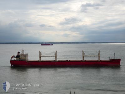
FEDERAL BRISTOL
Cargo
Current Trip
| Trip Time | 4 days |
|---|---|
| Trip Distance | 1218.10 nm |
| AVG Speed | 12.3 Knopen |
| MAX Speed | 14.5 Knopen |
| Diepgang | 6.5 M |
| AVG Wind | 16.1 knots |
| MAX Wind | 34 knots |
| MIN Temp | 12.7°C / 54.86°F |
| MAX Temp | 26.6°C / 79.88°F |
| Positie ontvangen | 2 d geleden |
Current Position
| Lengtegraad | 122.88949° |
|---|---|
| Breedtegraat | 36.45189° |
| Status | Under way using engine |
| Snelheid | 13.2 Knopen |
| Koers | 1.4° |
| Gebied | Yellow Sea |
| Station | T-AIS |
| Positie ontvangen | 2 d geleden |
Info
Information
The current position of FEDERAL BRISTOL is in Yellow Sea with coordinates 36.45189° / 122.88949° as reported on 2024-05-18 10:14 by AIS to our vessel tracker app. The vessel's current speed is 13.2 Knopen and is currently inside the port of CAOFEIDIAN.
The vessel FEDERAL BRISTOL (IMO: 9697844, MMSI: 538006433) is a Cargo It's sailing under the flag of [MH] Marshall Is.
In this page you can find informations about the vessels current position, last detected port calls, and current voyage information. If the vessels is not in coverage by AIS you will find the latest position.
The current position of FEDERAL BRISTOL is detected by our AIS receivers and we are not responsible for the reliability of the data. The last position was recorded while the vessel was in Coverage by the Ais receivers of our vessel tracking app.
The current draught of FEDERAL BRISTOL as reported by AIS is 6.5 meters
Weather
| Temperature | 14.3°C / 57.74°F |
|---|---|
| Wind Speed | 3 knots |
| Direction | 112° ESE |
| Pressure | 1017.7 hPa |
| Humidity | 71.9 % |
| Cloud Coverage | 51 % |
Featured Company
Last Port Calls
| Port | Arrival | Departure | Time In Port |
|---|---|---|---|
| 2024-05-20 01:48 | |||
| 2024-05-12 01:52 | 2024-05-15 11:41 | 3 d | |
| 2024-04-29 22:49 | 2024-05-03 10:08 | 3 d | |
| 2024-04-22 07:15 | 2024-04-23 15:36 | 1 d | |
| 2024-04-20 09:11 | 2024-04-22 05:12 | 1 d | |
| 2024-04-15 13:06 | |||
| 2024-03-04 00:45 | |||
| 2024-03-02 02:20 |
Most Visited Ports (Last year)
| Port | Arrivals | |
|---|---|---|
| 4 | ||
| 4 | ||
| 3 | ||
| 2 | ||
| 2 | ||
| 1 |
Last Trips
| Origin | Departure | Destination | Arrival | Distance | |
|---|---|---|---|---|---|
| 2024-05-15 19:41 | 2024-05-20 09:48 | 1218.10 nm | |||
| 2024-05-03 18:08 | 2024-05-12 09:52 | 1286.06 nm | |||
| 2024-04-23 23:36 | 2024-04-30 06:49 | 514.49 nm | |||
| 2024-04-22 13:12 | 2024-04-22 15:15 | 44.88 nm | |||
| 2024-03-02 10:20 | 2024-03-04 08:45 | 148.36 nm |
Events
| Tijd | Evenement | Details | Positie / Bestemming | Info |
|---|---|---|---|---|
| 2024-05-20 02:40 | Stop beweging |
38.98381 / 118.46847
[CN] CAOFEIDIAN
|
Snelheid: 0.2 kn Koers: 1° |
|
| 2024-05-20 01:48 | Aankomsthaven |
|
38.92988 / 118.46390
[CN] CAOFEIDIAN
|
Snelheid: 7.4 kn Koers: 17° |
| 2024-05-20 00:08 | Start beweging | 14.87 nm, South West of CAOFEIDIAN |
38.90089 / 118.29860
CNCFD
|
Snelheid: 4.3 kn Koers: 279° |
| 2024-05-19 11:34 | Stop beweging | 15.02 nm, South West of CAOFEIDIAN |
38.89841 / 118.29661
CNCFD
|
Snelheid: 0.1 kn Koers: 109° |
| 2024-05-18 10:20 | Status Changed | Default Under way using engine |
36.47503 / 122.89047
CNCFD
|
Snelheid: 13.2 kn Koers: 1.4° |
| 2024-05-18 10:14 | Buitenbereik |
36.45189 / 122.88949
Yellow Sea
CNCFD
|
Snelheid: 13.2 kn Koers: 1.4° |
|
| 2024-05-18 09:55 | Wijzig zee gebeid | Chinese part of the Yellow Sea South Korean part of the Eastern China Sea |
36.38263 / 122.89566
Yellow Sea
CNCFD
|
Snelheid: 13.2 kn Koers: 349.4° |
| 2024-05-18 09:54 | Status Changed | Under way using engine Default |
36.38155 / 122.89590
CNCFD
|
Snelheid: 13.3 kn Koers: 350° |
| 2024-05-18 09:48 | Binnenbereik |
36.38263 / 122.89566
Yellow Sea
CNCFD
|
Snelheid: 13.2 kn Koers: 349.4° |
|
| 2024-05-17 19:37 | Buitenbereik |
33.23420 / 123.43089
Eastern China Sea
CNCFD
|
Snelheid: 13.2 kn Koers: 357.2° |