

EVRIMA
Passenger

Current Trip
| Time Travelled | 2 days |
|---|---|
| Remaining Time | --- |
| Distance Travelled | 312.07 nm |
| Remaining Distance | --- |
| AVG Speed | 9.5 Knopen |
| MAX Speed | 11.9 Knopen |
| AVG Wind | 16.8 knots |
| MAX Wind | 22 knots |
| MIN Temp | 25.6°C / 78.08°F |
| MAX Temp | 27°C / 80.6°F |
| Diepgang | 6 M |
| Positie ontvangen | 3 m geleden |
Current Position
| Lengtegraad | --- |
|---|---|
| Breedtegraat | --- |
| Status | At anchor |
| Snelheid | 0.1 Knopen |
| Koers | 345° |
| Gebied | Caribbean Sea |
| Station | T-AIS |
| Positie ontvangen | 3 m geleden |
Information
The current position of EVRIMA is in Caribbean Sea with coordinates 18.08748° / -63.10752° as reported on 2025-03-25 13:50 by AIS to our vessel tracker app. The vessel's current speed is 0.1 Knopen
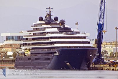
The vessel EVRIMA (IMO: 9823687, MMSI: 215001000) is a Passenger It's sailing under the flag of [MT] Malta.
In this page you can find informations about the vessels current position, last detected port calls, and current voyage information. If the vessels is not in coverage by AIS you will find the latest position.
The current position of EVRIMA is detected by our AIS receivers and we are not responsible for the reliability of the data. The last position was recorded while the vessel was in Coverage by the Ais receivers of our vessel tracking app.
The current draught of EVRIMA as reported by AIS is 6 meters
Weather
| Temperature | 26.2°C / 79.16°F |
|---|---|
| Wind Speed | 22 knots |
| Direction | 99° E |
| Pressure | 1019.3 hPa |
| Humidity | 70.3 % |
| Cloud Coverage | 1 % |


Featured Company
Last Port Calls
| Port | Arrival | Departure | Time In Port |
|---|---|---|---|
| 2025-03-22 05:49 | 2025-03-22 19:31 | 13 h | |
| 2025-03-20 07:20 | 2025-03-20 20:42 | 13 h | |
| 2025-03-17 07:18 | 2025-03-17 22:01 | 14 h | |
| 2025-03-15 05:50 | 2025-03-15 19:38 | 13 h | |
| 2025-03-13 06:50 | 2025-03-13 18:39 | 11 h | |
| 2025-03-10 05:51 | 2025-03-10 20:13 | 14 h | |
| 2025-03-07 07:00 | 2025-03-07 18:57 | 11 h | |
| 2025-03-06 07:16 | 2025-03-06 18:48 | 11 h | |
| 2025-03-04 05:38 | 2025-03-04 18:50 | 13 h | |
| 2025-02-28 05:51 | 2025-02-28 19:20 | 13 h |
Most Visited Ports (Last year)
| Port | Arrivals | |
|---|---|---|
| 13 | ||
| 9 | ||
| 7 | ||
| 7 | ||
| 6 | ||
| 6 |
Last Trips
| Origin | Departure | Destination | Arrival | Distance | |
|---|---|---|---|---|---|
| 2025-03-20 20:42 | 2025-03-22 05:49 | 269.68 nm | |||
| 2025-03-17 22:01 | 2025-03-20 07:20 | 421.23 nm | |||
| 2025-03-15 19:38 | 2025-03-17 07:18 | 511.97 nm | |||
| 2025-03-13 18:39 | 2025-03-15 05:50 | 220.19 nm | |||
| 2025-03-10 20:13 | 2025-03-13 06:50 | 291.57 nm | |||
| 2025-03-07 18:57 | 2025-03-10 05:51 | 388.95 nm | |||
| 2025-03-06 18:48 | 2025-03-07 07:00 | 102.29 nm | |||
| 2025-03-04 18:50 | 2025-03-06 07:16 | 279.81 nm | |||
| 2025-02-28 19:20 | 2025-03-04 05:38 | 438.19 nm | |||
| 2025-02-26 09:05 | 2025-02-28 05:51 | 239.04 nm |
Events
| Tijd | Evenement | Details | Positie / Bestemming | Info |
|---|---|---|---|---|
| 2025-03-25 11:17 | Status Changed | At anchor Under way using engine |
18.08818 / -63.10646
MF MAR
|
Snelheid: 0.4 kn Koers: 91° |
| 2025-03-25 11:08 | Stop beweging | 1.84 nm, North West of MARIGOT |
18.08822 / -63.10655
MF MAR
|
Snelheid: 0.3 kn Koers: 47° |
| 2025-03-25 10:38 | Destination Changed | MF MAR BL SBH |
18.10492 / -63.16402
MF MAR
|
Snelheid: 9.4 kn Koers: 91.9° |
| 2025-03-25 10:38 | ETA Changed | 2025/03/25 11:00 2025/03/24 11:15 |
18.10492 / -63.16402
MF MAR
|
Snelheid: 9.4 kn Koers: 91.9° |
| 2025-03-25 10:34 | Wijzig zee gebeid | Saint-Martin part of the Caribbean Sea Anguilla part of the Caribbean Sea |
18.10560 / -63.17503
Caribbean Sea
|
Snelheid: 9.4 kn Koers: 94.9° |
| 2025-03-25 08:07 | Wijzig zee gebeid | Anguilla part of the Caribbean Sea Saba part of the Caribbean Sea |
18.10837 / -63.57437
Caribbean Sea
|
Snelheid: 9.9 kn Koers: 70.8° |
| 2025-03-25 08:07 | Status Changed | Under way using engine Default |
18.10837 / -63.57437
BL SBH
|
Snelheid: 10.2 kn Koers: 4° |
| 2025-03-25 08:07 | Binnenbereik |
18.10837 / -63.57437
Caribbean Sea
|
Snelheid: 9.9 kn Koers: 70.8° |
|
| 2025-03-25 06:28 | Status Changed | Default Under way using engine |
17.86427 / -63.55393
BL SBH
|
Snelheid: 9.7 kn Koers: 270.8° |
| 2025-03-25 06:23 | Buitenbereik |
17.86335 / -63.54037
Caribbean Sea
|
Snelheid: 9.7 kn Koers: 270.8° |