
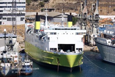
EUROPEAN STAR
Ro-Ro/Passenger Ship
Current Trip
| Trip Time | 7 h, 14 mins |
|---|---|
| Trip Distance | 67.40 nm |
| AVG Speed | 9.4 Knopen |
| MAX Speed | 10.7 Knopen |
| Diepgang | 5.1 M |
| AVG Wind | 6.4 knots |
| MAX Wind | 10 knots |
| MIN Temp | 7.6°C / 45.68°F |
| MAX Temp | 13.7°C / 56.66°F |
| Positie ontvangen | 10 h, 19 m geleden |
Current Position
| Lengtegraad | --- |
|---|---|
| Breedtegraat | --- |
| Status | Under way using engine |
| Snelheid | 8.7 Knopen |
| Koers | 283° |
| Gebied | Adriatic Sea |
| Station | T-AIS |
| Positie ontvangen | 10 h, 19 m geleden |
Info
Information
The current position of EUROPEAN STAR is in Adriatic Sea with coordinates 40.63796° / 18.30407° as reported on 2024-11-25 03:52 by AIS to our vessel tracker app. The vessel's current speed is 8.7 Knopen and is currently inside the port of BRINDISI.
The vessel EUROPEAN STAR (IMO: 7813949, MMSI: 374081000) is a Ro-Ro/Passenger Ship that was built in 1981 ( 43 Jaar oud ). It's sailing under the flag of [PA] Panama.
In this page you can find informations about the vessels current position, last detected port calls, and current voyage information. If the vessels is not in coverage by AIS you will find the latest position.
The current position of EUROPEAN STAR is detected by our AIS receivers and we are not responsible for the reliability of the data. The last position was recorded while the vessel was in Coverage by the Ais receivers of our vessel tracking app.
The current draught of EUROPEAN STAR as reported by AIS is 5.1 meters
Weather
| Temperature | 13.1°C / 55.58°F |
|---|---|
| Wind Speed | 7 knots |
| Direction | 350° N |
| Pressure | 1027.5 hPa |
| Humidity | 50.2 % |
| Cloud Coverage | 8 % |
Featured Company
Last Port Calls
| Port | Arrival | Departure | Time In Port |
|---|---|---|---|
| 2024-11-25 05:43 | |||
| 2024-11-24 06:41 | 2024-11-24 22:29 | 15 h | |
| 2024-11-23 21:23 | 2024-11-24 00:46 | 3 h | |
| 2024-11-23 12:49 | 2024-11-23 16:32 | 3 h | |
| 2024-11-22 05:24 | 2024-11-23 07:43 | 1 d | |
| 2024-11-21 06:38 | 2024-11-21 21:49 | 15 h | |
| 2024-11-20 05:55 | 2024-11-20 23:05 | 17 h | |
| 2024-11-19 06:03 | 2024-11-19 23:04 | 17 h | |
| 2024-11-18 06:07 | 2024-11-18 22:56 | 16 h | |
| 2024-11-16 18:22 | 2024-11-16 23:21 | 4 h |
Last Trips
| Origin | Departure | Destination | Arrival | Distance | |
|---|---|---|---|---|---|
| 2024-11-24 23:29 | 2024-11-25 06:43 | 67.40 nm | |||
| 2024-11-24 01:46 | 2024-11-24 07:41 | 70.53 nm | |||
| 2024-11-23 17:32 | 2024-11-23 22:23 | 47.16 nm | |||
| 2024-11-23 08:43 | 2024-11-23 13:49 | 70.99 nm | |||
| 2024-11-21 22:49 | 2024-11-22 06:24 | 46.51 nm | |||
| 2024-11-21 00:05 | 2024-11-21 07:38 | 72.53 nm | |||
| 2024-11-20 00:04 | 2024-11-20 06:55 | 66.08 nm | |||
| 2024-11-18 23:56 | 2024-11-19 07:03 | 69.64 nm | |||
| 2024-11-17 00:21 | 2024-11-18 07:07 | 90.23 nm | |||
| 2024-11-16 14:23 | 2024-11-16 19:22 | 66.32 nm |
Events
| Tijd | Evenement | Details | Positie / Bestemming | Info |
|---|---|---|---|---|
| 2024-11-25 06:17 | Stop beweging |
40.64772 / 17.96440
[IT] BRINDISI
|
Snelheid: Koers: 74° |
|
| 2024-11-25 05:43 | Aankomsthaven |
|
40.65762 / 17.98281
[IT] BRINDISI
|
Snelheid: 7 kn Koers: 264° |
| 2024-11-25 04:01 | Status Changed | Default Under way using engine |
40.64388 / 18.27494
IT BDS
|
Snelheid: 8.7 kn Koers: 283° |
| 2024-11-25 03:52 | Buitenbereik |
40.63796 / 18.30407
Adriatic Sea
IT BDS
|
Snelheid: 8.7 kn Koers: 283° |
|
| 2024-11-25 02:39 | Destination Changed | IT BDS AL VOA |
40.58863 / 18.54935
IT BDS
|
Snelheid: 9.5 kn Koers: 283.9° |
| 2024-11-25 02:39 | ETA Changed | 2024/11/25 06:00 2024/11/24 08:00 |
40.58863 / 18.54935
IT BDS
|
Snelheid: 9.5 kn Koers: 283.9° |
| 2024-11-25 02:21 | Status Changed | Under way using engine Default |
40.57955 / 18.60963
AL VOA
|
Snelheid: 9.7 kn Koers: 277° |
| 2024-11-25 02:05 | Status Changed | Default Under way using engine |
40.56951 / 18.66967
AL VOA
|
Snelheid: 10 kn Koers: 283.9° |
| 2024-11-25 01:58 | Status Changed | Under way using engine Default |
40.56518 / 18.69254
AL VOA
|
Snelheid: 10 kn Koers: 283° |
| 2024-11-25 01:56 | Status Changed | Default Under way using engine |
40.56395 / 18.69910
AL VOA
|
Snelheid: 10 kn Koers: 283.4° |