
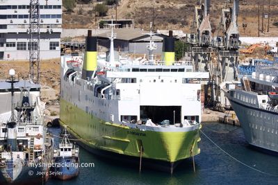
EUROPEAN STAR
Ro-Ro/Passenger Ship
Current Trip
| Time Travelled | 7 h, 46 mins |
|---|---|
| Remaining Time | --- |
| Distance Travelled | 33.23 nm |
| Remaining Distance | --- |
| AVG Speed | 10.2 Knots |
| MAX Speed | 10.8 Knots |
| AVG Wind | 12.9 knots |
| MAX Wind | 15 knots |
| MIN Temp | 11.9°C / 53.42°F |
| MAX Temp | 12.2°C / 53.96°F |
| Dybgang | 5 m |
| Position Modtaget | 3 h, 55 m siden |
Current Position
| Longitude | --- |
|---|---|
| Latitude | --- |
| Status | Under way using engine |
| Fart | 9.9 Knots |
| Kurs | 105.5° |
| Område | Adriatic Sea |
| Station | T-AIS |
| Position Modtaget | 3 h, 55 m siden |
Info
Information
The current position of EUROPEAN STAR is in Adriatic Sea with coordinates 40.56206° / 18.78267° as reported on 2025-02-18 02:23 by AIS to our vessel tracker app. The vessel's current speed is 9.9 Knots
The vessel EUROPEAN STAR (IMO: 7813949, MMSI: 374081000) is a Ro-Ro/Passenger Ship that was built in 1981 ( 44 år gamle ). It's sailing under the flag of [PA] Panama.
In this page you can find informations about the vessels current position, last detected port calls, and current voyage information. If the vessels is not in coverage by AIS you will find the latest position.
The current position of EUROPEAN STAR is detected by our AIS receivers and we are not responsible for the reliability of the data. The last position was recorded while the vessel was in Coverage by the Ais receivers of our vessel tracking app.
The current draught of EUROPEAN STAR as reported by AIS is 5 meters
Weather
| Temperature | 12°C / 53.6°F |
|---|---|
| Wind Speed | 10 knots |
| Direction | 353° N |
| Pressure | 1017.7 hPa |
| Humidity | 68.7 % |
| Cloud Coverage | 100 % |
Featured Company
Last Port Calls
| Port | Arrival | Departure | Time In Port |
|---|---|---|---|
| 2025-02-17 06:44 | 2025-02-17 23:33 | 16 h | |
| 2025-02-16 07:19 | 2025-02-16 23:32 | 16 h | |
| 2025-02-15 18:26 | 2025-02-15 23:54 | 5 h | |
| 2025-02-15 06:59 | 2025-02-15 13:24 | 6 h | |
| 2025-02-14 06:56 | 2025-02-14 23:48 | 16 h | |
| 2025-02-13 07:06 | 2025-02-13 23:09 | 16 h | |
| 2025-02-12 07:01 | 2025-02-12 23:33 | 16 h | |
| 2025-02-11 06:54 | 2025-02-11 23:30 | 16 h | |
| 2025-02-10 06:47 | 2025-02-10 23:38 | 16 h | |
| 2025-02-09 06:57 | 2025-02-10 00:07 | 17 h |
Last Trips
| Origin | Departure | Destination | Arrival | Distance | |
|---|---|---|---|---|---|
| 2025-02-16 23:32 | 2025-02-17 06:44 | 70.79 nm | |||
| 2025-02-15 23:54 | 2025-02-16 07:19 | 70.35 nm | |||
| 2025-02-15 13:24 | 2025-02-15 18:26 | 51.94 nm | |||
| 2025-02-14 23:48 | 2025-02-15 06:59 | 70.14 nm | |||
| 2025-02-13 23:09 | 2025-02-14 06:56 | 69.10 nm | |||
| 2025-02-12 23:33 | 2025-02-13 07:06 | 71.04 nm | |||
| 2025-02-11 23:30 | 2025-02-12 07:01 | 69.35 nm | |||
| 2025-02-10 23:38 | 2025-02-11 06:54 | 67.59 nm | |||
| 2025-02-10 00:07 | 2025-02-10 06:47 | 68.67 nm | |||
| 2025-02-08 23:59 | 2025-02-09 06:57 | 68.29 nm |
Events
| Tid | Hændelsen | Detaljer | Position / Dest | Info |
|---|---|---|---|---|
| 2025-02-18 02:35 | Status er ændret | Default Under way using engine |
40.55335 / 18.82621
AL VOA
|
Fart: 9.9 kn Kurs: 105.5° |
| 2025-02-18 02:23 | Udenfor Dækning |
40.56206 / 18.78267
Adriatic Sea
AL VOA
|
Fart: 9.9 kn Kurs: 105.5° |
|
| 2025-02-18 02:21 | Fundet i havområde | Albanian part of the Adriatic Sea |
40.56386 / 18.77446
Adriatic Sea
AL VOA
|
Fart: 10 kn Kurs: 107.6° |
| 2025-02-18 02:11 | Status er ændret | Under way using engine Default |
40.57172 / 18.74107
AL VOA
|
Fart: 9.8 kn Kurs: 106° |
| 2025-02-18 02:09 | Status er ændret | Default Under way using engine |
40.57300 / 18.73534
AL VOA
|
Fart: 9.8 kn Kurs: 106° |
| 2025-02-18 00:28 | Status er ændret | Under way using engine Default |
40.64904 / 18.37952
AL VOA
|
Fart: 10.3 kn Kurs: 105° |
| 2025-02-18 00:16 | Status er ændret | Default Under way using engine |
40.65839 / 18.33590
AL VOA
|
Fart: 10.3 kn Kurs: 104.9° |
| 2025-02-17 23:58 | Destination er ændret | AL VOA IT BDS |
40.67236 / 18.26952
AL VOA
|
Fart: 10.4 kn Kurs: 104.4° |
| 2025-02-17 23:58 | ETA er ændret | 2025/02/18 06:00 2025/02/17 06:00 |
40.67236 / 18.26952
AL VOA
|
Fart: 10.4 kn Kurs: 104.4° |
| 2025-02-17 23:56 | Status er ændret | Under way using engine Default |
40.67384 / 18.26207
IT BDS
|
Fart: 10.7 kn Kurs: 104° |