
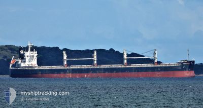
EMMANOUELA
Cargo
Current Trip
| Trip Time | 16 days |
|---|---|
| Trip Distance | 4115.29 nm |
| AVG Speed | 9.8 Knopen |
| MAX Speed | 14.4 Knopen |
| Diepgang | 12.9 M |
| AVG Wind | 8.8 knots |
| MAX Wind | 16.8 knots |
| MIN Temp | 12.3°C / 54.14°F |
| MAX Temp | 32.4°C / 90.32°F |
| Positie ontvangen | 5 d geleden |
Current Position
| Lengtegraad | 119.37682° |
|---|---|
| Breedtegraat | 22.27132° |
| Status | Under way using engine |
| Snelheid | 11.7 Knopen |
| Koers | 33.2° |
| Gebied | South China Sea |
| Station | T-AIS |
| Positie ontvangen | 5 d geleden |
Info
Information
The current position of EMMANOUELA is in South China Sea with coordinates 22.27132° / 119.37682° as reported on 2024-04-21 17:49 by AIS to our vessel tracker app. The vessel's current speed is 11.7 Knopen and is currently inside the port of LANSHAN.
The vessel EMMANOUELA (IMO: 9780976, MMSI: 538007176) is a Cargo It's sailing under the flag of [MH] Marshall Is.
In this page you can find informations about the vessels current position, last detected port calls, and current voyage information. If the vessels is not in coverage by AIS you will find the latest position.
The current position of EMMANOUELA is detected by our AIS receivers and we are not responsible for the reliability of the data. The last position was recorded while the vessel was in Coverage by the Ais receivers of our vessel tracking app.
The current draught of EMMANOUELA as reported by AIS is 12.9 meters
Weather
| Temperature | 12.8°C / 55.04°F |
|---|---|
| Wind Speed | 6 knots |
| Direction | 140° SE |
| Pressure | 1012.5 hPa |
| Humidity | 91.8 % |
| Cloud Coverage | 70 % |
Featured Company
Last Port Calls
| Port | Arrival | Departure | Time In Port |
|---|---|---|---|
| 2024-04-26 04:32 | |||
| 2024-04-08 10:39 | 2024-04-09 07:08 | 20 h | |
| 2024-03-28 02:56 | 2024-03-29 10:49 | 1 d | |
| 2024-03-19 15:17 | |||
| 2024-02-29 05:43 | 2024-03-01 15:27 | 1 d |
Most Visited Ports (Last year)
| Port | Arrivals | |
|---|---|---|
| 2 | ||
| 2 | ||
| 2 | ||
| 1 | ||
| 1 | ||
| 1 |
Last Trips
| Origin | Departure | Destination | Arrival | Distance | |
|---|---|---|---|---|---|
| 2024-04-09 12:38 | 2024-04-26 12:32 | 4115.29 nm | |||
| 2024-03-29 16:19 | 2024-04-08 16:09 | 878.55 nm | |||
| 2024-03-01 17:27 | 2024-03-19 20:47 | 4341.90 nm | |||
| 2024-01-29 17:44 | 2024-02-29 07:43 | 7601.01 nm |
Events
| Tijd | Evenement | Details | Positie / Bestemming | Info |
|---|---|---|---|---|
| 2024-04-26 04:40 | Stop beweging |
35.11821 / 119.41451
[CN] LANSHAN
|
Snelheid: 0.2 kn Koers: 71° |
|
| 2024-04-26 04:32 | Aankomsthaven |
|
35.11644 / 119.41465
[CN] LANSHAN
|
Snelheid: 6.4 kn Koers: 300° |
| 2024-04-26 01:45 | Start beweging | 12.82 nm, East of LANSHAN |
35.08004 / 119.65416
CN LSN
|
Snelheid: 3.7 kn Koers: 275° |
| 2024-04-25 08:59 | Stop beweging | 12.96 nm, East of LANSHAN |
35.07917 / 119.65678
CN LSN
|
Snelheid: 0.2 kn Koers: 70° |
| 2024-04-21 17:54 | Status Changed | Default Under way using engine |
22.28470 / 119.38583
CN LSN
|
Snelheid: 11.7 kn Koers: 33.2° |
| 2024-04-21 17:49 | Buitenbereik |
22.27132 / 119.37682
South China Sea
CN LSN
|
Snelheid: 11.7 kn Koers: 33.2° |
|
| 2024-04-21 17:33 | Destination Changed | CN LSN CN TXG |
22.22554 / 119.34535
CN LSN
|
Snelheid: 11.6 kn Koers: 32.2° |
| 2024-04-21 17:33 | ETA Changed | 2024/04/25 05:00 2024/04/25 11:00 |
22.22554 / 119.34535
CN LSN
|
Snelheid: 11.6 kn Koers: 32.2° |
| 2024-04-21 17:18 | Wijzig zee gebeid | Taiwanese part of the South China Sea Malaysian part of the Singapore Strait |
22.18664 / 119.31844
South China Sea
CN TXG
|
Snelheid: 11.5 kn Koers: 30° |
| 2024-04-21 17:18 | Status Changed | Under way using engine Default |
22.18664 / 119.31844
CN TXG
|
Snelheid: 11.5 kn Koers: 34° |