
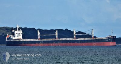
EMMANOUELA
Cargo
Current Trip
CN LSN
| Time Travelled | 9 days |
|---|---|
| Remaining Time | --- |
| Distance Travelled | 1011.02 nm |
| Remaining Distance | --- |
| AVG Speed | 11.7 Noeuds |
| MAX Speed | 13.7 Noeuds |
| AVG Wind | 11.1 knots |
| MAX Wind | 22.9 knots |
| MIN Temp | 11.4°C / 52.52°F |
| MAX Temp | 26.8°C / 80.24°F |
| Tirant d eau | 12.9 m |
| Position reçue | 1 d depuis |
Current Position
| Longitude | 119.86046° |
|---|---|
| Latitude | 23.87552° |
| Etat | Under way using engine |
| Vitesse | 9.9 Noeuds |
| Parcours | 187° |
| Zone | South China Sea |
| Station | T-AIS |
| Position reçue | 1 d depuis |
Info
Information
The current position of EMMANOUELA is in South China Sea with coordinates 23.87552° / 119.86046° as reported on 2024-05-07 10:21 by AIS to our vessel tracker app. The vessel's current speed is 9.9 Noeuds
The vessel EMMANOUELA (IMO: 9780976, MMSI: 538007176) is a Cargo It's sailing under the flag of [MH] Marshall Is.
In this page you can find informations about the vessels current position, last detected port calls, and current voyage information. If the vessels is not in coverage by AIS you will find the latest position.
The current position of EMMANOUELA is detected by our AIS receivers and we are not responsible for the reliability of the data. The last position was recorded while the vessel was in Coverage by the Ais receivers of our vessel tracking app.
The current draught of EMMANOUELA as reported by AIS is 12.9 meters
Weather
| Temperature | 28.9°C / 84.02°F |
|---|---|
| Wind Speed | 19 knots |
| Direction | 56° NE |
| Pressure | 1011.1 hPa |
| Humidity | 76 % |
| Cloud Coverage | 95 % |
Featured Company
Last Port Calls
| Port | Arrival | Departure | Time In Port |
|---|---|---|---|
| 2024-04-26 04:32 | 2024-04-28 12:20 | 2 d | |
| 2024-04-08 10:39 | 2024-04-09 07:08 | 20 h | |
| 2024-03-28 02:56 | 2024-03-29 10:49 | 1 d | |
| 2024-03-19 15:17 | |||
| 2024-03-01 15:27 |
Most Visited Ports (Last year)
| Port | Arrivals | |
|---|---|---|
| 2 | ||
| 2 | ||
| 2 | ||
| 1 | ||
| 1 | ||
| 1 |
Last Trips
| Origin | Departure | Destination | Arrival | Distance | |
|---|---|---|---|---|---|
| 2024-04-09 12:38 | 2024-04-26 12:32 | 4115.29 nm | |||
| 2024-03-29 16:19 | 2024-04-08 16:09 | 878.55 nm | |||
| 2024-03-01 17:27 | 2024-03-19 20:47 | 4341.90 nm |
Events
| Heure | Evenement | Détails | Position/ Destination | Info |
|---|---|---|---|---|
| 2024-05-07 10:28 | Etat Changé | Default Under way using engine |
23.85527 / 119.85841
CN LSN
|
Vitesse: 9.9 kn Parcours: 187° |
| 2024-05-07 10:21 | Hors de la zone couverte |
23.87552 / 119.86046
South China Sea
|
Vitesse: 9.9 kn Parcours: 187° |
|
| 2024-05-07 10:01 | Etat Changé | Under way using engine Default |
23.92602 / 119.88418
CN LSN
|
Vitesse: 10.7 kn Parcours: 222° |
| 2024-05-07 09:44 | Dans la zone couverte |
23.92563 / 119.88377
South China Sea
|
Vitesse: 10.8 kn Parcours: 222.7° |
|
| 2024-05-04 09:04 | Démarrage | 9.86 nm, East of LANSHAN |
35.09045 / 119.59456
CN LSN
|
Vitesse: 5.1 kn Parcours: 27° |
| 2024-04-28 13:32 | Arret | 9.63 nm, East of LANSHAN |
35.08662 / 119.58965
CN LSN
|
Vitesse: 0.3 kn Parcours: 141° |
| 2024-04-28 12:20 | PORT DE DEPART |
|
35.10226 / 119.42555
CN LSN
|
Vitesse: 6.6 kn Parcours: 158° |
| 2024-04-28 12:16 | Démarrage |
35.11109 / 119.41871
[CN] LANSHAN
|
Vitesse: 6.6 kn Parcours: 158° |