
DREAM
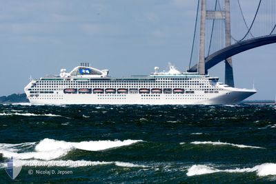
Passengers Ship
Current Trip
| Trip Time | 1 day |
|---|---|
| Trip Distance | 761.84 nm |
| AVG Speed | 16.4 Knopen |
| MAX Speed | 18.7 Knopen |
| Diepgang | 8.3 M |
| AVG Wind | 13.4 knots |
| MAX Wind | 27 knots |
| MIN Temp | 10.1°C / 50.18°F |
| MAX Temp | 18.2°C / 64.76°F |
| Positie ontvangen | 15 h, 14 m geleden |
Current Position
| Lengtegraad | 122.67269° |
|---|---|
| Breedtegraat | 37.93742° |
| Status | Under way using engine |
| Snelheid | 16.4 Knopen |
| Koers | 291.6° |
| Gebied | Yellow Sea |
| Station | T-AIS |
| Positie ontvangen | 15 h, 14 m geleden |
Info
Information
The current position of DREAM is in Yellow Sea with coordinates 37.93742° / 122.67269° as reported on 2024-05-10 14:38 by AIS to our vessel tracker app. The vessel's current speed is 16.4 Knopen and is currently inside the port of TIANJIN.
The vessel DREAM (IMO: 9150913, MMSI: 636020325) is a Passengers Ship that was built in 1998 ( 26 Jaar oud ). It's sailing under the flag of [LR] Liberia.
In this page you can find informations about the vessels current position, last detected port calls, and current voyage information. If the vessels is not in coverage by AIS you will find the latest position.
The current position of DREAM is detected by our AIS receivers and we are not responsible for the reliability of the data. The last position was recorded while the vessel was in Coverage by the Ais receivers of our vessel tracking app.
The current draught of DREAM as reported by AIS is 8.3 meters
Weather
| Temperature | 21.3°C / 70.34°F |
|---|---|
| Wind Speed | 17 knots |
| Direction | 307° NW |
| Pressure | 1010.2 hPa |
| Humidity | 23.3 % |
| Cloud Coverage | 35 % |
Featured Company
Last Port Calls
| Port | Arrival | Departure | Time In Port |
|---|---|---|---|
| 2024-05-11 05:48 | |||
| 2024-05-08 21:56 | 2024-05-09 07:20 | 9 h | |
| 2024-05-07 21:57 | 2024-05-08 07:13 | 9 h | |
| 2024-05-06 01:28 | 2024-05-06 09:32 | 8 h | |
| 2024-05-03 22:12 | 2024-05-04 07:28 | 9 h | |
| 2024-05-01 23:40 | 2024-05-02 07:52 | 8 h | |
| 2024-04-30 00:42 | 2024-04-30 09:07 | 8 h | |
| 2024-04-28 04:40 | 2024-04-28 12:16 | 7 h | |
| 2024-04-25 21:56 | 2024-04-26 07:28 | 9 h | |
| 2024-04-22 23:40 | 2024-04-23 09:20 | 9 h |
Last Trips
| Origin | Departure | Destination | Arrival | Distance | |
|---|---|---|---|---|---|
| 2024-05-09 16:20 | 2024-05-11 13:48 | 761.84 nm | |||
| 2024-05-08 16:13 | 2024-05-09 06:56 | 197.50 nm | |||
| 2024-05-06 17:32 | 2024-05-08 06:57 | 569.54 nm | |||
| 2024-05-04 16:28 | 2024-05-06 09:28 | 573.21 nm | |||
| 2024-05-02 15:52 | 2024-05-04 07:12 | 575.77 nm | |||
| 2024-04-30 18:07 | 2024-05-02 07:40 | 591.87 nm | |||
| 2024-04-28 20:16 | 2024-04-30 09:42 | 572.94 nm | |||
| 2024-04-26 16:28 | 2024-04-28 12:40 | 760.39 nm | |||
| 2024-04-23 17:20 | 2024-04-26 06:56 | 808.69 nm | |||
| 2024-04-21 16:36 | 2024-04-23 07:40 | 576.82 nm |
Events
| Tijd | Evenement | Details | Positie / Bestemming | Info |
|---|---|---|---|---|
| 2024-05-11 05:48 | Aankomsthaven |
|
38.95818 / 117.86777
[CN] TIANJIN
|
Snelheid: 12.2 kn Koers: 281° |
| 2024-05-10 14:45 | Status Changed | Default Under way using engine |
37.94855 / 122.63793
TIANJIN CN
|
Snelheid: 16.4 kn Koers: 291.6° |
| 2024-05-10 14:38 | Buitenbereik |
37.93742 / 122.67269
Yellow Sea
TIANJIN CN
|
Snelheid: 16.4 kn Koers: 291.6° |
|
| 2024-05-10 14:34 | Status Changed | Under way using engine Default |
37.93041 / 122.69444
TIANJIN CN
|
Snelheid: 16.5 kn Koers: 296° |
| 2024-05-10 14:29 | Binnenbereik |
37.93041 / 122.69444
Yellow Sea
TIANJIN CN
|
Snelheid: 16.3 kn Koers: 292.2° |
|
| 2024-05-10 11:04 | Status Changed | Default Under way using engine |
37.21885 / 123.54429
TIANJIN CN
|
Snelheid: 18.3 kn Koers: 334.6° |
| 2024-05-10 10:59 | Status Changed | Under way using engine Default |
37.19252 / 123.55967
TIANJIN CN
|
Snelheid: 18.3 kn Koers: 335° |
| 2024-05-10 10:59 | Buitenbereik |
37.19252 / 123.55967
Yellow Sea
TIANJIN CN
|
Snelheid: 18.3 kn Koers: 334.6° |
|
| 2024-05-10 10:28 | Status Changed | Default Under way using engine |
37.05507 / 123.64297
TIANJIN CN
|
Snelheid: 17.9 kn Koers: 339.5° |
| 2024-05-10 10:03 | Status Changed | Under way using engine Default |
36.93600 / 123.70068
TIANJIN CN
|
Snelheid: 17.7 kn Koers: 339° |