
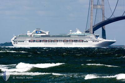
DREAM
Passengers Ship
Current Trip
JEJU.KOREA
| Time Travelled | 7 h, 38 mins |
|---|---|
| Remaining Time | --- |
| Distance Travelled | 115.78 nm |
| Remaining Distance | --- |
| AVG Speed | 16 Knots |
| MAX Speed | 17 Knots |
| AVG Wind | 9.8 knots |
| MAX Wind | 17 knots |
| MIN Temp | 14.1°C / 57.38°F |
| MAX Temp | 15.5°C / 59.9°F |
| Draught | 8.3 m |
| Position Received | 7 h, 44 m ago |
Current Position
| Longitude | --- |
|---|---|
| Latitude | --- |
| Status | Under way using engine |
| Speed | 14.4 Knots |
| Course | 295° |
| Area | Japan Sea |
| Station | T-AIS |
| Position Received | 7 h, 44 m ago |
Info
Information
The current position of DREAM is in Japan Sea with coordinates 33.63521° / 130.34357° as reported on 2025-03-01 12:09 by AIS to our vessel tracker app. The vessel's current speed is 14.4 Knots
The vessel DREAM (IMO: 9150913, MMSI: 636020325) is a Passengers Ship that was built in 1998 ( 27 years old ). It's sailing under the flag of [LR] Liberia.
In this page you can find informations about the vessels current position, last detected port calls, and current voyage information. If the vessels is not in coverage by AIS you will find the latest position.
The current position of DREAM is detected by our AIS receivers and we are not responsible for the reliability of the data. The last position was recorded while the vessel was in Coverage by the Ais receivers of our vessel tracking app.
The current draught of DREAM as reported by AIS is 8.3 meters
Weather
| Temperature | 15.5°C / 59.9°F |
|---|---|
| Wind Speed | 12 knots |
| Direction | 211° SSW |
| Pressure | 1014.7 hPa |
| Humidity | 96.9 % |
| Cloud Coverage | 100 % |
Featured Company
Last Port Calls
| Port | Arrival | Departure | Time In Port |
|---|---|---|---|
| 2025-03-01 04:05 | 2025-03-01 12:16 | 8 h | |
| 2025-02-26 23:25 | 2025-02-27 07:37 | 8 h | |
| 2025-02-24 04:05 | 2025-02-24 12:23 | 8 h | |
| 2025-02-21 23:32 | 2025-02-22 06:57 | 7 h | |
| 2025-02-19 04:36 | 2025-02-19 12:30 | 7 h | |
| 2025-02-12 23:57 | 2025-02-17 07:17 | 4 d | |
| 2025-02-11 00:58 | 2025-02-11 10:01 | 9 h | |
| 2025-02-10 04:15 | 2025-02-10 13:33 | 9 h | |
| 2025-02-08 00:25 | 2025-02-08 08:21 | 7 h | |
| 2025-02-05 04:46 | 2025-02-05 23:06 | 18 h |
Last Trips
| Origin | Departure | Destination | Arrival | Distance | |
|---|---|---|---|---|---|
| 2025-02-27 15:37 | 2025-03-01 13:05 | 762.29 nm | |||
| 2025-02-24 21:23 | 2025-02-27 07:25 | 802.79 nm | |||
| 2025-02-22 14:57 | 2025-02-24 13:05 | 757.69 nm | |||
| 2025-02-19 21:30 | 2025-02-22 07:32 | 775.30 nm | |||
| 2025-02-17 15:17 | 2025-02-19 13:36 | 755.86 nm | |||
| 2025-02-11 19:01 | 2025-02-13 07:57 | 574.61 nm | |||
| 2025-02-10 22:33 | 2025-02-11 09:58 | 197.31 nm | |||
| 2025-02-08 16:21 | 2025-02-10 13:15 | 760.85 nm | |||
| 2025-02-06 08:06 | 2025-02-08 08:25 | 757.12 nm | |||
| 2025-02-03 16:01 | 2025-02-05 13:46 | 758.94 nm |
Events
| Time | Event | Details | Position / Dest | Info |
|---|---|---|---|---|
| 2025-03-01 12:16 | Status Changed | Default Under way using engine |
33.64631 / 130.30855
JEJU.KOREA
|
Speed: 14.4 kn Course: 295° |
| 2025-03-01 12:16 | PORT DEPARTURE |
|
33.64631 / 130.30855
JEJU.KOREA
|
Speed: 14.4 kn Course: 295° |
| 2025-03-01 12:09 | OUT of Coverage |
33.63521 / 130.34357
Japan Sea
JEJU.KOREA
|
Speed: 14.4 kn Course: 295.3° |
|
| 2025-03-01 12:02 | Destination Changed | JEJU.KOREA FUKUOKA JAPAN |
33.62481 / 130.36985
[JP] HAKATA
|
Speed: 11.9 kn Course: 293° |
| 2025-03-01 12:02 | ETA Changed | 2025/03/02 01:00 2025/03/01 04:00 |
33.62481 / 130.36985
[JP] HAKATA
|
Speed: 11.9 kn Course: 293° |
| 2025-03-01 11:54 | START Moving |
33.61147 / 130.39249
[JP] HAKATA
|
Speed: 5.8 kn Course: 305° |
|
| 2025-03-01 11:51 | Status Changed | Under way using engine Default |
33.61018 / 130.39493
[JP] HAKATA
|
Speed: 0.3 kn Course: 309° |
| 2025-03-01 11:41 | IN Coverage |
33.61067 / 130.39386
Japan Sea
[JP] HAKATA
|
Speed: 3.7 kn Course: 303° |
|
| 2025-03-01 04:56 | Status Changed | Default Moored |
33.61031 / 130.39551
[JP] HAKATA
|
Speed: 0.2 kn Course: 310° |
| 2025-03-01 04:52 | OUT of Coverage |
33.61031 / 130.39550
Japan Sea
[JP] HAKATA
|
Speed: 0.2 kn Course: 66.9° |