
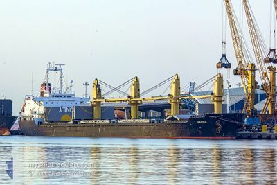
DINA OCEAN
Bulk Carrier
Current Trip
CN LYG
| Time Travelled | 13 days |
|---|---|
| Remaining Time | --- |
| Distance Travelled | 1395.98 nm |
| Remaining Distance | --- |
| AVG Speed | 10.6 Knopen |
| MAX Speed | 13.2 Knopen |
| AVG Wind | 16.8 knots |
| MAX Wind | 33 knots |
| MIN Temp | -4.4°C / 24.08°F |
| MAX Temp | 15.8°C / 60.44°F |
| Diepgang | 8.6 M |
| Positie ontvangen | 2024-12-28 20:50 |
Current Position
| Lengtegraad | --- |
|---|---|
| Breedtegraat | --- |
| Status | Under way using engine |
| Snelheid | 9.6 Knopen |
| Koers | 81.4° |
| Gebied | Singapore Strait |
| Station | T-AIS |
| Positie ontvangen | 2024-12-28 20:50 |
Info
Information
The current position of DINA OCEAN is in Singapore Strait with coordinates 1.25821° / 104.15593° as reported on 2024-12-28 20:50 by AIS to our vessel tracker app. The vessel's current speed is 9.6 Knopen
The vessel DINA OCEAN (IMO: 9177480, MMSI: 355735000) is a Bulk Carrier that was built in 1998 ( 27 Jaar oud ). It's sailing under the flag of [PA] Panama.
In this page you can find informations about the vessels current position, last detected port calls, and current voyage information. If the vessels is not in coverage by AIS you will find the latest position.
The current position of DINA OCEAN is detected by our AIS receivers and we are not responsible for the reliability of the data. The last position was recorded while the vessel was in Coverage by the Ais receivers of our vessel tracking app.
The current draught of DINA OCEAN as reported by AIS is 8.6 meters
Weather
| Temperature | 15.2°C / 59.36°F |
|---|---|
| Wind Speed | 24 knots |
| Direction | 47° NE |
| Pressure | 1019.6 hPa |
| Humidity | 71.3 % |
| Cloud Coverage | --- |
Featured Company
Last Port Calls
| Port | Arrival | Departure | Time In Port |
|---|---|---|---|
| 2025-01-28 05:50 | 2025-02-04 12:45 | 7 d | |
| 2025-01-13 15:29 | 2025-01-15 19:37 | 2 d |
Most Visited Ports (Last year)
| Port | Arrivals | |
|---|---|---|
| 3 | ||
| 1 | ||
| 1 | ||
| 1 | ||
| 1 | ||
| 1 |
Last Trips
| Origin | Departure | Destination | Arrival | Distance | |
|---|---|---|---|---|---|
| 2025-01-15 19:37 | 2025-01-28 05:50 | 573.88 nm | |||
| 2024-11-28 08:02 | 2025-01-13 15:29 | 6984.71 nm |
Events
| Tijd | Evenement | Details | Positie / Bestemming | Info |
|---|---|---|---|---|
| 2025-02-15 10:28 | Start beweging |
30.50204 / 123.00281
CN LYG
|
Snelheid: 10.9 kn Koers: 180° |
|
| 2025-02-15 08:50 | Stop beweging |
30.53188 / 123.00691
CN LYG
|
Snelheid: Koers: 324° |
|
| 2025-02-14 20:17 | Start beweging | 13.59 nm, South East of TAICANG |
31.50126 / 121.38107
CN LYG
|
Snelheid: 6 kn Koers: 115° |
| 2025-02-11 07:25 | Stop beweging | 13.41 nm, South East of TAICANG |
31.50014 / 121.37459
CN LYG
|
Snelheid: Koers: 302° |
| 2025-02-10 23:37 | Start beweging |
31.19620 / 122.48448
CN LYG
|
Snelheid: 5 kn Koers: 190° |
|
| 2025-02-10 10:25 | Stop beweging |
31.20647 / 122.48614
CN LYG
|
Snelheid: 0.3 kn Koers: 38° |
|
| 2025-02-10 07:17 | Start beweging |
31.57921 / 122.56802
CN LYG
|
Snelheid: 3.4 kn Koers: 313° |
|
| 2025-02-08 11:43 | Stop beweging |
31.57220 / 122.57000
CN LYG
|
Snelheid: Koers: 91° |
|
| 2025-02-08 11:25 | Start beweging |
31.57191 / 122.57002
CN LYG
|
Snelheid: 3.8 kn Koers: 87° |