

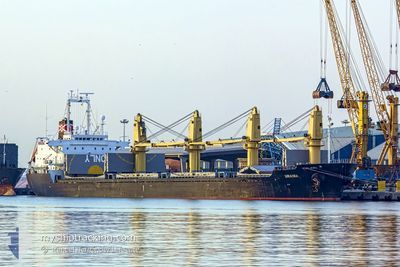
DINA OCEAN
Bulk Carrier

Current Trip
| Time Travelled | 16 days |
|---|---|
| Remaining Time | 4 days |
| Distance Travelled | 3310.01 nm |
| Remaining Distance | 1269.18 nm |
| AVG Speed | 11.1 Knop |
| MAX Speed | 15.3 Knop |
| AVG Wind | 8.3 knots |
| MAX Wind | 19 knots |
| MIN Temp | 23.1°C / 73.58°F |
| MAX Temp | 29.3°C / 84.74°F |
| Djupgående | 9.7 m |
| Position mottagen | 1 d sen |
Current Position
| Longitud | --- |
|---|---|
| Latitude | --- |
| Status | Under way using engine |
| Fart | 10.9 Knop |
| Kurs | 123.2° |
| Område | Laccadive Sea |
| Station | T-AIS |
| Position mottagen | 1 d sen |
Information
The current position of DINA OCEAN is in Laccadive Sea with coordinates 7.27235° / 77.77517° as reported on 2025-03-26 10:03 by AIS to our vessel tracker app. The vessel's current speed is 10.9 Knop and is heading at the port of SINGAPORE. The estimated time of arrival as calculated by MyShipTracking vessel tracking app is 2025-04-02 03:47 LT
The vessel DINA OCEAN (IMO: 9177480, MMSI: 355735000) is a Bulk Carrier that was built in 1998 ( 27 År gammal ). It's sailing under the flag of [PA] Panama.
In this page you can find informations about the vessels current position, last detected port calls, and current voyage information. If the vessels is not in coverage by AIS you will find the latest position.
The current position of DINA OCEAN is detected by our AIS receivers and we are not responsible for the reliability of the data. The last position was recorded while the vessel was in Coverage by the Ais receivers of our vessel tracking app.
The current draught of DINA OCEAN as reported by AIS is 9.7 meters
Weather
| Temperature | 27.8°C / 82.04°F |
|---|---|
| Wind Speed | 3 knots |
| Direction | 34° NE |
| Pressure | 1008.1 hPa |
| Humidity | 73.7 % |
| Cloud Coverage | 87 % |


Featured Company
Last Port Calls
| Port | Arrival | Departure | Time In Port |
|---|---|---|---|
| 2025-03-04 14:03 | 2025-03-11 17:51 | 7 d | |
| 2025-01-28 05:50 | 2025-02-04 12:45 | 7 d | |
| 2025-01-13 15:29 | 2025-01-15 19:37 | 2 d |
Most Visited Ports (Last year)
| Port | Arrivals | |
|---|---|---|
| 3 | ||
| 2 | ||
| 1 | ||
| 1 | ||
| 1 | ||
| 1 |
Last Trips
| Origin | Departure | Destination | Arrival | Distance | |
|---|---|---|---|---|---|
| 2025-02-04 12:45 | 2025-03-04 14:03 | 5546.06 nm | |||
| 2025-01-15 19:37 | 2025-01-28 05:50 | 573.88 nm | |||
| 2024-11-28 08:02 | 2025-01-13 15:29 | 6984.71 nm |
Events
| Tid | Event | Detaljer | Position / Dest | Information |
|---|---|---|---|---|
| 2025-03-26 10:07 | Status ändrad | Default Under way using engine |
7.26613 / 77.78441
SGSIN
|
Fart: 10.9 kn Kurs: 123.2° |
| 2025-03-26 10:03 | UTANFÖR täckningsområde |
7.27235 / 77.77517
Laccadive Sea
SGSIN
|
Fart: 10.9 kn Kurs: 123.2° |
|
| 2025-03-26 09:53 | Status ändrad | Under way using engine Default |
7.29078 / 77.74840
SGSIN
|
Fart: 10.8 kn Kurs: 125° |
| 2025-03-26 09:41 | I täckningsområde |
7.29078 / 77.74840
Laccadive Sea
SGSIN
|
Fart: 11.1 kn Kurs: 125.7° |
|
| 2025-03-26 07:50 | Status ändrad | Default Under way using engine |
7.50476 / 77.44392
SGSIN
|
Fart: 10.7 kn Kurs: 121.2° |
| 2025-03-26 07:42 | UTANFÖR täckningsområde |
7.51790 / 77.42210
Laccadive Sea
SGSIN
|
Fart: 10.7 kn Kurs: 121.2° |
|
| 2025-03-26 02:01 | Status ändrad | Under way using engine Default |
8.10699 / 76.58627
SGSIN
|
Fart: 11.3 kn Kurs: 126° |
| 2025-03-26 01:51 | Status ändrad | Default Under way using engine |
8.12514 / 76.55791
SGSIN
|
Fart: 11.3 kn Kurs: 122.7° |
| 2025-03-26 01:39 | Djupgående ändrat | 9.7 8.4 |
8.14670 / 76.52587
SGSIN
|
Fart: 11.3 kn Kurs: 125.1° |
| 2025-03-26 01:39 | Destination ändrad | SGSIN IN BOM |
8.14670 / 76.52587
SGSIN
|
Fart: 11.3 kn Kurs: 125.1° |