
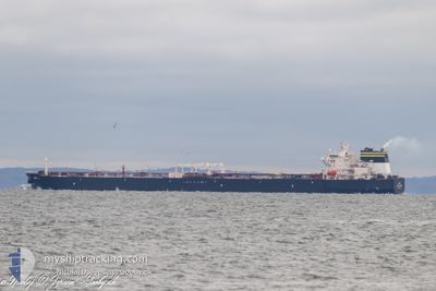
DALI
Tanker
Current Trip
LTDJF
| Time Travelled | 10 days |
|---|---|
| Remaining Time | --- |
| Distance Travelled | 2708.38 nm |
| Remaining Distance | --- |
| AVG Speed | 11.2 Knopen |
| MAX Speed | 15.3 Knopen |
| AVG Wind | 14.7 knots |
| MAX Wind | 33 knots |
| MIN Temp | 9.6°C / 49.28°F |
| MAX Temp | 20.7°C / 69.26°F |
| Diepgang | 13.8 M |
| Positie ontvangen | 1 d geleden |
Current Position
| Lengtegraad | 19.75606° |
|---|---|
| Breedtegraat | 56.04687° |
| Status | Under way using engine |
| Snelheid | 11.9 Knopen |
| Koers | 84.3° |
| Gebied | Baltic Sea |
| Station | T-AIS |
| Positie ontvangen | 1 d geleden |
Info
Information
The current position of DALI is in Baltic Sea with coordinates 56.04687° / 19.75606° as reported on 2024-05-17 07:37 by AIS to our vessel tracker app. The vessel's current speed is 11.9 Knopen
The vessel DALI (IMO: 9787936, MMSI: 319147800) is a Tanker It's sailing under the flag of [KY] Cayman Is.
In this page you can find informations about the vessels current position, last detected port calls, and current voyage information. If the vessels is not in coverage by AIS you will find the latest position.
The current position of DALI is detected by our AIS receivers and we are not responsible for the reliability of the data. The last position was recorded while the vessel was in Coverage by the Ais receivers of our vessel tracking app.
The current draught of DALI as reported by AIS is 13.8 meters
Weather
| Temperature | 12.8°C / 55.04°F |
|---|---|
| Wind Speed | 6 knots |
| Direction | 80° E |
| Pressure | 1018.5 hPa |
| Humidity | 70.6 % |
| Cloud Coverage | 9 % |
Featured Company
Most Visited Ports (Last year)
| Port | Arrivals | |
|---|---|---|
| 3 | ||
| 2 | ||
| 2 | ||
| 1 | ||
| 1 | ||
| 1 |
Events
| Tijd | Evenement | Details | Positie / Bestemming | Info |
|---|---|---|---|---|
| 2024-05-17 07:44 | Status Changed | Default Under way using engine |
56.04939 / 19.80194
LTDJF
|
Snelheid: 11.9 kn Koers: 84.3° |
| 2024-05-17 07:37 | Buitenbereik |
56.04687 / 19.75606
Baltic Sea
LTDJF
|
Snelheid: 11.9 kn Koers: 84.3° |
|
| 2024-05-17 05:47 | Gevonden in zee | Latvian part of the Baltic Sea |
56.00963 / 19.09816
Baltic Sea
LTDJF
|
Snelheid: 12.3 kn Koers: 84.6° |
| 2024-05-16 23:04 | ETA Changed | 2024/05/17 11:00 2024/05/17 11:30 |
55.79285 / 16.76254
LTDJF
|
Snelheid: 11.5 kn Koers: 75.9° |
| 2024-05-16 19:05 | Gevonden in zee | Swedish part of the Baltic Sea |
55.60163 / 15.44048
Baltic Sea
LTDJF
|
Snelheid: 11.4 kn Koers: 70.1° |
| 2024-05-16 13:47 | Gevonden in zee | Danish part of the Kattegat |
55.00017 / 14.05247
Kattegat
LTDJF
|
Snelheid: 11.7 kn Koers: 71.6° |
| 2024-05-16 13:26 | Wijzig zee gebeid | Swedish part of the Baltic Sea German part of the Baltic Sea |
54.97860 / 13.93971
Baltic Sea
LTDJF
|
Snelheid: 11.7 kn Koers: 71.8° |
| 2024-05-16 10:34 | ETA Changed | 2024/05/17 11:30 2024/05/17 06:30 |
54.80322 / 13.04274
LTDJF
|
Snelheid: 11.3 kn Koers: 71.6° |
| 2024-05-16 09:56 | Status Changed | Under way using engine Constrained by her draught |
54.76826 / 12.84920
LTDJF
|
Snelheid: 11.2 kn Koers: 74.4° |
| 2024-05-16 07:55 | Wijzig zee gebeid | German part of the Baltic Sea Danish part of the Baltic Sea |
54.63782 / 12.38709
Baltic Sea
LTDJF
|
Snelheid: 7 kn Koers: 63.2° |