
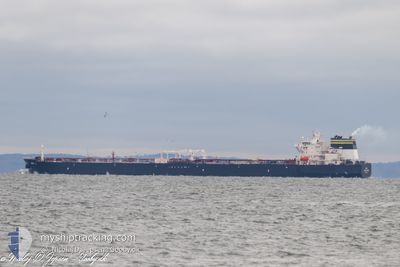
DALI
Tanker
Current Trip
LTDJF
| Time Travelled | 2 days |
|---|---|
| Remaining Time | --- |
| Distance Travelled | 724.59 nm |
| Remaining Distance | --- |
| AVG Speed | 12 Knots |
| MAX Speed | 15.1 Knots |
| AVG Wind | 13.3 knots |
| MAX Wind | 33 knots |
| MIN Temp | 16°C / 60.8°F |
| MAX Temp | 20.7°C / 69.26°F |
| Dybgang | 13.6 m |
| Position Modtaget | 1 m siden |
Current Position
| Longitude | -9.94890° |
|---|---|
| Latitude | 40.91951° |
| Status | Under way using engine |
| Fart | 12.5 Knots |
| Kurs | 359.1° |
| Område | North Atlantic Ocean |
| Station | T-AIS |
| Position Modtaget | 1 m siden |
Info
Information
The current position of DALI is in North Atlantic Ocean with coordinates 40.91951° / -9.94890° as reported on 2024-05-10 12:37 by AIS to our vessel tracker app. The vessel's current speed is 12.5 Knots
The vessel DALI (IMO: 9787936, MMSI: 319147800) is a Tanker It's sailing under the flag of [KY] Cayman Is.
In this page you can find informations about the vessels current position, last detected port calls, and current voyage information. If the vessels is not in coverage by AIS you will find the latest position.
The current position of DALI is detected by our AIS receivers and we are not responsible for the reliability of the data. The last position was recorded while the vessel was in Coverage by the Ais receivers of our vessel tracking app.
The current draught of DALI as reported by AIS is 13.6 meters
Weather
| Temperature | 17.9°C / 64.22°F |
|---|---|
| Wind Speed | 7 knots |
| Direction | 297° WNW |
| Pressure | 1014.7 hPa |
| Humidity | 73.8 % |
| Cloud Coverage | 5 % |
Featured Company
Most Visited Ports (Last year)
| Port | Arrivals | |
|---|---|---|
| 3 | ||
| 2 | ||
| 2 | ||
| 1 | ||
| 1 | ||
| 1 |
Events
| Tid | Hændelsen | Detaljer | Position / Dest | Info |
|---|---|---|---|---|
| 2024-05-10 11:50 | ETA er ændret | 2024/05/17 04:30 2024/05/17 03:30 |
40.75512 / -9.94866
LTDJF
|
Fart: 12.1 kn Kurs: 0.2° |
| 2024-05-09 13:17 | Status er ændret | Under way using engine Default |
36.59336 / -8.82045
LTDJF
|
Fart: 12.5 kn Kurs: 285° |
| 2024-05-09 13:03 | Status er ændret | Default Under way using engine |
36.58072 / -8.76161
LTDJF
|
Fart: 12.6 kn Kurs: 284.2° |
| 2024-05-09 12:45 | Status er ændret | Under way using engine Default |
36.56505 / -8.68570
LTDJF
|
Fart: 12.4 kn Kurs: 283° |
| 2024-05-09 12:42 | Status er ændret | Default Under way using engine |
36.56324 / -8.67658
LTDJF
|
Fart: 12.4 kn Kurs: 284° |
| 2024-05-09 11:55 | ETA er ændret | 2024/05/17 03:30 2024/05/17 02:30 |
36.52252 / -8.47789
LTDJF
|
Fart: 12.5 kn Kurs: 284.8° |
| 2024-05-09 08:17 | Fundet i havområde | Portuguese part of the North Atlantic Ocean |
36.32412 / -7.57090
North Atlantic Ocean
LTDJF
|
Fart: 12.4 kn Kurs: 288.4° |
| 2024-05-09 08:17 | Status er ændret | Under way using engine Default |
36.32412 / -7.57090
LTDJF
|
Fart: 12.4 kn Kurs: 288° |
| 2024-05-09 08:15 | Indenfor Dækning |
36.32412 / -7.57090
North Atlantic Ocean
LTDJF
|
Fart: 12.4 kn Kurs: 288.4° |
|
| 2024-05-09 05:57 | Udenfor Dækning |
36.17268 / -7.00232
North Atlantic Ocean
LTDJF
|
Fart: 12.4 kn Kurs: 288.5° |