
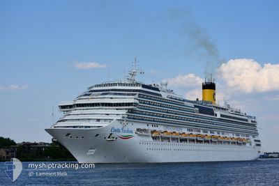
COSTA FAVOLOSA
Passengers Ship
Current Trip
| Time Travelled | 9 h, 42 mins |
|---|---|
| Remaining Time | 1 day |
| Distance Travelled | 160.19 nm |
| Remaining Distance | 506.06 nm |
| AVG Speed | 14.9 Knopen |
| MAX Speed | 17.8 Knopen |
| AVG Wind | 15.9 knots |
| MAX Wind | 29.3 knots |
| MIN Temp | 15°C / 59°F |
| MAX Temp | 19.9°C / 67.82°F |
| Diepgang | 8.3 M |
| Positie ontvangen | 4 m geleden |
Current Position
| Lengtegraad | --- |
|---|---|
| Breedtegraat | --- |
| Status | Under way using engine |
| Snelheid | 17.3 Knopen |
| Koers | 218.9° |
| Gebied | Balearic Sea |
| Station | T-AIS |
| Positie ontvangen | 4 m geleden |
Info
Information
The current position of COSTA FAVOLOSA is in Balearic Sea with coordinates 41.27653° / 3.06919° as reported on 2024-10-03 00:44 by AIS to our vessel tracker app. The vessel's current speed is 17.3 Knopen and is heading at the port of MALAGA. The estimated time of arrival as calculated by MyShipTracking vessel tracking app is 2024-10-04 05:52 LT
The vessel COSTA FAVOLOSA (IMO: 9479852, MMSI: 247311100) is a Passengers Ship that was built in 2011 ( 13 Jaar oud ). It's sailing under the flag of [IT] Italy.
In this page you can find informations about the vessels current position, last detected port calls, and current voyage information. If the vessels is not in coverage by AIS you will find the latest position.
The current position of COSTA FAVOLOSA is detected by our AIS receivers and we are not responsible for the reliability of the data. The last position was recorded while the vessel was in Coverage by the Ais receivers of our vessel tracking app.
The current draught of COSTA FAVOLOSA as reported by AIS is 8.3 meters
Weather
| Temperature | 17.4°C / 63.32°F |
|---|---|
| Wind Speed | 31 knots |
| Direction | 39° NE |
| Pressure | 1005.2 hPa |
| Humidity | 92.1 % |
| Cloud Coverage | 100 % |
Featured Company
Last Port Calls
| Port | Arrival | Departure | Time In Port |
|---|---|---|---|
| 2024-10-02 06:07 | 2024-10-02 15:07 | 9 h | |
| 2024-10-01 04:58 | 2024-10-01 15:24 | 10 h | |
| 2024-09-30 06:09 | 2024-09-30 16:32 | 10 h | |
| 2024-09-29 10:57 | 2024-09-29 19:05 | 8 h | |
| 2024-09-28 05:11 | 2024-09-28 15:52 | 10 h | |
| 2024-09-27 05:43 | 2024-09-27 16:18 | 10 h | |
| 2024-09-26 05:40 | 2024-09-26 16:51 | 11 h | |
| 2024-09-24 06:04 | 2024-09-24 16:30 | 10 h | |
| 2024-09-23 08:48 | 2024-09-23 20:07 | 11 h | |
| 2024-09-22 05:11 | 2024-09-22 16:11 | 11 h |
Most Visited Ports (Last year)
| Port | Arrivals | |
|---|---|---|
| 34 | ||
| 15 | ||
| 11 | ||
| 11 | ||
| 10 | ||
| 10 |
Last Trips
| Origin | Departure | Destination | Arrival | Distance | |
|---|---|---|---|---|---|
| 2024-10-01 17:24 | 2024-10-02 08:07 | 209.76 nm | |||
| 2024-09-30 18:32 | 2024-10-01 06:58 | 207.54 nm | |||
| 2024-09-29 21:05 | 2024-09-30 08:09 | 195.23 nm | |||
| 2024-09-28 17:52 | 2024-09-29 12:57 | 355.72 nm | |||
| 2024-09-27 18:18 | 2024-09-28 07:11 | 208.76 nm | |||
| 2024-09-26 18:51 | 2024-09-27 07:43 | 194.06 nm | |||
| 2024-09-24 18:30 | 2024-09-26 07:40 | 483.38 nm | |||
| 2024-09-23 22:07 | 2024-09-24 08:04 | 161.55 nm | |||
| 2024-09-22 17:11 | 2024-09-23 10:48 | 290.61 nm | |||
| 2024-09-21 17:29 | 2024-09-22 06:11 | 222.04 nm |
Events
| Tijd | Evenement | Details | Positie / Bestemming | Info |
|---|---|---|---|---|
| 2024-10-02 23:23 | Wijzig zee gebeid | Spanish part of the Balearic Sea Spanish part of the Mediterranean Sea - Western Basin |
41.58178 / 3.39086
Balearic Sea
ESAGP
|
Snelheid: 17.1 kn Koers: 218.5° |
| 2024-10-02 20:58 | Wijzig zee gebeid | Spanish part of the Mediterranean Sea - Western Basin French part of the Mediterranean Sea - Western Basin |
42.11445 / 3.98947
Mediterranean Sea - Western Basin
ESAGP
|
Snelheid: 17.6 kn Koers: 219.3° |
| 2024-10-02 20:57 | Status Changed | Under way using engine Default |
42.11603 / 3.99121
ESAGP
|
Snelheid: 17.6 kn Koers: 219° |
| 2024-10-02 20:51 | Status Changed | Default Under way using engine |
42.14060 / 4.01808
ESAGP
|
Snelheid: 17.6 kn Koers: 218.9° |
| 2024-10-02 20:42 | Status Changed | Under way using engine Default |
42.17295 / 4.05326
ESAGP
|
Snelheid: 17.3 kn Koers: 218° |
| 2024-10-02 20:42 | Binnenbereik |
42.11445 / 3.98947
Mediterranean Sea - Western Basin
ESAGP
|
Snelheid: 17.6 kn Koers: 219.3° |
|
| 2024-10-02 18:38 | Status Changed | Default Under way using engine |
42.63755 / 4.54506
ESAGP
|
Snelheid: 17.4 kn Koers: 219.5° |
| 2024-10-02 18:25 | Buitenbereik |
42.68922 / 4.60277
Mediterranean Sea - Western Basin
ESAGP
|
Snelheid: 17.4 kn Koers: 219.5° |
|
| 2024-10-02 16:18 | Status Changed | Under way using engine Default |
43.18745 / 5.04917
ESAGP
|
Snelheid: 17.6 kn Koers: 233° |
| 2024-10-02 16:17 | Status Changed | Default Under way using engine |
43.19104 / 5.05629
ESAGP
|
Snelheid: 17.6 kn Koers: 232.1° |