
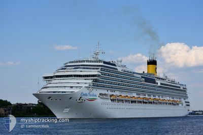
COSTA FAVOLOSA
Passengers Ship
Current Trip
| Time Travelled | 11 h, 9 mins |
|---|---|
| Remaining Time | --- |
| Distance Travelled | 188.80 nm |
| Remaining Distance | --- |
| AVG Speed | 17.6 Knots |
| MAX Speed | 18.4 Knots |
| AVG Wind | 16.8 knots |
| MAX Wind | 20 knots |
| MIN Temp | 21.5°C / 70.7°F |
| MAX Temp | 24.2°C / 75.56°F |
| Dybgang | 8.3 m |
| Position Modtaget | 11 h, 8 m siden |
Current Position
| Longitude | -46.34001° |
|---|---|
| Latitude | -24.01347° |
| Status | Under way using engine |
| Fart | 11.9 Knots |
| Kurs | 200° |
| Område | South Atlantic Ocean |
| Station | T-AIS |
| Position Modtaget | 11 h, 8 m siden |
Info
Information
The current position of COSTA FAVOLOSA is in South Atlantic Ocean with coordinates -24.01347° / -46.34001° as reported on 2024-04-26 21:18 by AIS to our vessel tracker app. The vessel's current speed is 11.9 Knots and is heading at the port of CAMBORIU. The estimated time of arrival as calculated by MyShipTracking vessel tracking app is 2024-04-27 10:00 LT
The vessel COSTA FAVOLOSA (IMO: 9479852, MMSI: 247311100) is a Passengers Ship that was built in 2011 ( 13 år gamle ). It's sailing under the flag of [IT] Italy.
In this page you can find informations about the vessels current position, last detected port calls, and current voyage information. If the vessels is not in coverage by AIS you will find the latest position.
The current position of COSTA FAVOLOSA is detected by our AIS receivers and we are not responsible for the reliability of the data. The last position was recorded while the vessel was in Coverage by the Ais receivers of our vessel tracking app.
The current draught of COSTA FAVOLOSA as reported by AIS is 8.3 meters
Weather
| Temperature | 23.6°C / 74.48°F |
|---|---|
| Wind Speed | 12 knots |
| Direction | 14° NNE |
| Pressure | 1012.6 hPa |
| Humidity | 88.5 % |
| Cloud Coverage | 100 % |
Featured Company
Last Port Calls
| Port | Arrival | Departure | Time In Port |
|---|---|---|---|
| 2024-04-26 09:26 | 2024-04-26 21:18 | 11 h | |
| 2024-04-22 09:33 | 2024-04-22 21:49 | 12 h | |
| 2024-04-19 09:33 | 2024-04-19 21:56 | 12 h | |
| 2024-04-15 08:55 | 2024-04-15 22:20 | 13 h | |
| 2024-04-12 09:49 | 2024-04-12 23:02 | 13 h | |
| 2024-04-09 08:49 | 2024-04-09 22:38 | 13 h | |
| 2024-04-06 09:01 | 2024-04-06 23:04 | 14 h | |
| 2024-04-03 09:10 | 2024-04-03 21:48 | 12 h | |
| 2024-03-31 09:05 | 2024-04-01 00:42 | 15 h | |
| 2024-03-28 09:18 | 2024-03-28 22:18 | 12 h |
Last Trips
| Origin | Departure | Destination | Arrival | Distance | |
|---|---|---|---|---|---|
| 2024-04-22 18:49 | 2024-04-26 06:26 | 649.38 nm | |||
| 2024-04-19 18:56 | 2024-04-22 06:33 | 563.81 nm | |||
| 2024-04-15 19:20 | 2024-04-19 06:33 | 646.57 nm | |||
| 2024-04-12 20:02 | 2024-04-15 05:55 | 575.61 nm | |||
| 2024-04-09 19:38 | 2024-04-12 06:49 | 564.28 nm | |||
| 2024-04-06 20:04 | 2024-04-09 05:49 | 564.20 nm | |||
| 2024-04-03 18:48 | 2024-04-06 06:01 | 462.52 nm | |||
| 2024-03-31 21:42 | 2024-04-03 06:10 | 519.21 nm | |||
| 2024-03-28 19:18 | 2024-03-31 06:05 | 387.24 nm | |||
| 2024-03-25 20:57 | 2024-03-28 06:18 | 524.16 nm |
Events
| Tid | Hændelsen | Detaljer | Position / Dest | Info |
|---|---|---|---|---|
| 2024-04-26 21:25 | Status er ændret | Default Under way using engine |
-24.03440 / -46.34895
BRCBU
|
Fart: 11.9 kn Kurs: 200° |
| 2024-04-26 21:18 | Udenfor Dækning |
-24.01347 / -46.34001
South Atlantic Ocean
BRCBU
|
Fart: 11.9 kn Kurs: 200.7° |
|
| 2024-04-26 21:18 | Afsejlet fra sidste havn |
|
-24.01347 / -46.34001
BRCBU
|
Fart: 9.5 kn Kurs: 216° |
| 2024-04-26 21:11 | Status er ændret | Under way using engine Default |
-23.99564 / -46.32923
[BR] SANTOS
|
Fart: 9.6 kn Kurs: 251° |
| 2024-04-26 21:05 | Status er ændret | Default Under way using engine |
-23.99214 / -46.31186
[BR] SANTOS
|
Fart: 8.3 kn Kurs: 219° |
| 2024-04-26 20:40 | START Sejllads |
-23.95378 / -46.30680
[BR] SANTOS
|
Fart: 5 kn Kurs: 141° |
|
| 2024-04-26 20:36 | Status er ændret | Under way using engine Moored |
-23.95264 / -46.30901
[BR] SANTOS
|
Fart: Kurs: 146° |
| 2024-04-26 20:11 | Status er ændret | Moored Default |
-23.95291 / -46.30949
[BR] SANTOS
|
Fart: Kurs: 146° |
| 2024-04-26 20:05 | Status er ændret | Default Moored |
-23.95291 / -46.30949
[BR] SANTOS
|
Fart: Kurs: 146° |
| 2024-04-26 19:41 | Status er ændret | Moored Default |
-23.95291 / -46.30949
[BR] SANTOS
|
Fart: Kurs: 146° |